Hello and welcome to my LIKETHEHIKE blog. I’m PJ and I write about the hikes I take, giving you insights, photos, commentary, tips, and tools so you can enjoy hiking and embrace the experience.
VELKOMINN TIL ISLANDS! We’re in Iceland! Land of fire and ice, home to huldufolk, Bjork, the cod wars, glaciers, puffins, $25 glasses of wine (!), and whales.
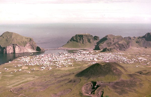
One of our destinations was the island town of Vestmannaeyjar. Located off the southern coast of Iceland, Vestmannaeyjar is a small fishing town on the island of Heimaey, and completely unremarkable except for an incident in 1973 that made global headlines and firmly planted this small island on the tourist map forever.
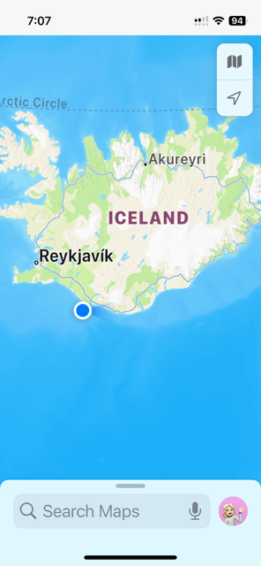

Before we get into the hike – and yes, I really did hike up and down a live volcano – a bit of context about Heimaey. It’s part of a group of 15 islands and has about 5,000 residents. Believe it or not, this makes Vestmannaeyjar the 12th most populous place in Iceland, given the total population is only 380,000, and 140,000 of those live in the capital Reykjavik.
Heimaey was settled sometime in the 9th century and has remained populated since then, despite losing large numbers of residents to a Turkish pirate raid in 1627 and then the inevitable disease and infant mortality in the 18th century.
Fast forward to January 1973.


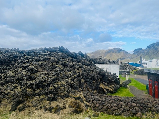
Without any warning, an eruption started in the early hours of 23 January and completely destroyed about 60% of the town. Half the houses disappeared under a lava flow, and almost all of the residents were evacuated to the nearby mainland. Bad weather the previous week meant the fishing fleet was in port, miraculous indeed as this enabled the residents to be moved to safety. Amazingly, only one resident died during the eruption. Our local guide advised that the person had broken into a local pharmacy during the eruption and died from noxious fumes after lingering too long…. eek!
The eruption was declared over by July 1973, when the massive cleanup operation commenced. 300 houses had gone under the lava field, and the rest of the town was covered in thick black ash.
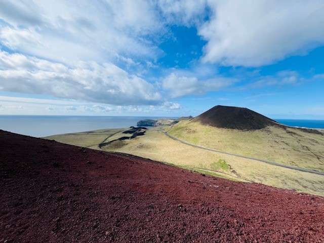
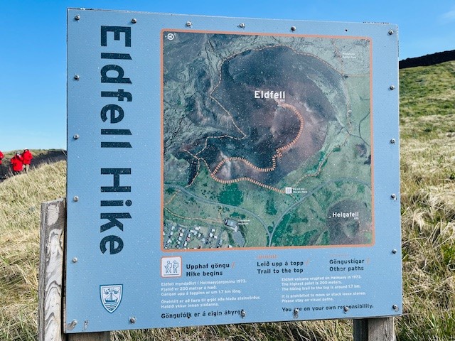
The result of the eruption was the creation of a brand new volcano called Eldfell (hill of fire). Eldfell recently turned 50 years old, so is younger than yours truly! The eruption and resulting lava flow increased the island size by about 20% and completely changed the coastline, pushing into the sea before finally cooling.
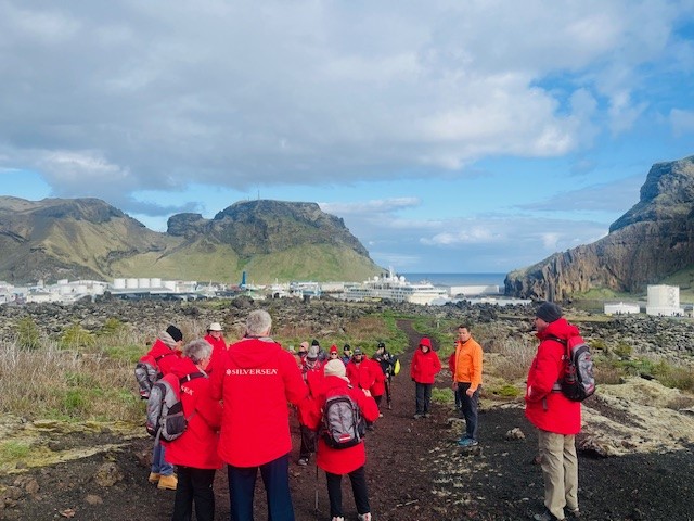
Eldfell was our hiking destination – I was going to climb an active volcano!!!
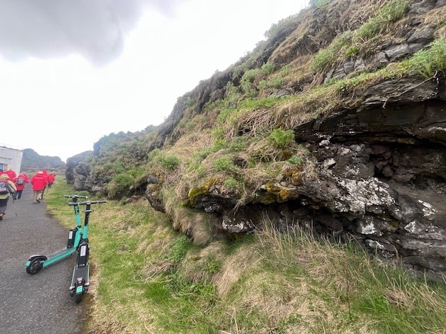
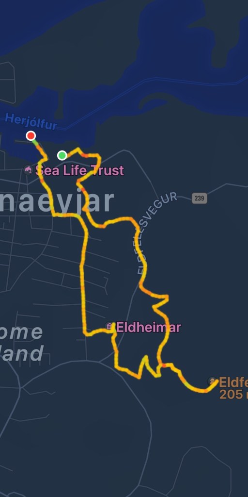
About 20 of us started but that number dropped quickly when the incline of the hike became apparent. We started at the port with our guide taking us past the edge of the lava field, pretty much where the residents were able to stop the lava flow by pumping sea water at it for over 4 months, via huge pumps provided by the US military.

The main export of Heimaey is fish, but not just for eating. The town manufactures fish oil, and also artificial skin for grafting – all from fish skin! Absolutely fascinating – if you can stand the smell of the factory 😦
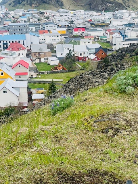
We started upward past what was once the town swimming pool and water supply, now under 10m of lava field. The eruption destroyed much of the island’s small forest, which has been replanted. However, due to such a short growing season, it’s taking a while to get reforested. There’s a saying in Iceland, if you get lost in the forest, just stand up 🙂


The day was cold but clear and the sun provided some relief from the biting wind. I was pleased the hike was heading uphill – it gave me a good chance to warm up.
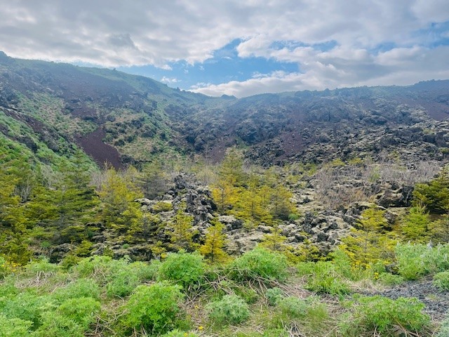
I really struggled to wrap my head around the fact that before January 1973, the landscape we were hiking through didn’t exist. It’s not like the volcano was there before and erupted….nope. Before 1973 it was fields, a dairy farm, and houses. The volcano literally came up out of the earth and grew.

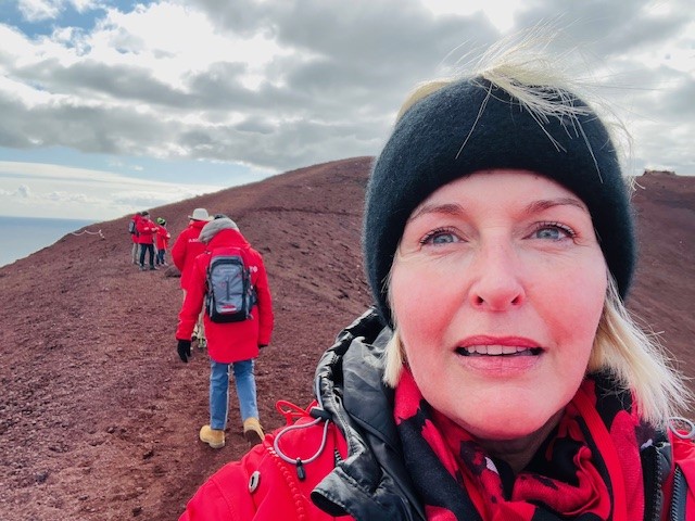
The hiking terrain quickly changed from grass and vegetation to red volcanic rubble. Every now and again little bits of vegetation were present, but it was pretty much barren. It really did feel like we were hiking on the moon. the trail switched back and forth up the side of the volcano and then trekked along the crests. Some parts were a little narrow, but I found that if I kept my head down and focussed on the path, the edges were less scary. Some readers may recall that I really don’t like hiking along cliff edges, it’s not the fear of heights, it’s the fear of falling… 🙂

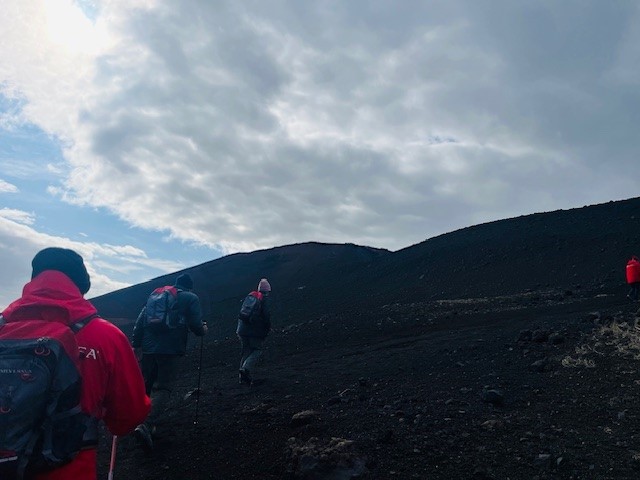

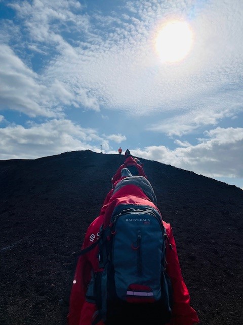
Two cairns marked the start of the final climb. I could see our destination across the valley and the silhouettes of a couple of hikers right up the top – eeek! It seemed like quite a long way and 200m doesn’t sound that bad until you have to hike it.


After a lot of huffing and puffing, we made it to the top – kinda. There was a stone marker and a bit of flat space to stand and look at the amazing views, and the original inactive Heimaey volcano called Helgafell.

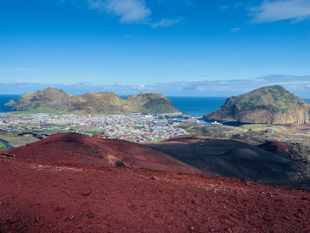
What the photo on the right shows very clearly, is the original coastline to the right, and the new land on the left created by the lava flow….quite incredible.
We then walked along the final quite narrow crest to a section of the volcano where the ground remains warm – confirming we were on an active volcano! Our lovely guide told us that until recently, his party trick was to drop a piece of paper into one of the fissures at the top of the volcano and it would burst into flames. Imagine his disappointment when one day – no fire…! Eldfell is slowly cooling down, but we still felt the warmth in the ground. Thankfully the weather held and the views from the top were pretty amazing.


FUN FACT
The island to the right in the photo is called Ellioaey and is meme famous for being the loneliest place on earth. However – it’s not in the “middle of nowhere” and it’s not “Bjork’s old home” nor has it been “empty for 100 years” and definitely not “built by a billionaire to escape a zombie invasion”– it’s a lodge that can be booked for weekend getaways, and as you can see, it’s literally within spitting distance from Heimaey. Myth busted!
It was time to start the downward journey. Funnily enough, downhill is actually harder than uphill. We were hiking on volcanic scree (little stones) and it made the path quite slippery. More than one person took a backward tumble onto their butts!
I have mentioned this before, but there is a knack to hiking downhill, especially if you’re on loose gravel. If you tilt every so slightly forward from your waist, and just go a little bit faster than normal, your centre of gravity stays marginally in front, so rather than your feet slipping out from under you (and you ending up on your butt) you tend to stay upright. Trust me – it works!


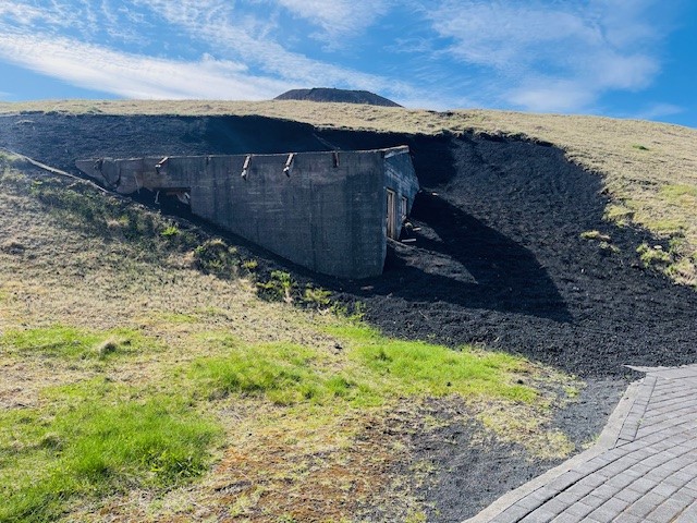
We weren’t going down the trail we came up, We deviated to the southern side of the volcano as our destination was Eldheimar – a museum dedicated to the Eldfell eruption. At the museum, there were a couple of partially excavated homes, and our guide dropped a bombshell. One of the homes belonged to his foourafi (grandfather)!! Very personal.


Our hike then looped back into town and down to the port. We saw markers for lava flow, where the side of a street was destroyed, and the other side untouched. We covered about 7km and it was worth every chilly and windy step!
Some of the most interesting hikes emerge from the unlikeliest of places, and our hike up Eldfell was exactly that. If you choose to be a traveller, rather than a tourist, you will discover some amazing opportunities and experiences. Being open is the key.
As you saw above, Mr PJ was along for the hike and loved it. There was a bit of grumbling about the climb, but that quickly evaporated with the amazing views.
As Icelandic folk say to describe a really great experience…..rusinan I pylsuendanum….. have fun unpicking that one!
See you out on the trails
PJ 🙂
