Hello and welcome to my LIKETHEHIKE blog.
I’m PJ and I write about the hikes I take, giving you insights, photos, commentary, tips and tools so you can enjoy hiking and embrace the experience.
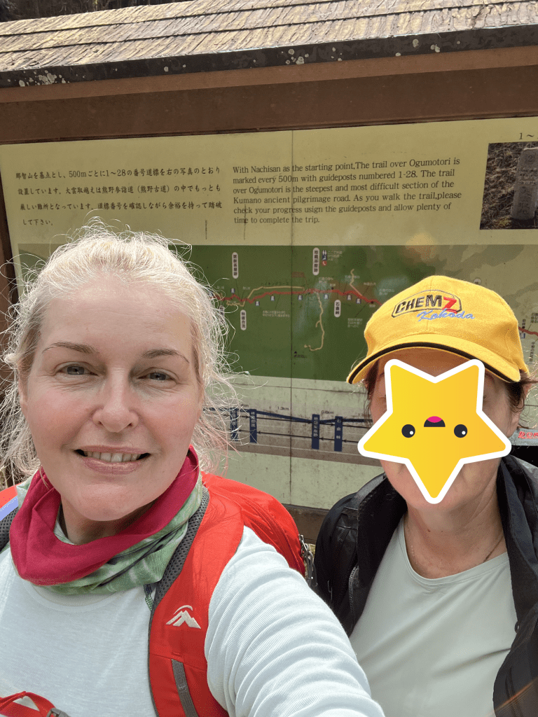
TB and I are back – day three of hiking Kumano….and it’s still bloody FANTASTIC!
DAY THREE – KUMANO NACHI TAISHA TO KOGUCHI
After a non-hiking day exploring Shingu and the seaside town of Kii-Katsuura, TB and I were ready to hit the trails. Today was going to be a challenging day – hiking Ogumotori-goe in reverse.

FIRST LEG – KII-KATSUURA TO KUMANO NACHI-TAISHA
However, before we got onto the trail, we needed to get from Kii-Katsuura on the coast, up to Kumano Nachi Taisha. Our travel company advised that there was no accommodation at Nachi, so we stayed down in Kii-Katsuura which was amazing – except for the timing when we left on day five or our trip.
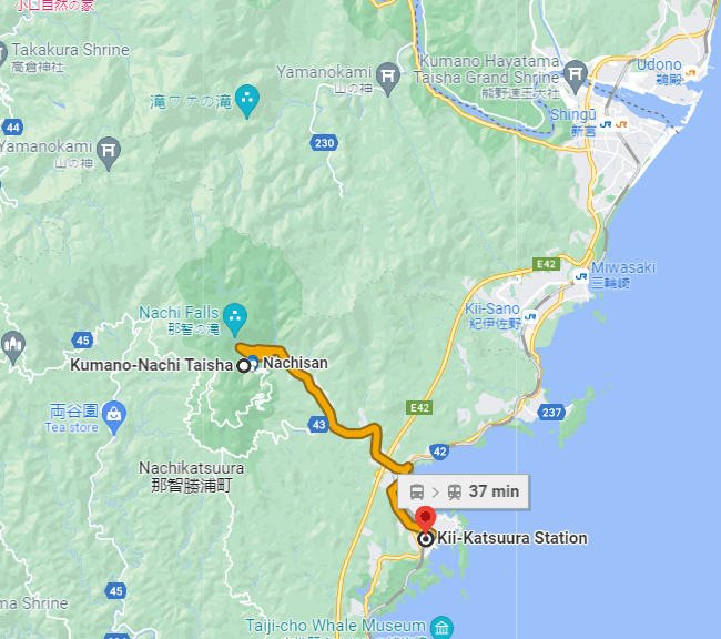
Breakfast didn’t commence until 7.30am (and we needed brekkie!), and we also had to buy some lunch in town, and then catch the 8.25 bus. This got us to Nachisan around 9am.
The bus trip was quite spectacular. We followed Nachi River up into the foothills, wound our way up to and past the famous Seigantoji pagoda and the Nachi no Taki waterfall.


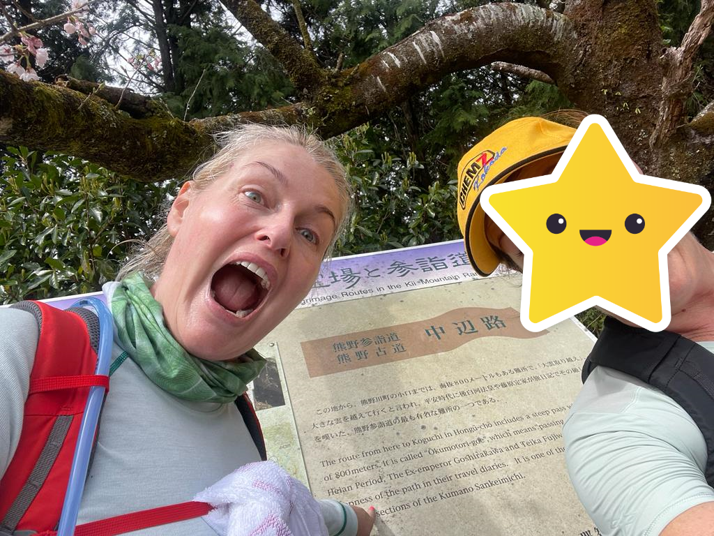
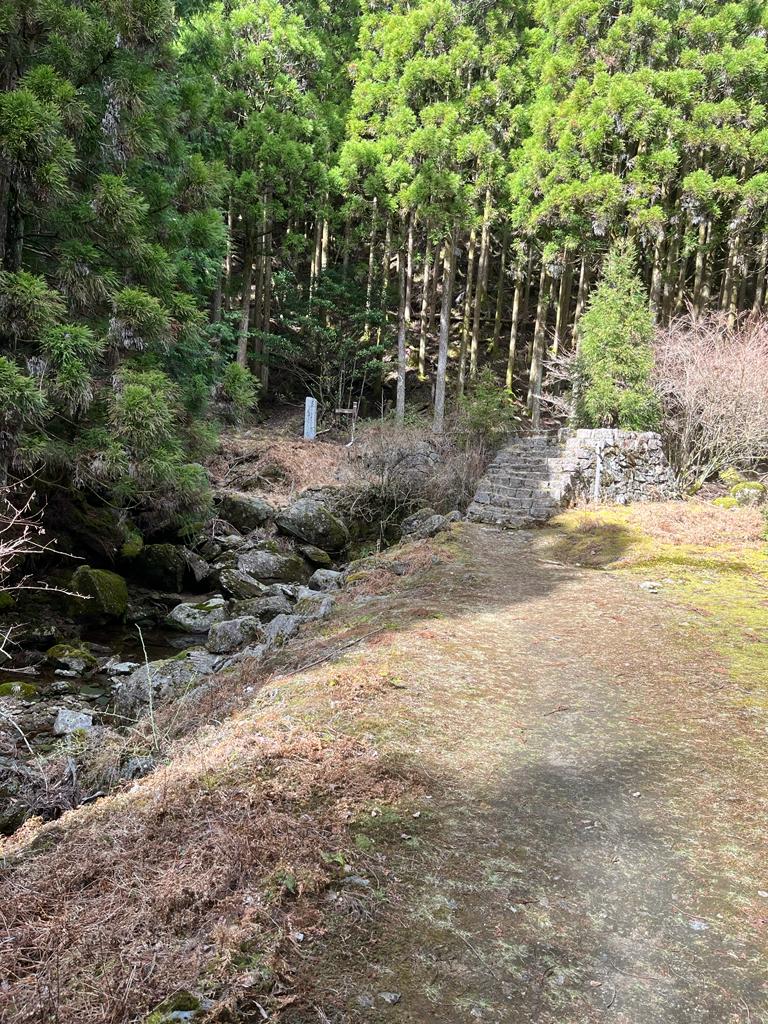
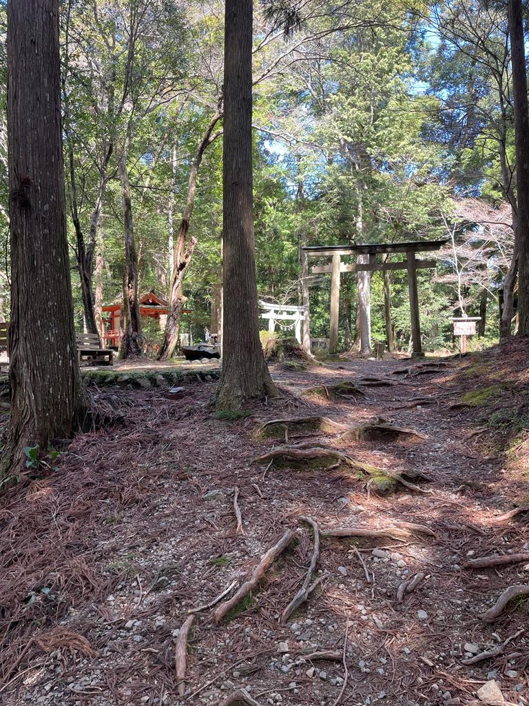
We jumped off the bus at Nachisan, and it was at this point we got a little confused. We walked back down through the village to have a look at the shrine and torii – and peeked at the waterfall – but really struggled to find the start of the trail. Up the hill there were a number of buildings and shrines and we could see that the trail started somewhere there, but DO YOU THINK WE COULD FIND IT???!

Time was ticking and I was getting nervous about actually getting started. We had 15km to hike and the terrain looked quite challenging. There weren’t any other hikers around (we were doing the section in reverse) so there wasn’t a stream of people to follow.
Via a process of elimination and toilet spotting, TB and I FINALLY found the stone staircase trailhead adjacent to the second building, right at the top around 10am. We were off! Albeit late, but we were determined to make it work.
SECOND LEG – KUMANO NACHI TAISHA TO FUNAMI-JAYA TEAHOUSE REMAINS
We knew from the outset that this would be a challenging hike – but one we were looking forward to. Ogumotori-goe is described by the Tanabe Tourism Bureau as “one of the toughest sections of the Nakahechi Route…a climb and descent over three passes and is mostly in forested mountains”. The total elevation gain is 1,260m and loss is 930m so lots of ups and downs.
Admittedly, hiking north from Nachisan to Koguchi would appear to be the more strategic choice given the terrain (no flies on me!) but it’s still a decent cardio commitment.
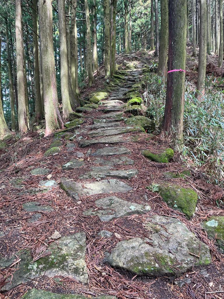
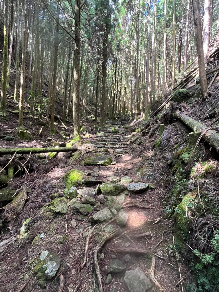
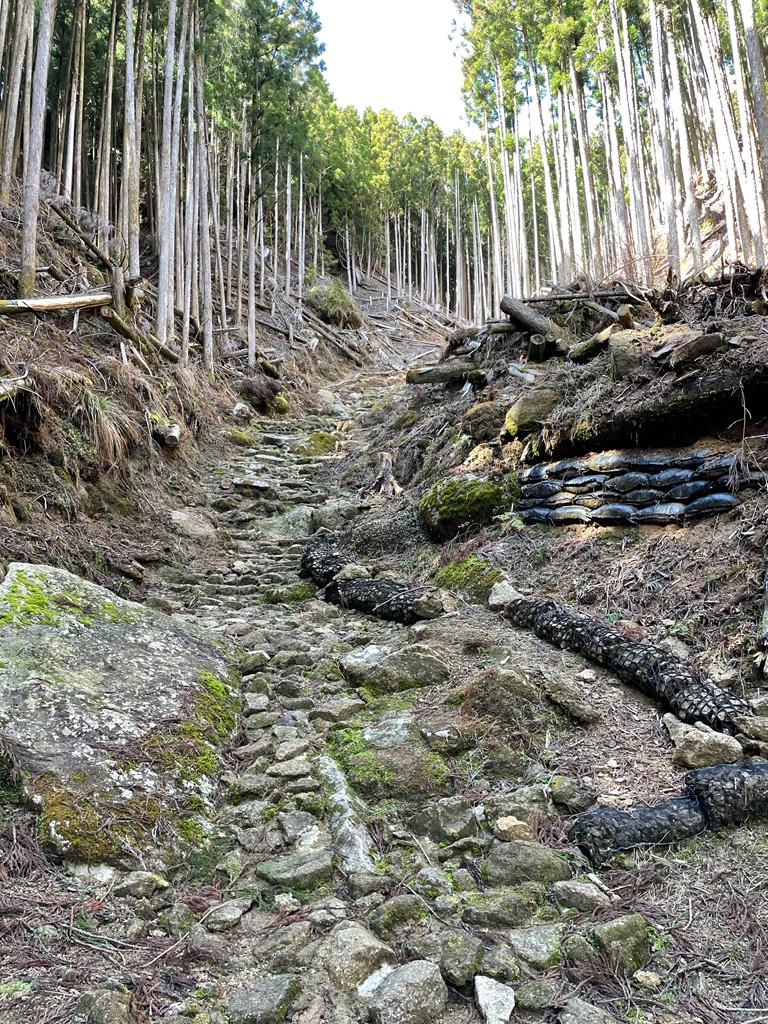
The first 2km took us through the start of the trail – and up some beautiful stone stairs which seemed to stretch forever. It was a good opportunity to engage my ‘mindful hiking’ mode, and put the drama of our late start behind me.
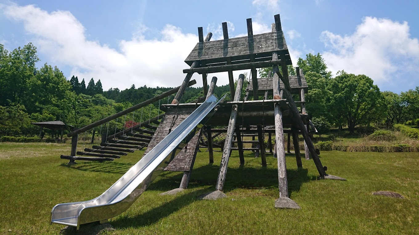
About a km along the trail we entered Nachi Kogen Park – which was a bit of a surprise. It’s an outdoor family adventure park with slides, climbing equipment and other outdoorsy entertainment, and the Kumano trail went up and through it…
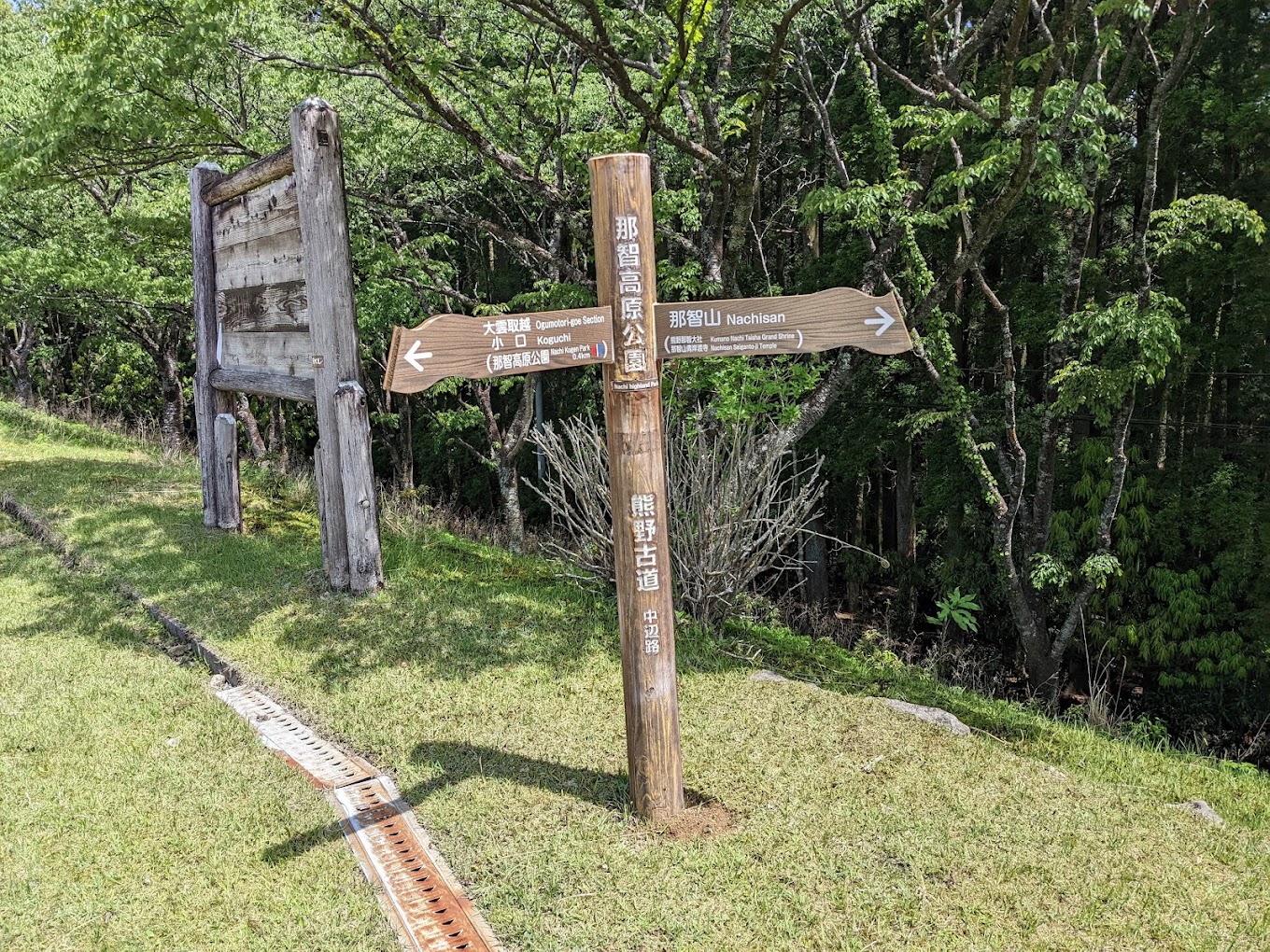
We followed the signs and kept walking up and through the park, which was completely deserted. At the crest of the hill was an access road, and on the other side, the trail running into the forest. It was here that we encountered ‘the sign’. Even the emperors from centuries ago recorded the steepness and challenge of the three passes which make up the Ogumotori-goe…!
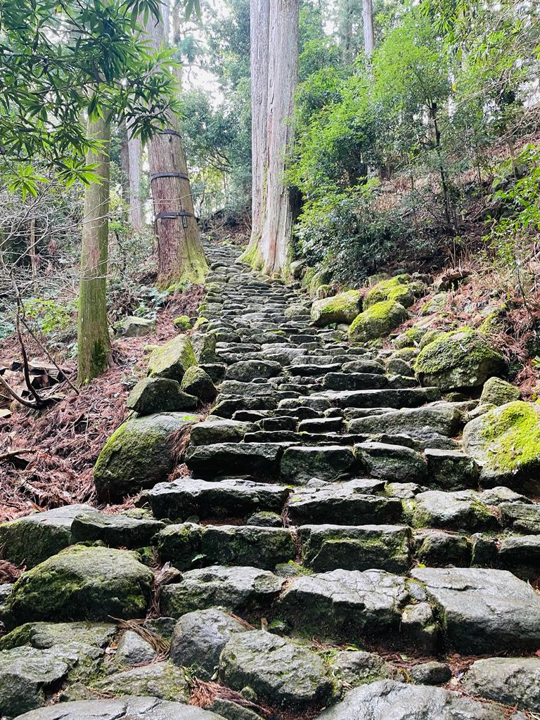
And then the climb began. I settled into a slow but steady uphill rhythm which proved to be handy as the sections weren’t ultra-steep, but they just kept going. The trails still had morning dampness on them, so quite pleased were were going uphill, not down. Our signage was a little different also, gone were the brown wood posts, we now had stone markers.


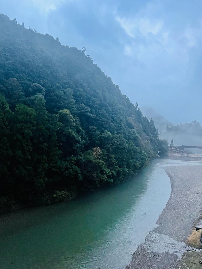
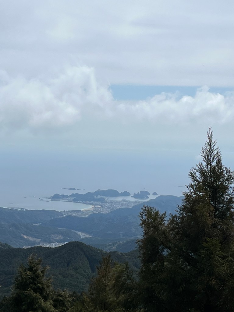
After about 90 minutes we arrived at our first stop – Funami-toge Pass, where the teahouse remains were. We figured this would be a good place to have a 15 minute break, drink some coffee and regroup after a hectic and delayed start to the day. And we weren’t wrong – check out the view all the way our to the Pacific Ocean!

As with the previous days, we had the trail completely to ourselves….and hadn’t bumped into any other hikers so far. This allowed us to really embrace the trail experience and soak up all that the Kumano Kodo had to offer.
THIRD LEG – FUNAMI-JAYA TEAHOUSE REMAINS TO JIZO-JAYA TEAHOUSE REMAINS
Feeling well fortified after hot coffee and some lovely snacks, courtesy of a Katsuura supermarket spree, TB and I departed Funami-jaya. We had climbed over 500m in the last 4km so quite an energetic hike so far.
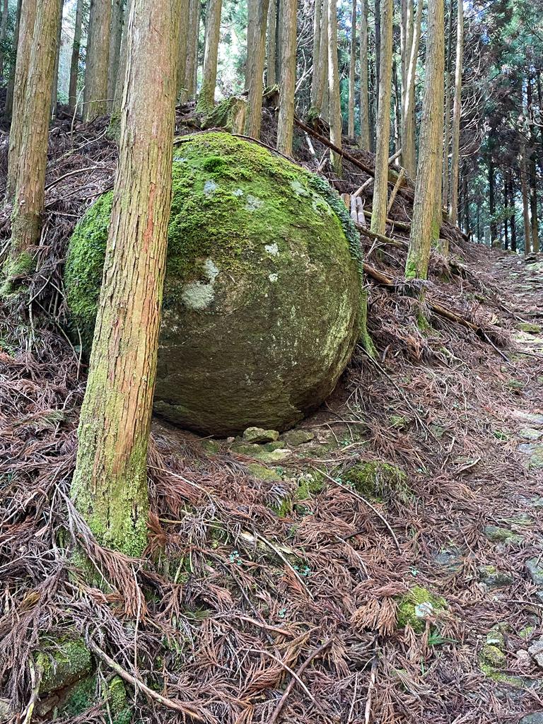
As we hiked deeper into the forest, the temperature dropped, not significantly but still noticeable. The forest canopy was high, but thick and kept the light at bay, so it felt like we were traversing an alternate universe as honoured guests. Every second step we found new things to marvel at – and of course I kept forgetting to take photos – but did take some…
This leg kept us quite high on the pass, and it was about midday when we passed our first hikers heading in the other direction. I was keen to find out what time they set off, and to assuage my fears that we were in trouble time wise! I chatted with a couple of them, and they had covered off their section in about 4-5 hours, so that was good news for us. We hoped to be off the trail by dusk.
We emerged from the forest and onto an asphalt access road which promised to take us down to our lunch destination, the Jizo-jaya Teahouse. We encountered another ‘elastic’ distance marker which showed the teahouse was 1.5km down the road. It took us 45 minutes at a fast trot to get there….which means it was more like 3-4km!
Lunchtime – yay!

The teahouse shelter was a great location by the river and had two completely full vending machines with all manner of drinks, hot and cold. The toilets were lovely and clean, our lunch was oishii – what more do you need on a hike 🙂
FOURTH LEG – JIZO-JAYA TEAHOUSE TO KOGUCHI
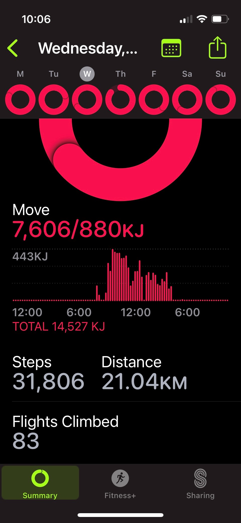
The final push – only 6.2km according to the map. I had my doubts as AppleFit and Strava seem to tell a different tale (as did my legs!) but the distance was actually immaterial – were were HIKING THE KUMANO KODO!!!
Once we left the teahouse it was upward again – but a short sharp incline. The area looked like a slip had ripped through, it was a bit desolate and had been reinforced.
It was here we passed our last hiker of the day, a lovely young Slovakian person who made the trail look like a stroll through a dog park! We chatted for a bit and discovered she was supremely confident she would be in Nachisan in a couple of hours. I sincerely hope she was correct 😮
Another hour brought us to the highest point for the day – Echizen-toge Pass.
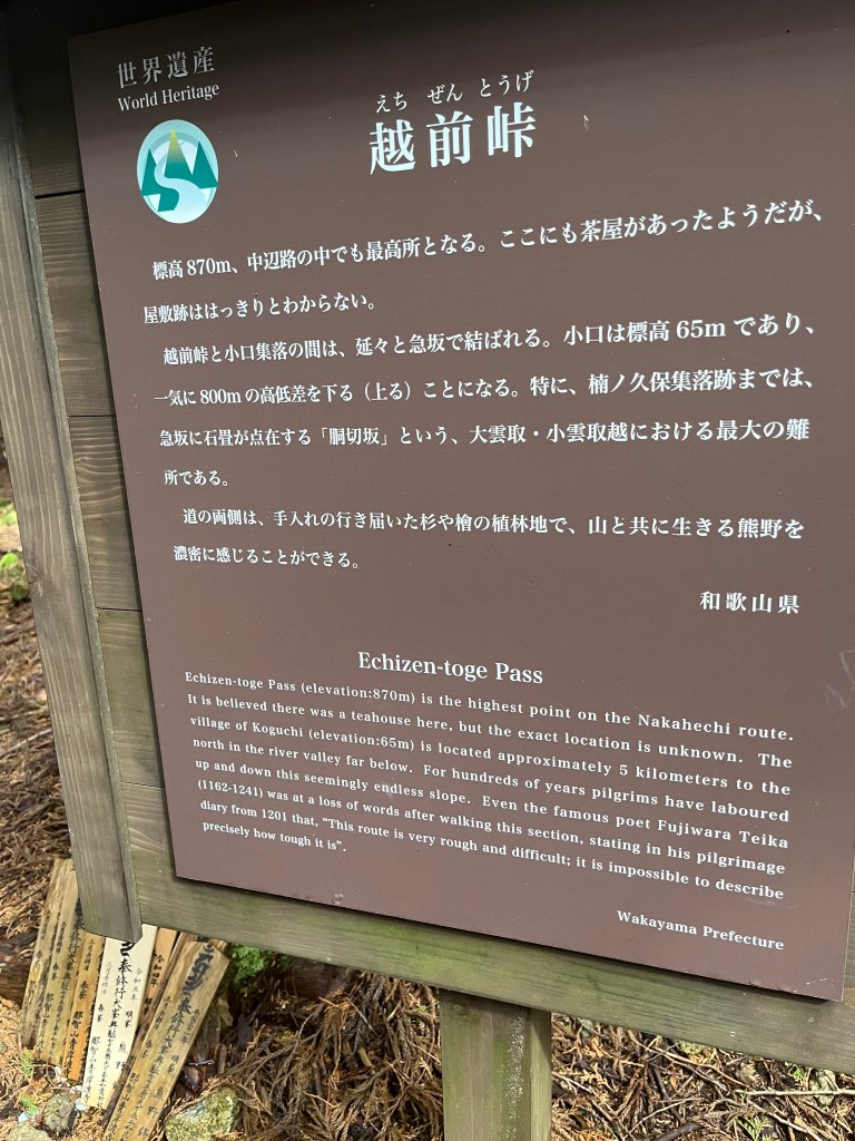

A famous 10th century poet was at a loss for words after walking this section “this route is very rough and difficult; it is impossible to describe precisely how tough it is”
From here it was downhill all the way. The section is known as ‘dogiri-zaka’ which can roughly be translated as ‘body breaking slope‘. Working on the premise you’re coming up the hill. Which, thankfully, we weren’t.
The next couple of hours can only be described as a mad scramble descent. Our deadline of 4.30pm was forefront in our minds and as we descended, the light was slowly becoming dimmer.

I was supremely grateful for two things – sturdy hiking boots and walking poles.
These two items meant we could power down the stone stairs, paths and trails with accuracy and support. We passed some incredible ryokan ruins at Kusuonkubo-jaya and from there, the steep slope became less treacherous and more gentle.
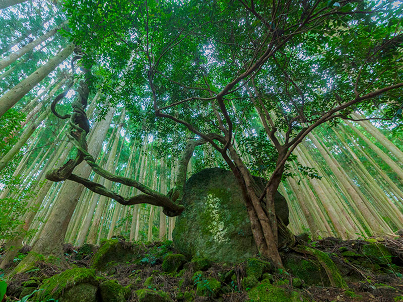

The history and grace that resides in the Kumano Kodo is quite simply – awe inspiring. Around every corner is another historical delight to enjoy. I didn’t get my own photos of everything, but above are two images from the Tourist Centre – see what I mean?!
DESTINATION – KOGUCHI
After the final two km dropping gently down into the valley, we popped out into Koguchi – but not before clambering down the final set of perilous moss covered stone stairs! With aching legs, I do believe this was the most dangerous part of the day 🙂
Our instructions were to phone our accommodation providers (Takata Green Land) for a pickup when we arrived and wait outside the Minakata grocery store. Very specific. I’m good at following instructions, so we duly phoned and our pickup was booked for 30 mins time.
Happily the store was open, so a refreshing beverage was in order. We sat outside the store and can I tell you, it was the best beer I’VE EVER HAD… and TB advised that it was the best sake she had tasted that day (ha!)


I can’t help myself – here are the distance comparisions:
Paper map = 14.2km
AppleFit = 21.04km
Strava = 29.1km
hmmm.

OUR ACCOMMODATION – TAKATA GREEN LAND
Our shuttle arrived, and 20 minutes later we were at Takata Green Land, aka Kumotori Onsen, a “low key hot spring inn”.
The best way to describe the accommodation was compliments of TB – it was “Hi-De-Hi during off season”. For those of you not in the know, Hi-De-Hi was an English sitcom set in the 1960’s when families went to holiday camps complete with dining halls, communal loos, and kitsch everything – all in perpetual rain. Everything appeared a little grubby, and the dining room was in use as a very large storage cupboard. Our tatami room was a bit battered and didn’t’ have any toilet facilities, they were communal in the hall. There were hardly any guests around – only three of us for dinner and breakfast, so I’m assuming it really was off season.
The onsen was lovely though – we wallowed outside in the hot pool in the misty rain, very warm and relaxing for tired muscles. Ditto the food, it was plentiful, tasty and did the trick.
Day three of hiking the Kumano was done and dusted. We were happy, health and injury free – what a great way to finish a great day.
Stay tuned for our final day on the Kumano, as well as some blogs on ryokans, onsens and other Japanese adventures – yippee!!
Thanks for tagging along – see you out on the trails.
PJ 🙂
