Hello and welcome to my LIKETHEHIKE blog.
I’m PJ and I write about the hikes I take, giving you insights, photos, commentary, tips and tools so you can enjoy hiking and embrace the experience.
Today we are exploring the Main Border Track in Lamington National Park, in the Gold Coast hinterland. A track that’s been making hikers happy for almost 100 years.
A Weekend Escape!
It was time for me to return to my hiking roots, and what better way than a hike in the South East Queensland corner. Other Half (OH) and I had a birthday weekend planned at O’Reilly’s Retreat, a delightful tourist destination high in the McPherson Ranges, a two hour drive from the coast. Another reason to go to O’Reilly’s was to finally hike the Main Border Track!
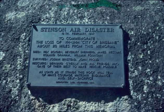
O’Reilly’s Retreat is embedded in Queensland history. It was founded in 1926 by the O’Reilly family when an attempt at dairy farming in the ranges failed. To be fair, they bought the land sight unseen, and there was NO WAY dairy farming was going to be possible in the mountainous and uncleared forest. So, rather than selling milk and cheese, they started selling eco-tourism. O’Reilly’s gained global fame in 1937 when Bernard O’Reilly tramped for three days through impenetrable forest to locate a downed Australian National Airways flight missing enroute from Brisbane to Sydney with seven people on board. A nationwide search for over a week failed to find any sign of the plane, but Bernard had a good idea where it may have come down, based on his knowledge of the area, the storm patterns and down drafts. Because of Bernard, the two survivors were rescued 10 days after the crash and reunited with loved ones.
The Main Border Track
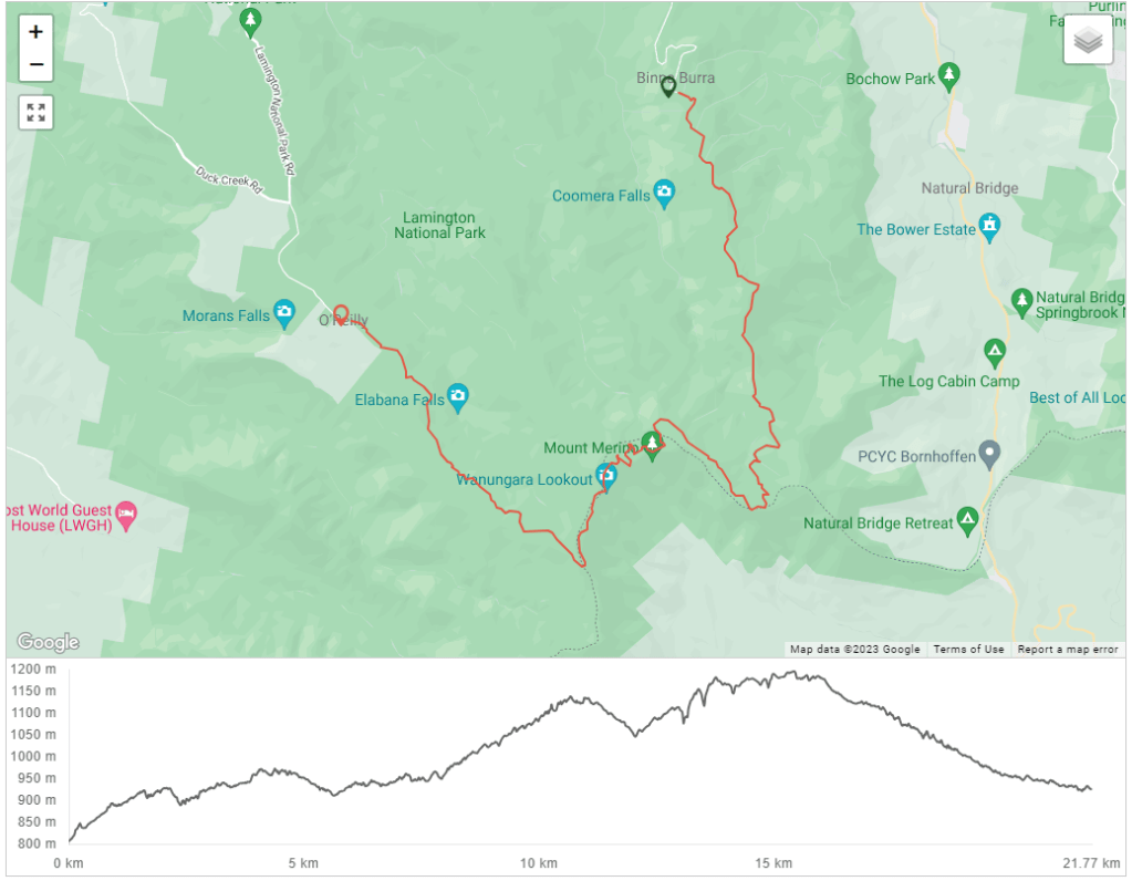
The Main Border Track runs between O’Reilly’s Resort and Binna Burra. It was built in July 1937 in two sections, with one crew cutting in from O’Reilly’s toward the second track crew working in from Binna Burra. It took 50 men 18 months to join the 22km track.
FUN FACT
As the crow flies, O’Reilly’s and Binna Burra are only 6km apart. However, the track is 22km as it winds its way around escarpments and ranges, and the drive from one to the other is over 70km!
The track can be walked in either direction. I caught a shuttle from O’Reilly’s to Binna Burra and walked back. Mary, our driver, is a long term employee at O’Reilly’s and had lots of tips and fascinating information about the area, the Track and whether leeches are around in winter. They are but only come out when it rains…
We departed around 7.45am, which put me at Binna Burra around 9.15am and I was off! Mary advised that most hikers tend to pop out the other end somewhere around 4pm, so a hike time was anticipated of around 6 hours. That was my goal, and it also meant I would be off the track before forest dusk.
Starting the Track…0-5km


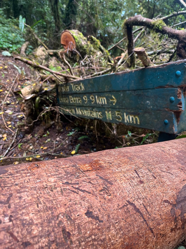
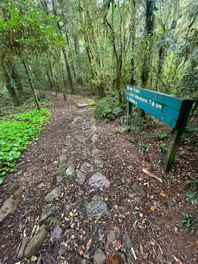
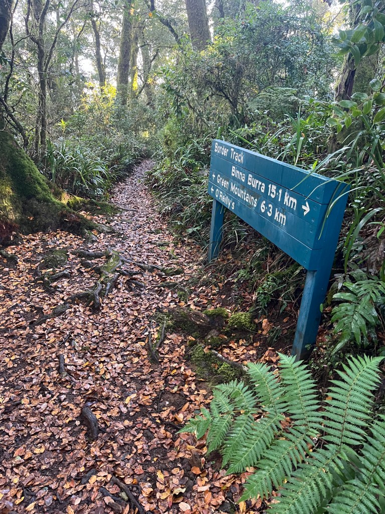
The commencement of the Border Track is pretty simple. You walk under the arch – and you have started! Lamington National Park is very good with signage, and the Track is very well signposted from start to finish.
Don’t be freaked out when the first sign you see has “Green Mountains” as the destination, not O’Reilly’s. Green Mountains is a section of Lamington National Park and the day use area is adjacent to O’Reilly’s so they are one in the same. Your end goal is Green Mountains 🙂

The first few kilometres are a gentle incline away from Binna Burra. You will be climbing several hundred metres upward over the first half of the track, but it’s gentle. This part of the track is taking you up the side of the Beechmont Range, with Coomera Gorge to your right. There are several circuit walks and tracks intersecting with the Border Track, just keep an eye on the signage.
About 3.7km in, I arrived at the first lookout, Joalah, and my first glimpse of a view. The vegetation has been growing vigorously since the last fires came through, so I wasn’t holding out much hope for clear lookouts. I stopped for a photo and a coffee. Those of you familiar with my Kumano Kodo blogs will remember the trusty Thermos – it was ready to go in my backpack!


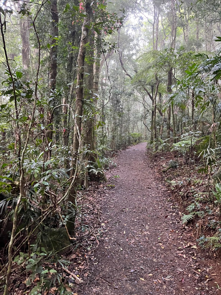
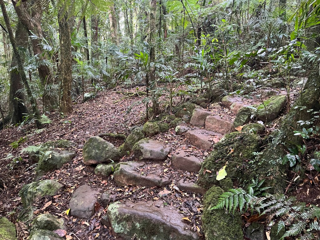
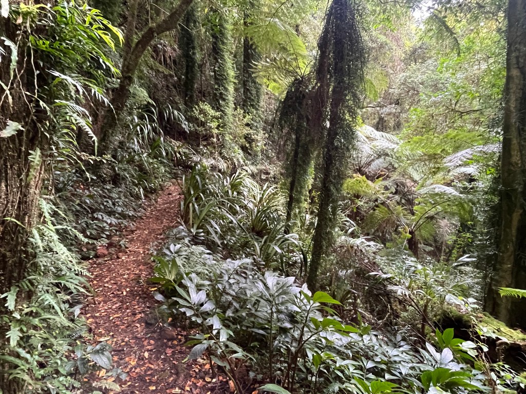
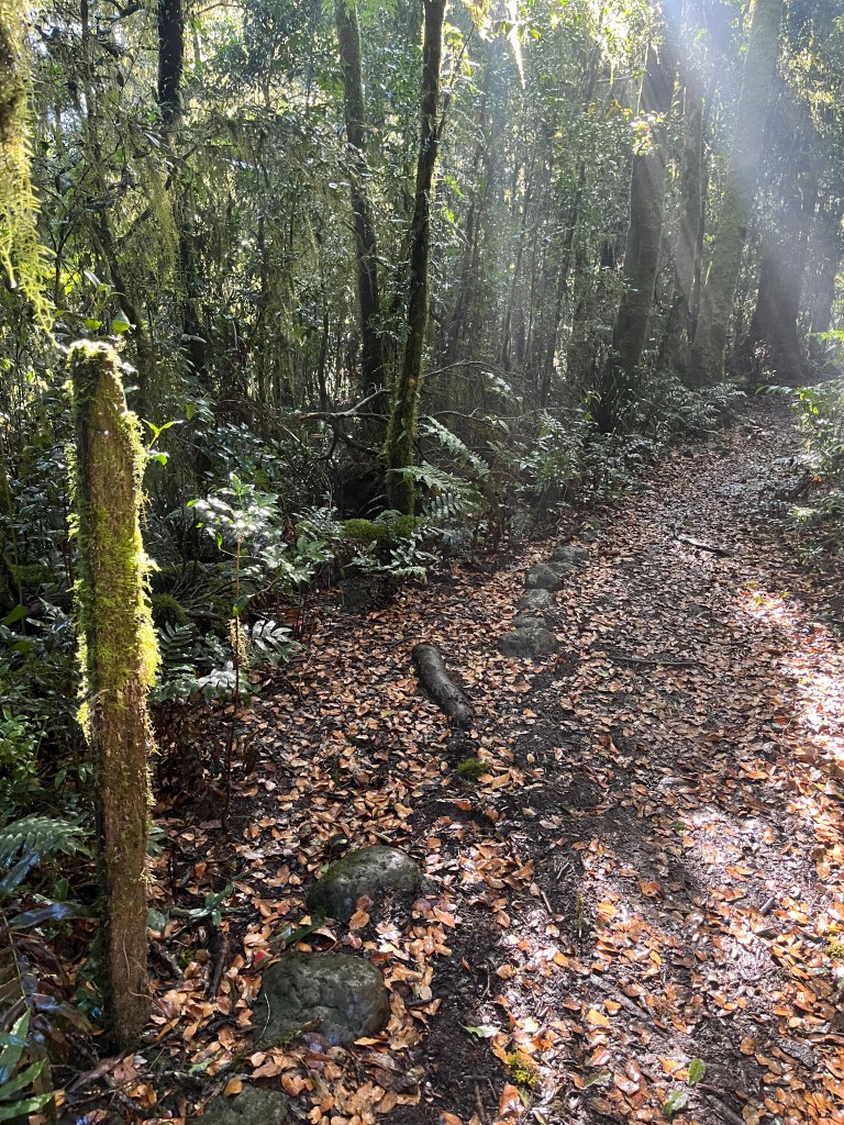
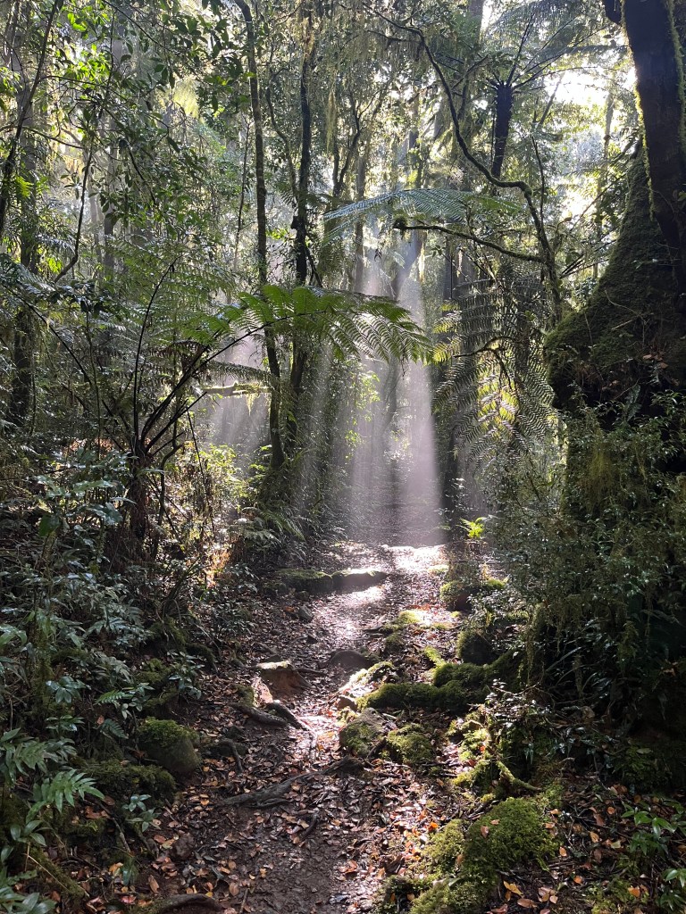
The track has a primordial forest feel. It was an overcast winters day with lots of low cloud and mist blowing up from the south. I had the place to myself and there was an abundance of trees and flora to look at as I walked. Until you get on the Border Track proper (no criss cross trails) the path is wide and flat. Once you move beyond other trails, the track narrows considerably, and is strewn with rocks and root systems.
CAUTION – EYES ON THE PRIZE
Foot placement and managing the terrain are two really important aspects of hiking. It’s unusual to be on a hike where you don’t ever have to look down to navigate the terrain. Sometimes it feels that you can’t lift your head as you are forever looking down to plan your next safe step. Beware the temptation to look at a map or your phone while mobile, chances are you’ll stack. That’s the fun of hiking, keeping your eyes on the prize and staying upright…
Getting into a Rhythm…5-10km
I must admit, rocks and root systems aren’t my favourite terrain, but you play the cards you’re dealt. As I moved through the 5km mark I was feeling great. The track narrowed again and became a little rougher. There were a few creek crossings, and whilst not in full flow, they weren’t dry either so it was a careful transit across Hobwee Creek at 5.7km, Bower Bird Creek at 6.3km and Dragoon Bird Creek at 7km.
Dragoon crossing was a slippery sucker! I can only imagine what it would be like at the height of summer with the creeks roaring with water… you’d need a snorkel and flippers to make it across.


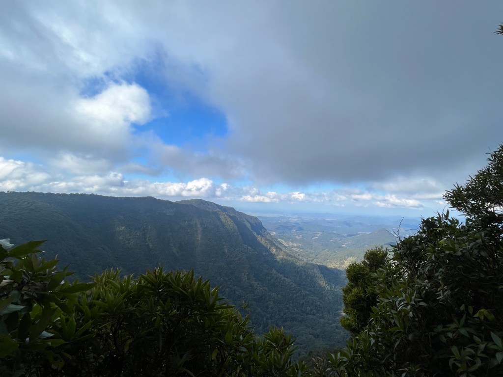
At the 8km mark there was the option to detour to the Dacelo Lookout. So far the southerly had been delivering misty squalls so I decided not to add 2km to my hike to see it. However, at around 8.5km I did sneak off the track (safely and without risk) to take a fabulous photo of the view down into the Woggunba Valley – and lo – the clouds stayed on the western side. Take a look…

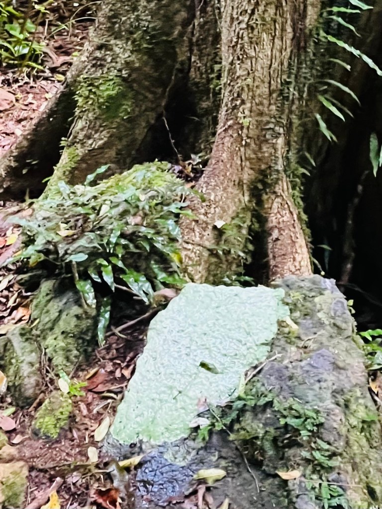
The attraction of a new trail is discovering new things, sometimes odd things. Along the track I saw stones which appeared to be covered in a light green calcification, not the whole stone but just part of it. No idea what it is, so dear readers, fill me in if you know.
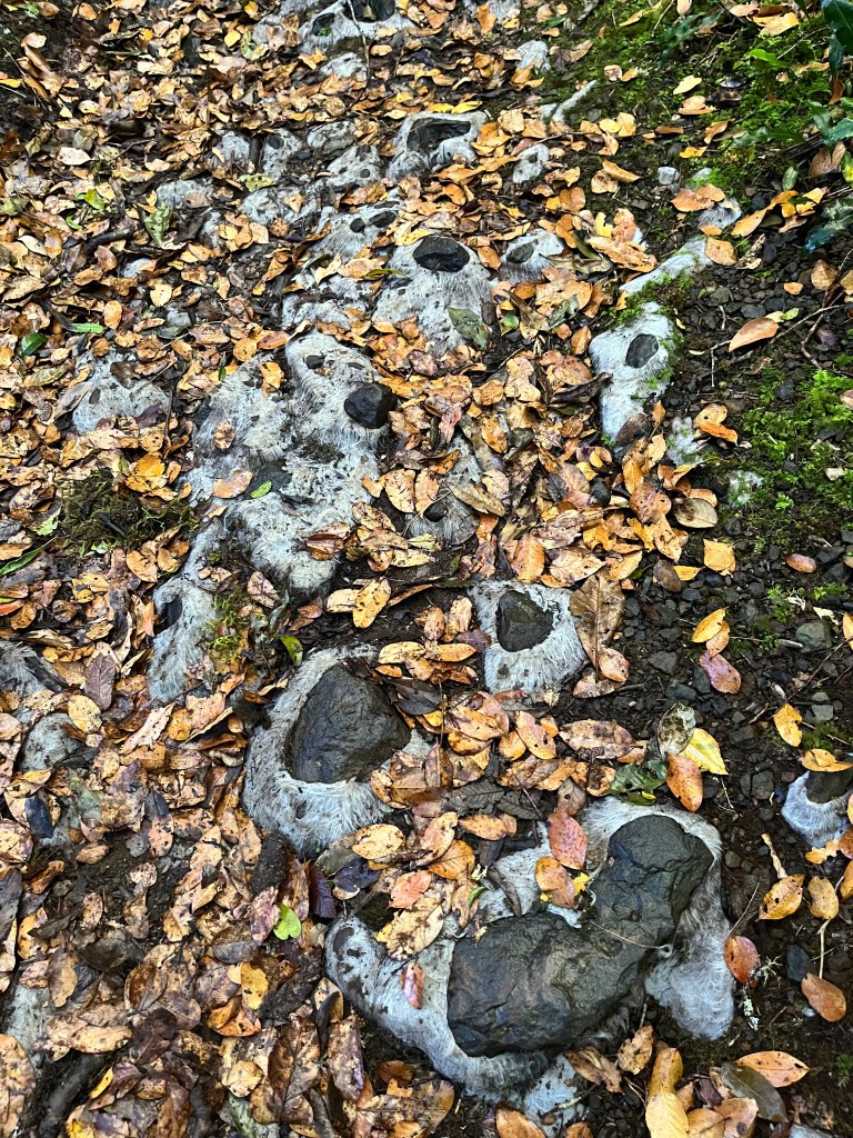
Oh, and then I saw the white stuff which I thought was a type of moss or fungus… ? Got all excited – then I realised what it was…..doh. It’s the underlay put down before gravel.
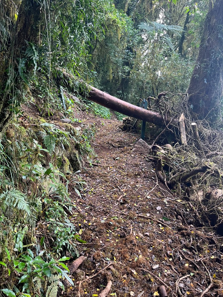
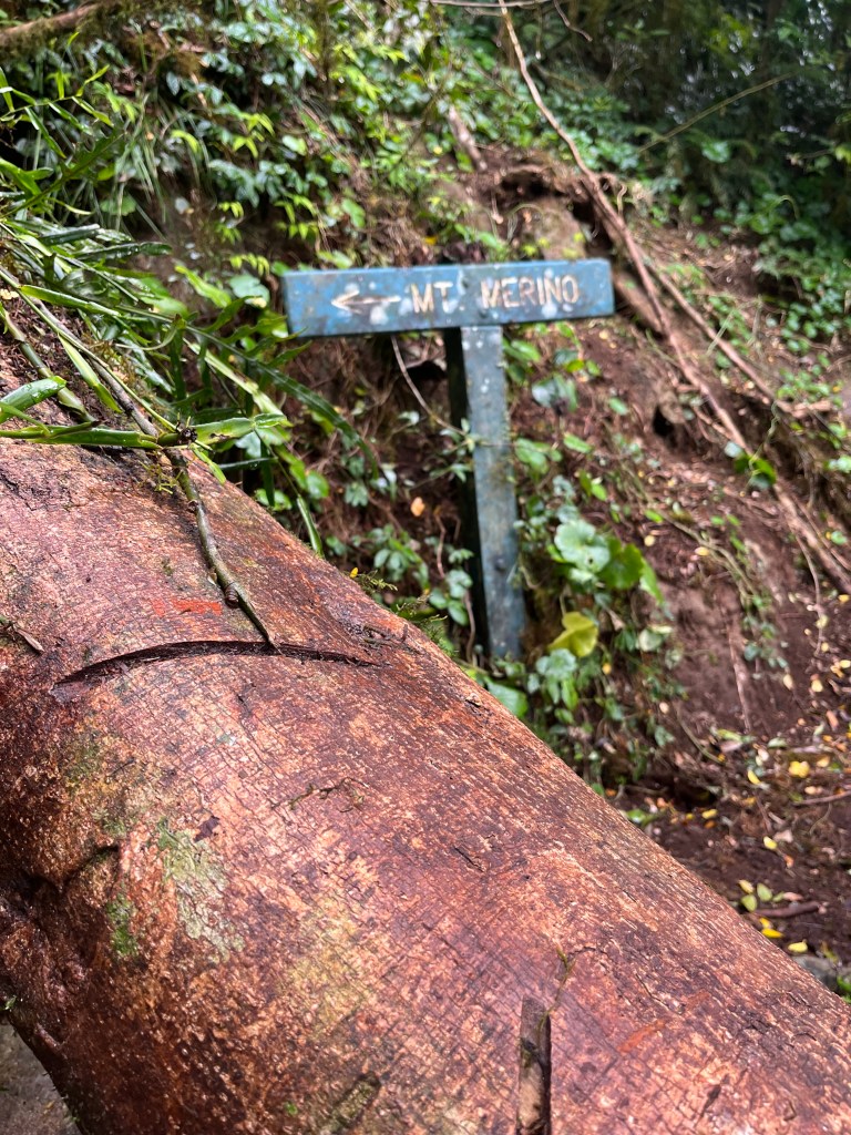
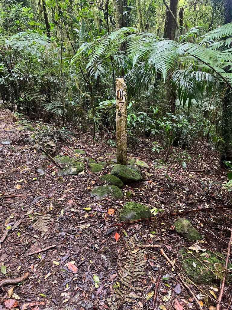
Around 9.5km I came across the sign and trail for Mt Marino. A large tree had taken exception to the sign and completely destroyed it. This quickly became the theme for the hike. There were a number of downed trees and vine entanglements to navigate over, under or around. It did provide for some interesting moments as I am not the most flexible of humans and clambering through downed foliage was a bit of a challenge.
Over Halfway…10-15km
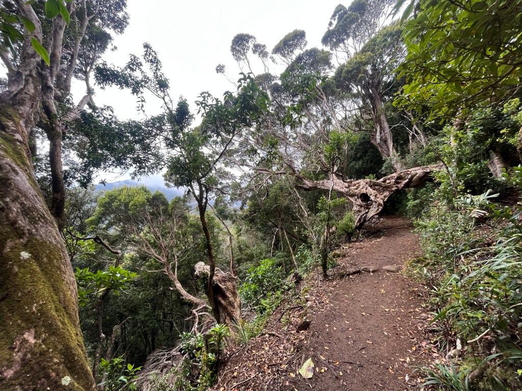
It was time for morning tea and a break. The first half of the hike had been a gradual climb upward, with an altitude gain of around 600m. The lookout and rest opportunities had been few and far between so when I came to Chakoonya Lookout which had a view AND a place to sit, I sat.

The views, when you come across them, are simply spectacular. When you can’t see the distance, you are enveloped in the green hug of the forest. You can see how narrow the track becomes and the vines were that close you are pushing your way through. However, you never feel lost thanks to the stone markers on the track floor, most of which are close to 100 years old.

By now I was passing hikers coming from the O’Reilly’s side. For about 45 minutes, it was rush hour as we all crossed over. I also passed the original halfway marker, at around 10.5km. Luckily for the American followers, the marker shows our old imperial measurements. The Main Border Track is exactly 14 miles long and thoughtfully it shows the direction and distance for each destination.

A few more lookouts, Nyamulli, Wanugara and Tooloona, so more impressive escarpment vantage points. There was a distinct lack of places to sit, which may be a small failing of the track because unless you sit on the ground for a rest, there really is nowhere else to park up. Perhaps I have been spoiled on other hikes where carefully placed rocks and logs provide welcome perching places.


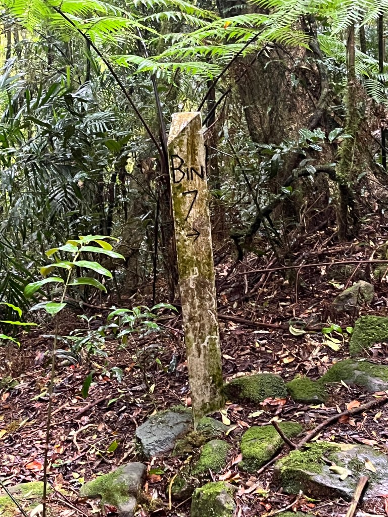
I was starting to count down the kilometres now, and each sign showed that I was getting closer to my destination. I did pass another triangular marker sign, but couldn’t work out the etchings….a mystery for another time 🙂
Almost There…15-22km
The Border Track is advertised as a 20km hike. It is, in fact, close to 22km. If you are dead set on accuracy, the last couple of km might be soul destroying so factor this in.
The marker for the last 6km downwards to O’Reilly’s is the Bithongabel Bush Camp sign, which is cryptically signposted as “Bithongabel”.
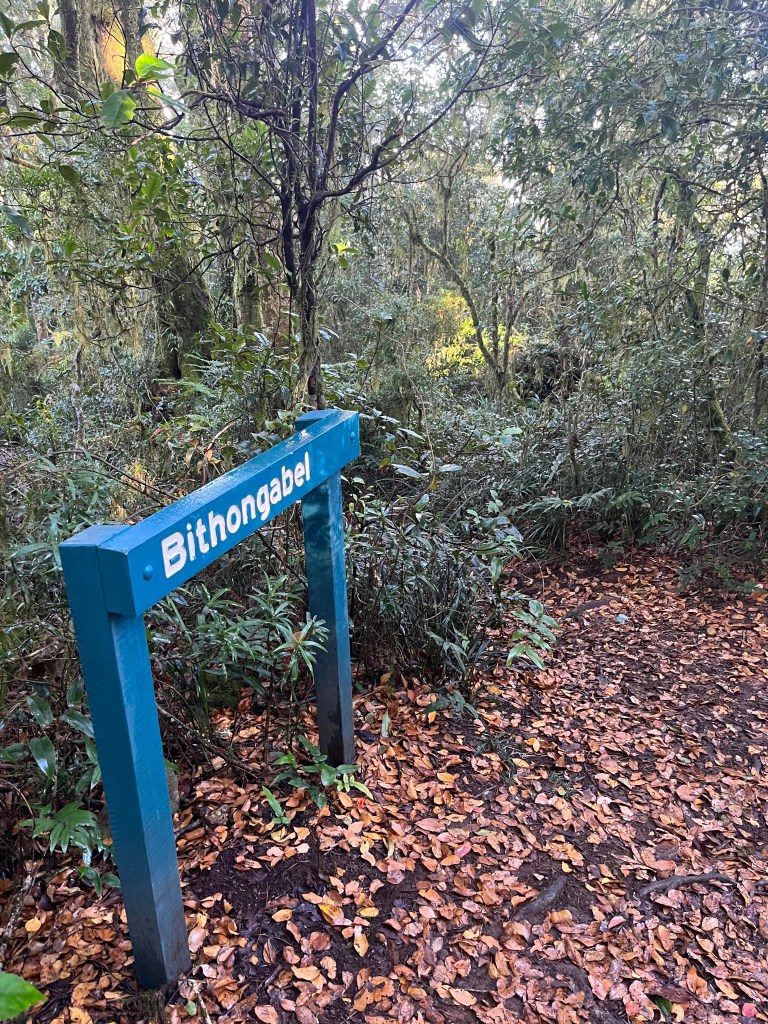
I did a bit of research, and Bithongabel is where keen hikers doing the full immersive experience of the Gold Coast Great Walk can camp overnight. So, once you arrive at this sign you’re almost done, and O’Reilly’s is not far away. The sun was out so the last couple of hours were in dappled sun and on a wider, more forgiving track. It was transitioning from 100% rocks and roots to a springy leaf litter surface. I was definitely in the Antarctic Beech Forest section now.
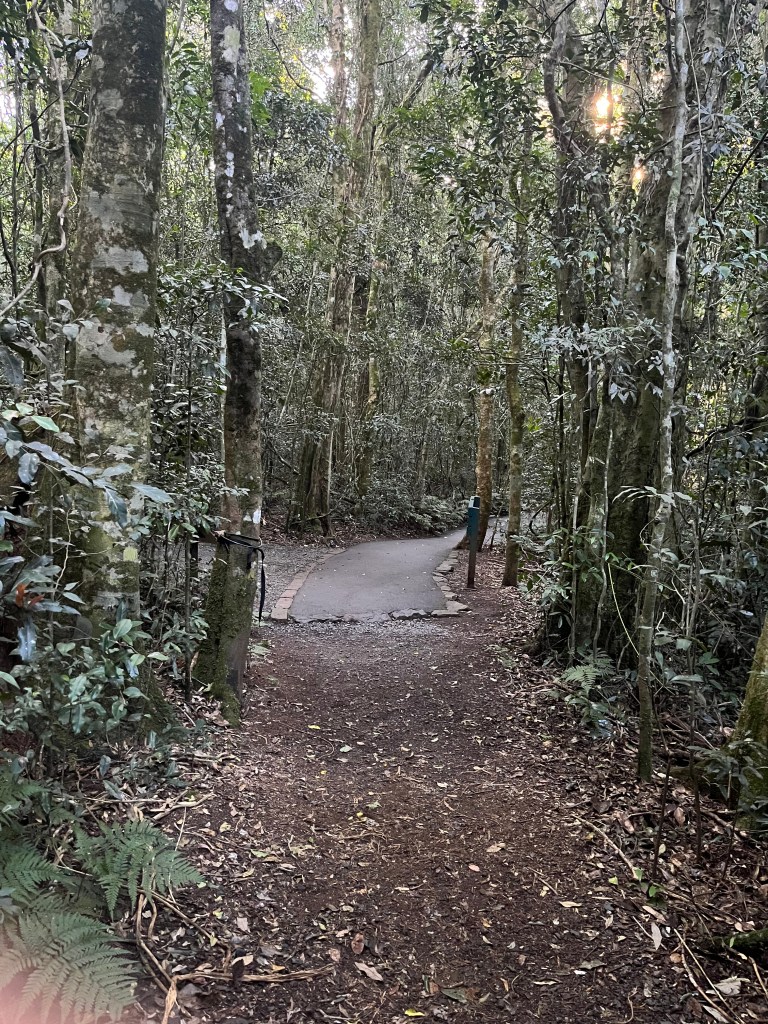
You’re almost finished when you reach the paved trail, which is about 800m from the end. It was such a lovely sight, as dusk was falling in the forest and the light starting to dim.
I knew that a warm shower and a lovely glass of O’Reilly’s Sparkling Chambourcin was awaiting me, as well as a sumptuous dinner next to a roaring fire. Funny how that put a spark in my step 🙂


In Summary…
I’m really pleased that I hiked this track solo. It was great to boost my confidence as a ‘hiker’ and tick off an achievement that was mine alone.
I was prepared. I had food, water, a headlamp, a space blanket and additional clothing in case I was delayed on the track. I sent my Strava beacon to OH, who tracked my progress and came down to meet me at the finish.
The Border Track is challenging, but not insurmountable. It’s beautiful, wild and ancient, and perfect for a solo hike.
Go on, discover what might be in your back yard and as always, embrace the experience.
See you next time out on the trails
PJ 😉
