Ships Ahoy and Ticks Galore!

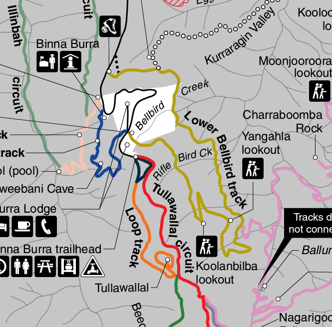
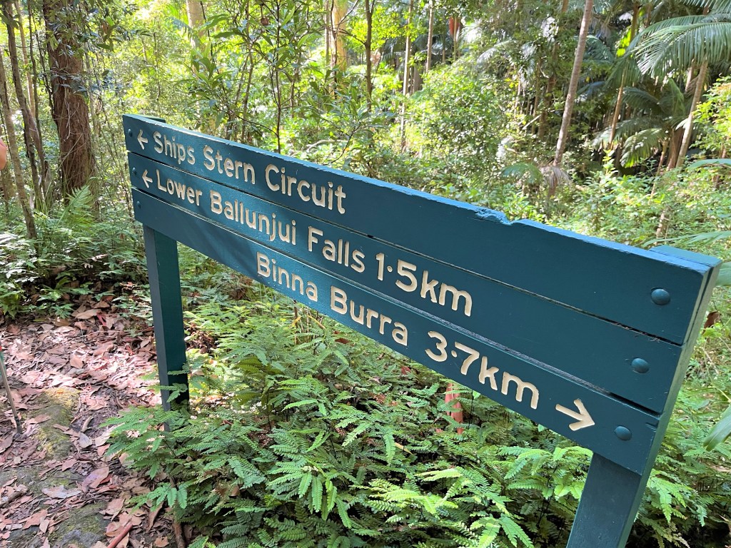
Tackling the Ships Stern Circuit in Lamington National Park

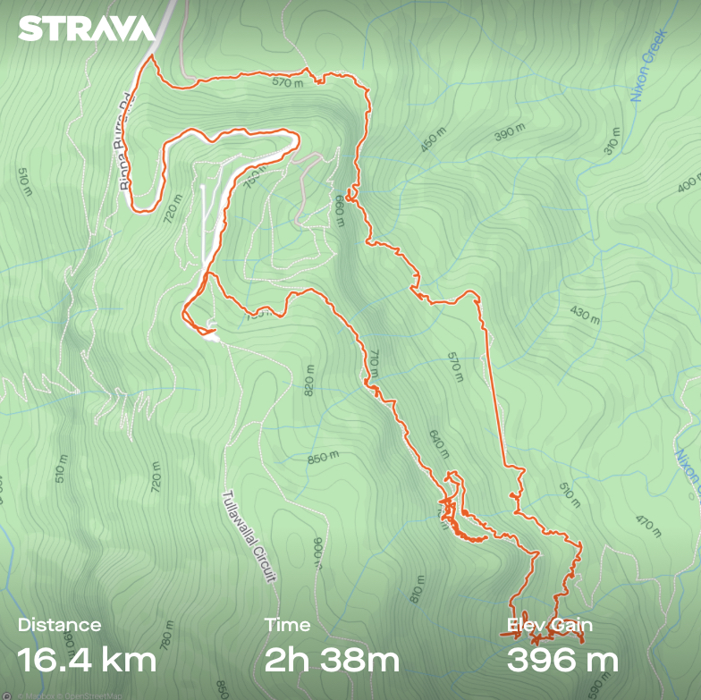
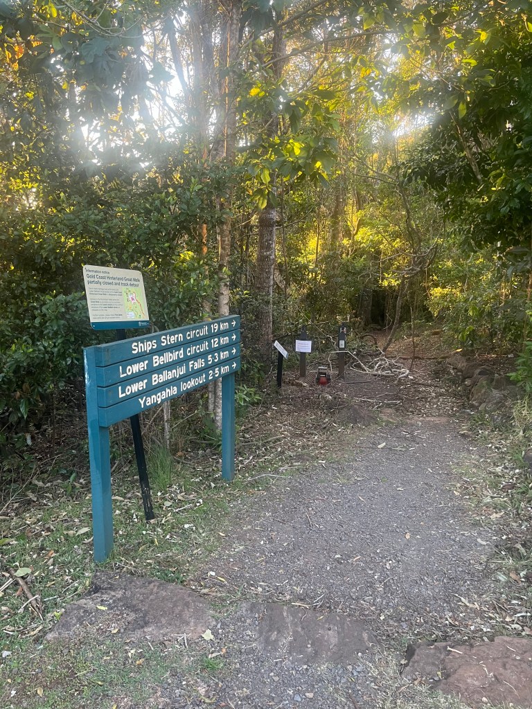
Ahoy fellow hikers! Welcome back to another grand adventure, this time exploring one of Queensland’s treasures – the 20km Ships Stern Circuit in Lamington National park. A mere 70 minute hop from the Gold Coast, this park is part of the majestic Gondwana Rainforest, covering over 366,500 hectares of pure hiking heaven.

I’ve dallied with parts of Ships Stern before but never braved the full 20km loop. Well, today was the day! What could possibly go wrong, right? Spoiler alert: I didn’t anticipate the unseasonable heat, or the final unwelcome hitchhiker.

First Stage: Downward Delight (And Spiderweb Swords)

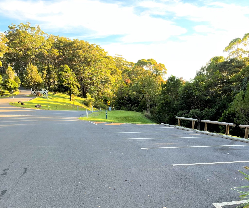
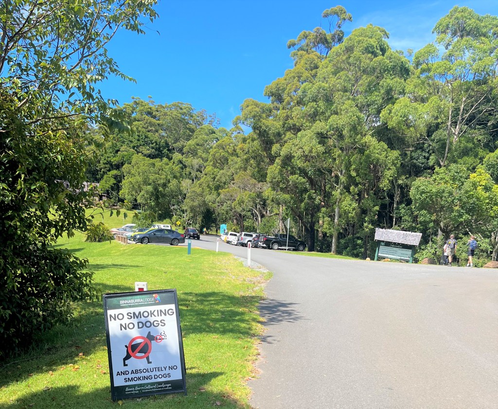
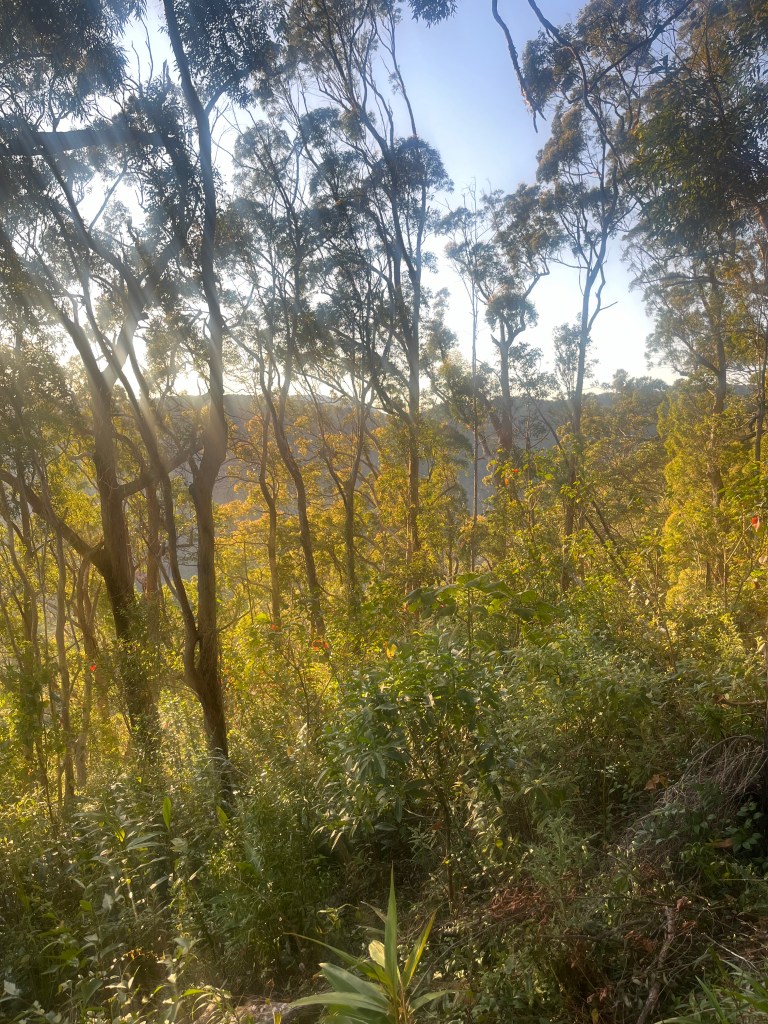
Being the clever clogs that I am, I arrived before 5.30am and parked at the top of the park near the Binna Burra Cafe, giving me an easy downhill finish to the hike. Plus, with a forecast of over 33 degrees Celsius, I wanted to beat the midday heat.

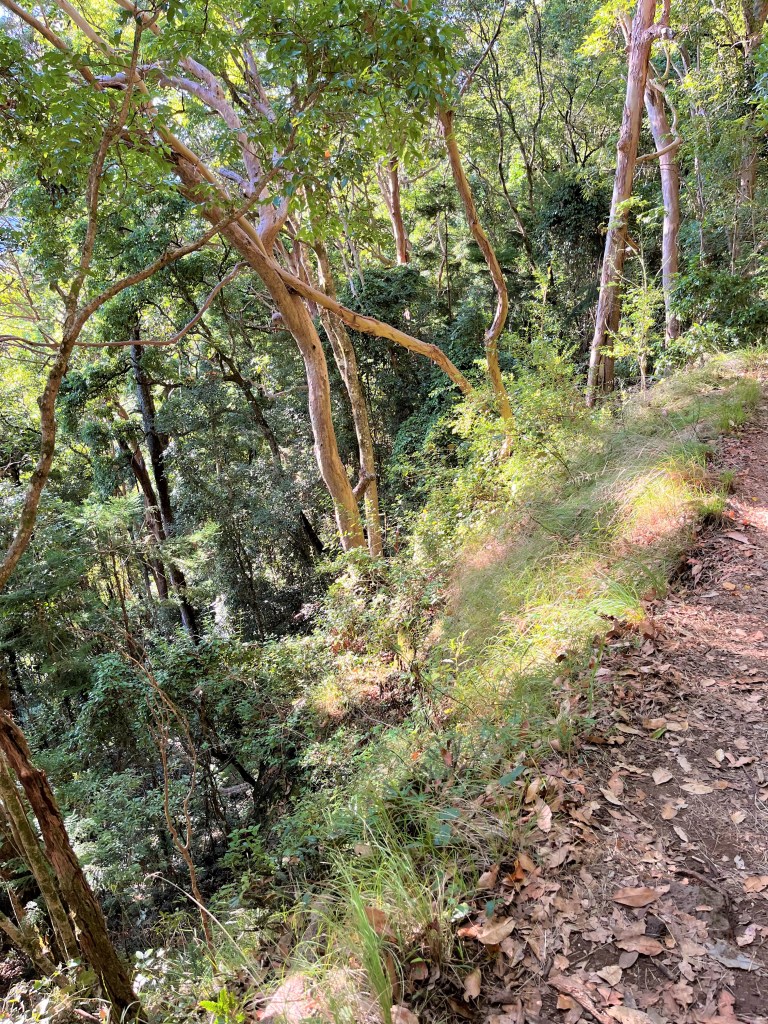
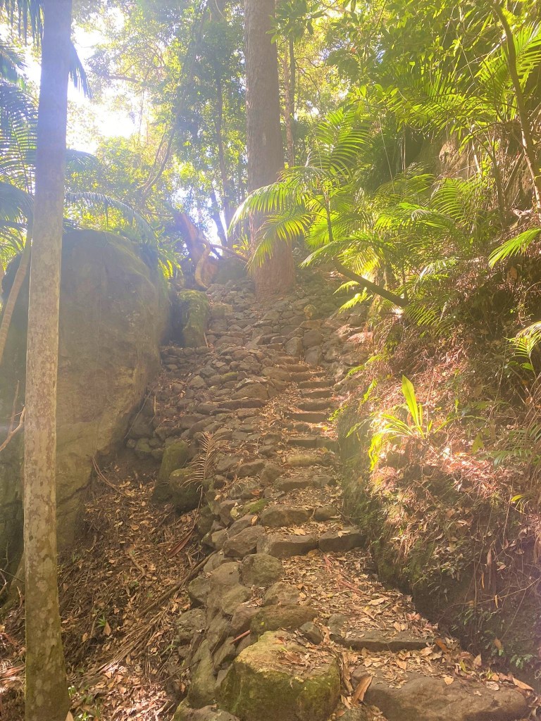
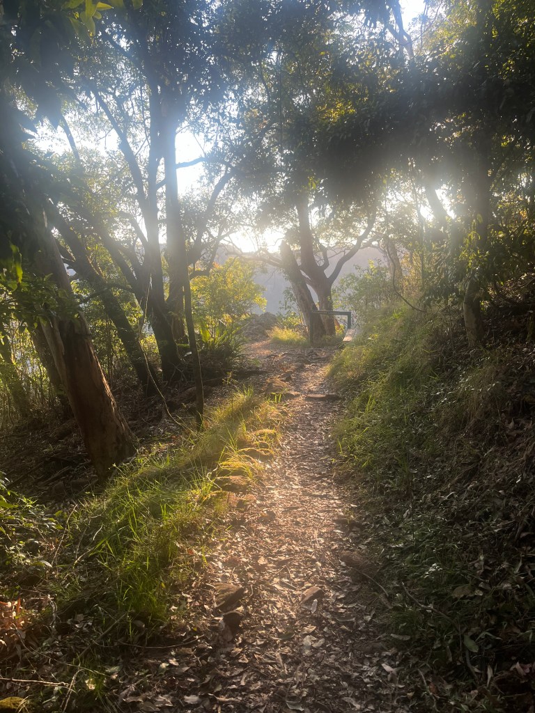
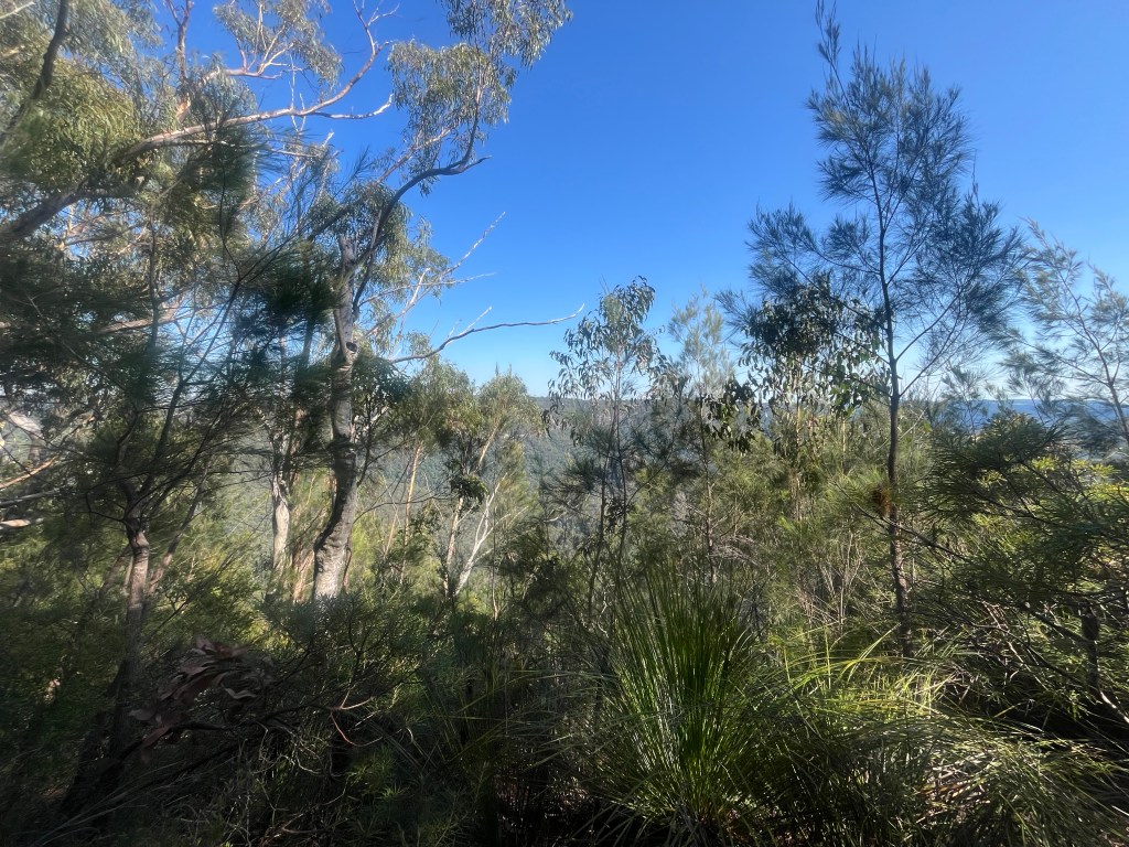
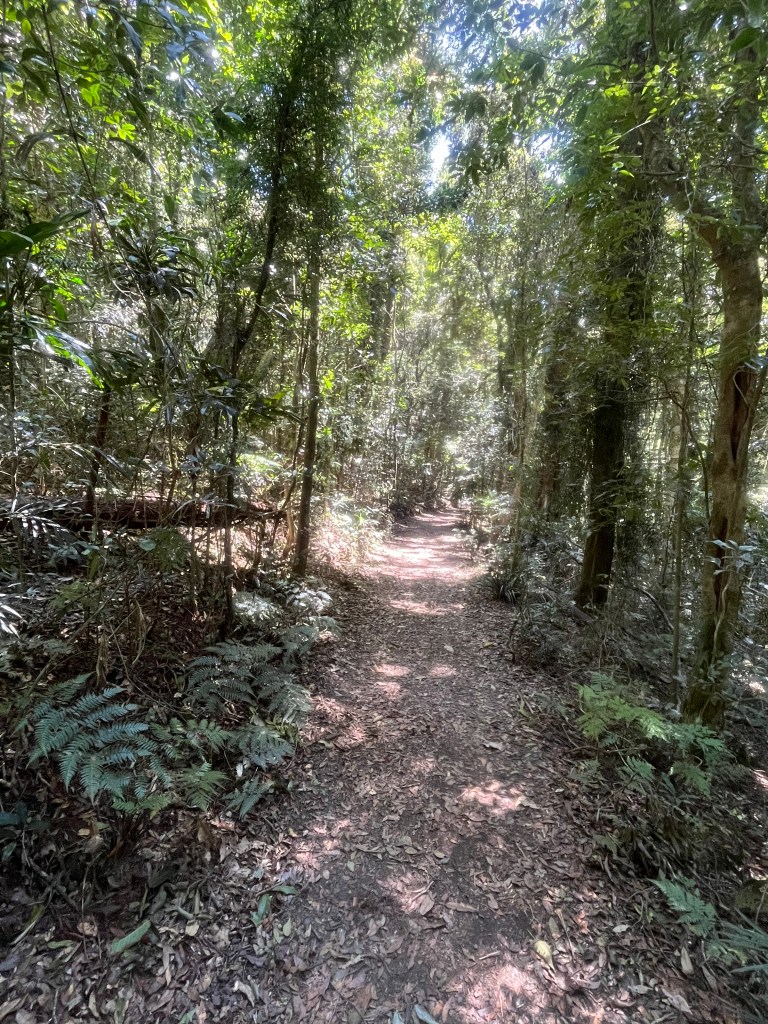
The first part of the trail was a lovely, gentle descent, perfect for soaking up the early morning rays….and as it turns out, spiderwebs. Oh, the webs! I became an impromptu samurai, waving a stick to fend off what felt like an entire arachnid population weaving across the trail! Note to self -arriving early means you get the fresh webs, lucky me.

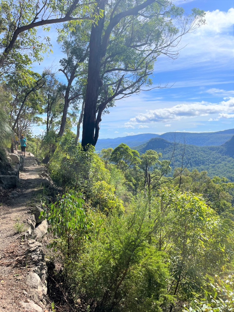
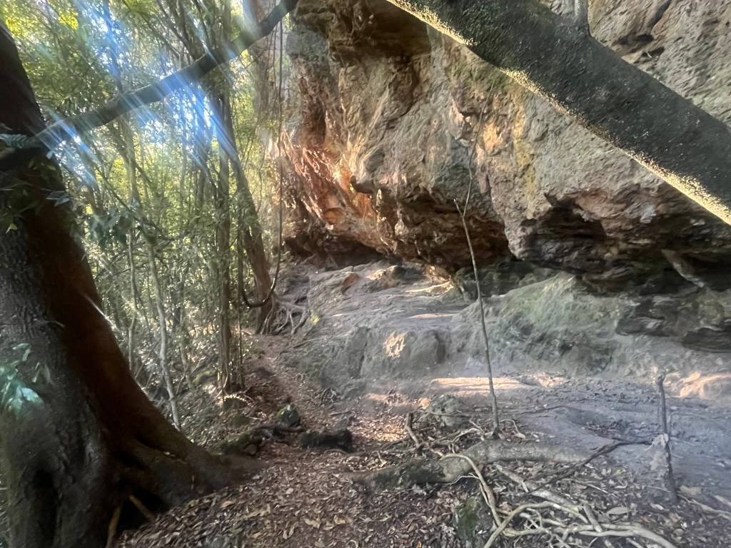
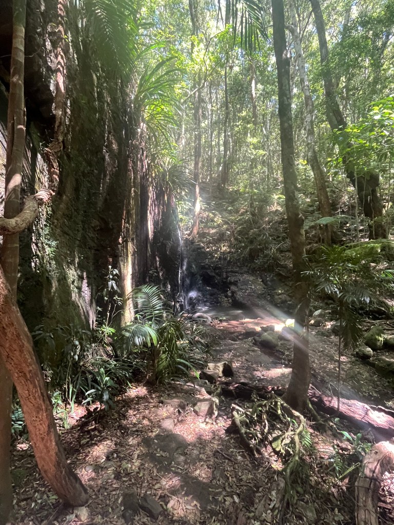
At about 1.5km in I hit my first dry creek crossing and took in the beautiful views from Koolanbilba Lookout. The trail became steeper as I continued, but I couldn’t help pausing at a natural cave around the 2.6km mark. Who else had sheltered her over the centuries? I felt like an explorer uncovering new lands and treasures – until I remembered I was actually just sweaty and armed with a samurai spider-stick.

Second Stage: Snakes, Sticks and Stunning Views

By the time I hit the 6.5km mark, I started the uphill slog. Let’s be real, I was a little nervous that the rest of the hike might be all uphill from here – but hey, what’s life without a a challenge?

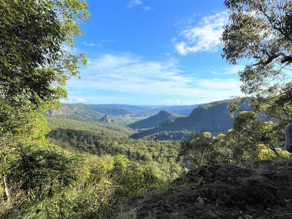
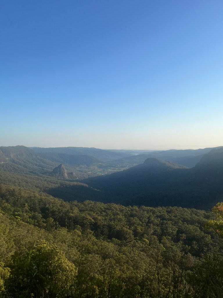
As I trudged upward, the trail opened up to spectacular valley views with grassy vistas, and I swapped my cobweb stick for a snake stick. in Queensland’s spring heat, snakes are out and about looking for love. Fortunately I only encountered one tine brown snake and it slithered away quicker than I could say, “NOPE!”

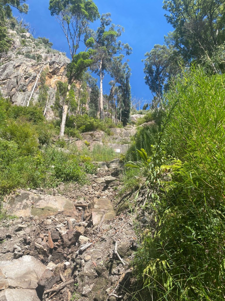
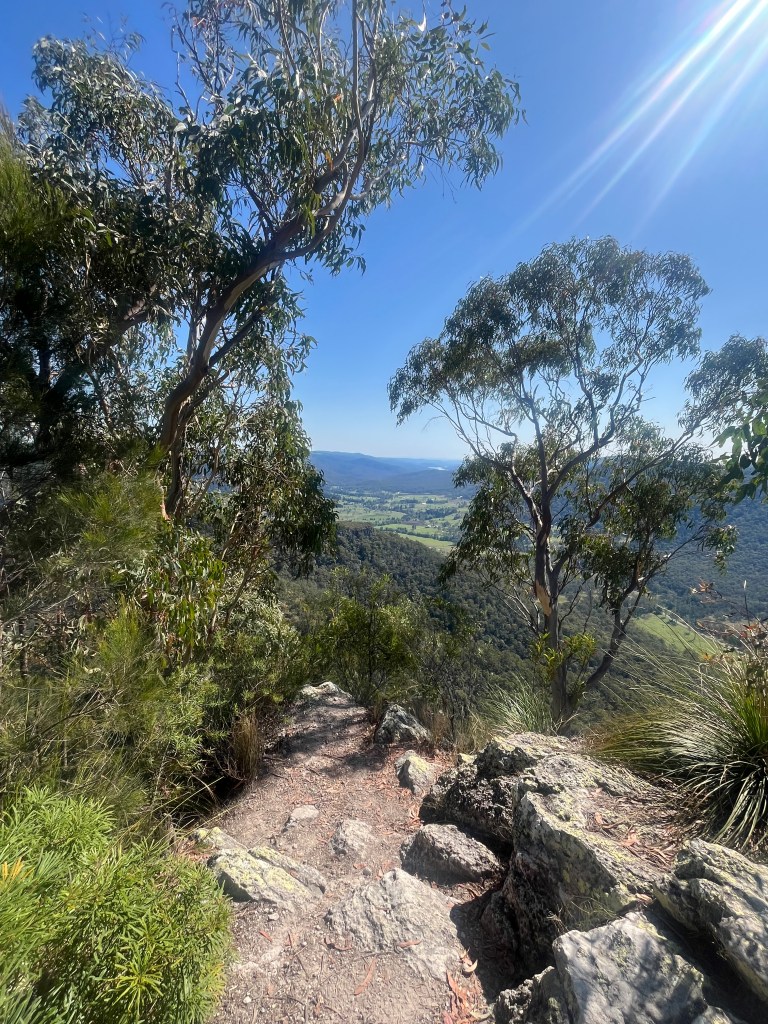
At 8.5km, I arrived at Charraboomba Rock, a stunning rocky outcrop with heart-stopping stairs that cling to the edge of the cliff. Heights aren’t my thing so I skipped this side adventure. Brave souls, you’re on your own for that one! I still had amazing views, so all was well.

Third Stage: Cliff Views and Cliffhangers

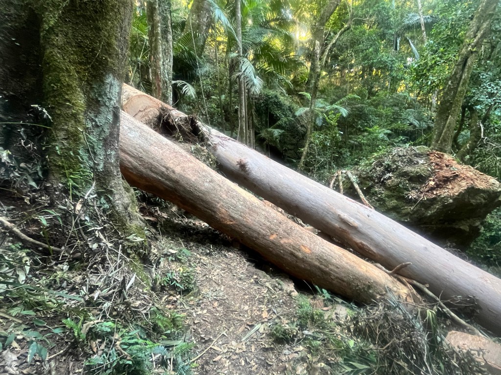
At 10km I found a perfect log for my snack break. Just me, my salad wrap, chocolate bar, and the valley stretching out below. I took the opportunity to spray myself liberally with insect repellent, than goodness for that decision as the next part of this tale will reveal!

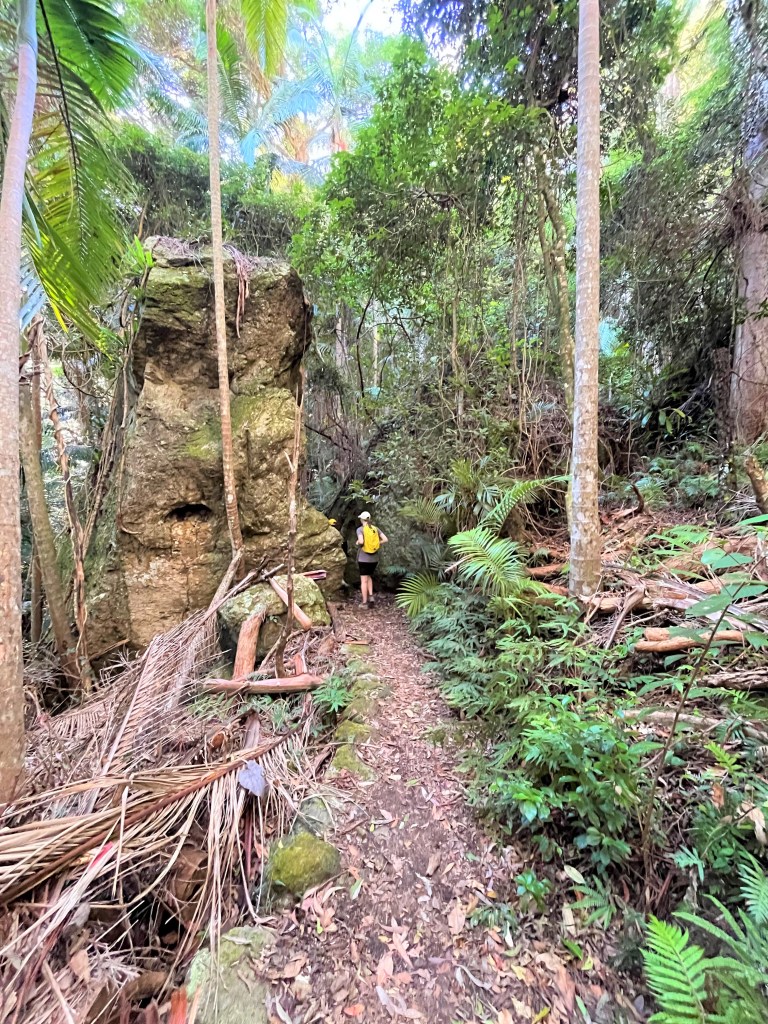
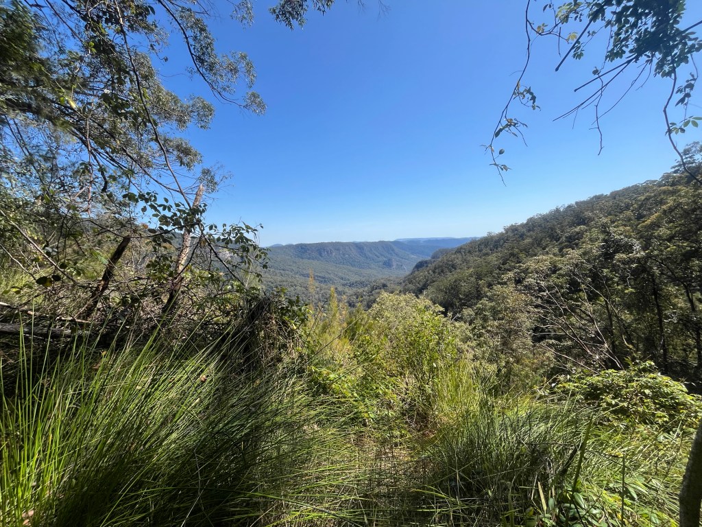
Feeling refreshed, I set off again, only to find the second stunning lookout just 500m later. Could’ve had my breakfast with an even better view, but oh well! I had a sit and a look, and then continued along the trail, enjoying the breath-taking scenery and the stillness of the morning completely to myself. So far, I had not seen another soul on the trail – a very special experience.

By now I was halfway through the circuit and starting the long trek back. Around the 13km mark, I began the final ascent. I knew that the last 2km would be downhill, but getting there was a sweaty grind – happily the views made it worthwhile.

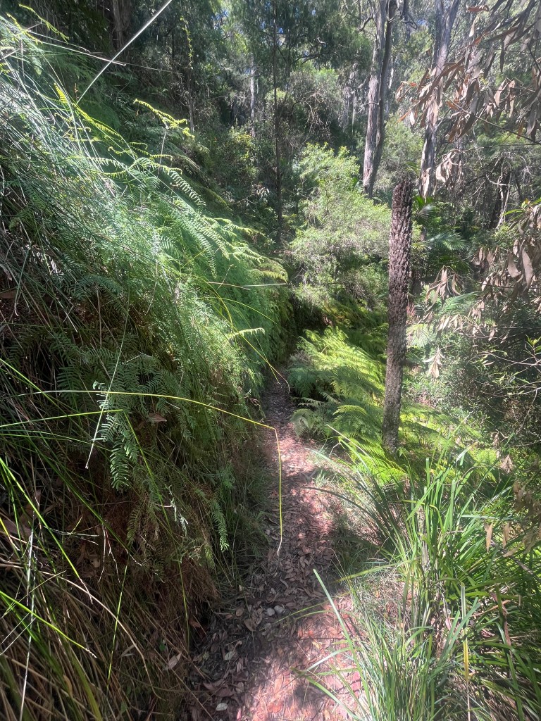
At 15km I took a breather at Nagarigoon Falls – the only ‘falling’ waterfall I found. Not a huge amount of water, but hey, it was still peaceful and pretty.

Fourth Stage: The Downhill Stretch (And… The Incident)

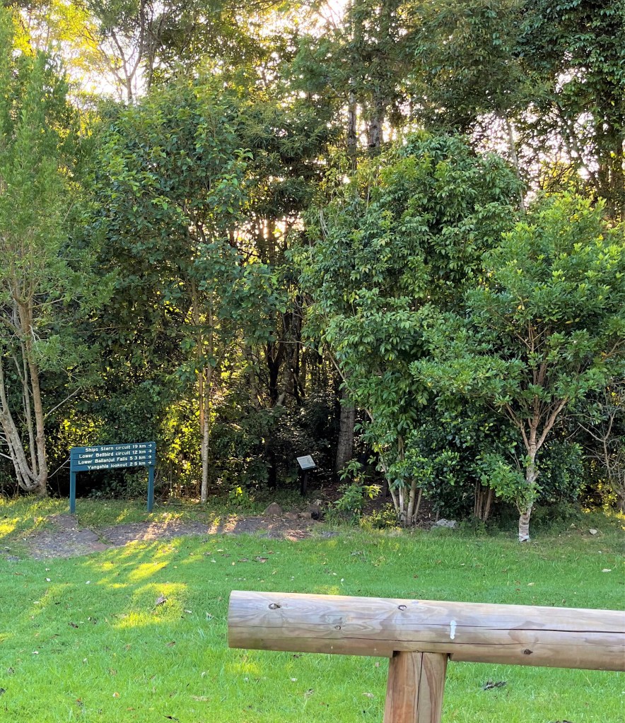
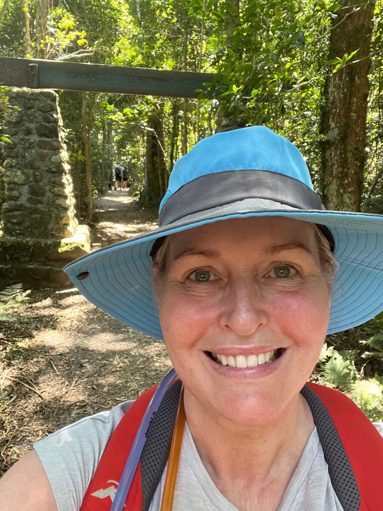
Finally, I reached the marker for the Border Track and the start of the downhill section, just 2.3km to my car, and more importantly, a flat white at the Binna Burra Café. With gravity on my side, I happily trotted along, oblivious to the horror that awaited me.

With around 1km to go, my backpack strap started to feel…odd. The right hand side was digging in, and no amount of adjusting seemed to help. But I pressed on, keen to finish. It wasn’t until I got back to the car that I discovered the truth.

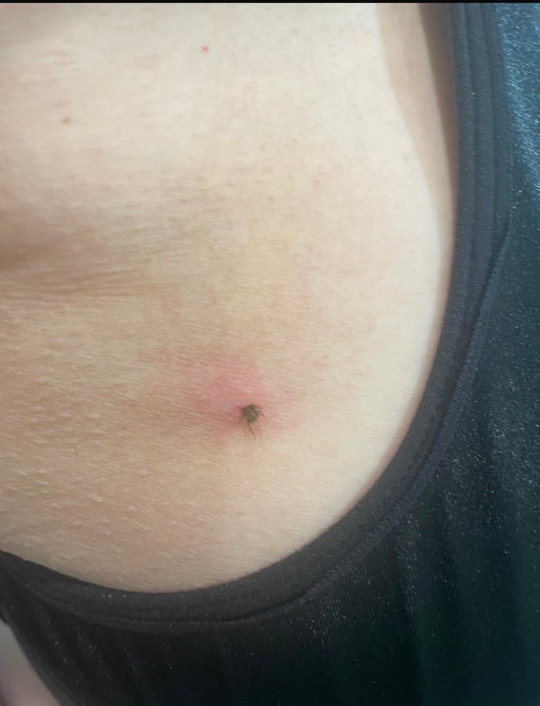
Fifth Stage: THE TICK (Cue Dramatic Music)

Back at the car, sipping my well earned coffee, the discomfort in the front of my right shoulder was getting worse. What was going on? I checked the area, and there it was. A massive black tick, wriggling happily away like it was at a buffet.

My photographic skills right handed without glasses!

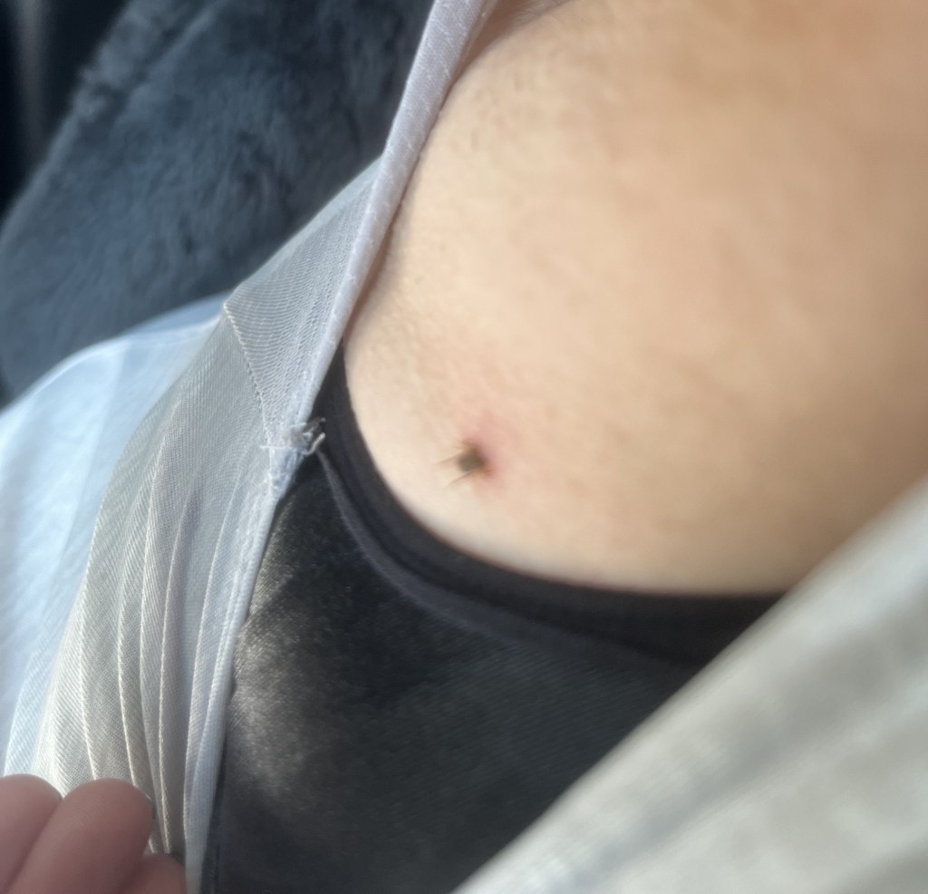
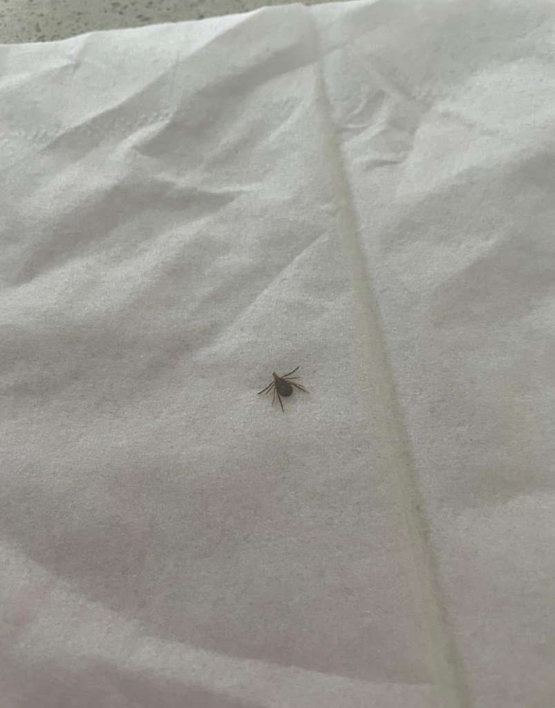
I’ll spare you the gruesome details (yeah nah), but let’s just say that tick had dug in DEEP. With a 70 minute drive home, I had to resist the urge to yank it out, knowing full well you can’t just pull a tick out without risking leaving its head – and its toxins – behind. I emptied a half a can of insect spray on the little bugger and called my sister (a.k.a. tick removal expert). After a tense tweezer-tugging session at her place, the tick was out, intact, and my armpit was back to normal the next day. Crisis averted!

Final Thoughts

Tick drama aside, Ships Stern Circuit was another incredible experience. Stunning views, varied terrain and a good mix of challenge and fun.

Just remember – pack extra insect repellent, watch out for snakes and always, always check for ticks!!

See you out on the trails…

PJ

Going to Gondwana – Our Hike into the Distant Past!

Hello and welcome to my LikeToHike blog. I’m PJ and I write about the hikes I take, giving you insights, photos, commentary, tips and tools so you can enjoy hiking and embrace the experience.

Today’s blog is pretty special – we are heading into the Gondwana Rainforest!

Gondwana Rainforest is a cluster of 50 separate reserves stretching from Newcastle in the south to Brisbane in the north. Gondwana was World Heritage listed in 1986, and contains the remnants of the great rainforests which once covered the entire continent of Australia.

Gondwana is known for vertical stone cliffs, volcanic craters, inspiring waterfalls and a range of ancient flora and fauna. Included in the Gondwana footprint is Lamington National Park, and within that, Binna Burra. One of the many trails at Binna Burra is the Lower Bellbird Track – which is my blog for today…

Welcome to Lower Bellbird Trail

CAUTION

Binna Burra is SW of Gold Coast and close to the Qld/NSW border. The road up to Binna Burra was washed out about a year ago in heavy rains. The trip up takes over an hour to travel 55km as sections of the road are down to single lane and controlled by traffic lights. Allow enough time to get up and down the mountain.

We chose the Lower Bellbird Trail because 1) the name is lovely, 2) I prefer hiking circuits so you’re on new ground the whole way and 3) we wanted a trail that was over 10km long. We are in training for Kumano Kodo, so need to get some miles on the boots.

We hiked Lower Bellbird anti-clockwise, starting at the southern entry point, and looping south, then turning north, and finishing at the northern exit point.

TIP

It’s important to note that Lower Bellbird Trail doesn’t fully loop. Otherwise it would be called Lower Bellbird Circuit!
You will finish at a different place to where you started. We finished further down the mountain, and then walked back up the road to our car, which was at the southern entry point carpark. There are carparks near the southern and northern entry/exit points to Bellbird, but regardless where you park, you will still need to walk on the road to start or finish Bellbird.

Let’s Go!

The Lower Bellbird Trail is well marked and easy to find. We started at 6am, and as you can see, no cars. By 9.30am when we returned, different story. Parking is limited so if you want a good park, start early.

Binna Burra Lodge and the surrounding areas were developed in the 1930’s. Many of the hiking trails were built around the same time. Along some of the older trails you will see stones set into the side of the trail. I find these stones immensely reassuring, because if the stones are there, that means I’m in the right place!

stones = right trail

The first 2.8km of Lower Bellbird leads you down a gentle slope, under a beautiful forest canopy. It doesn’t take long to realise you’re in for a very special hike. The forest is dense and cool, and the bird calls are an assault on the senses. It wasn’t long before we got our first glimpse of the views. The trail was taking us long the side of a cliff face, not exposed but certainly high and that afforded us a view from the top of the world.

Lookout Spots – AMAZING!

There are two lookout spots on the Lower Bellbird, Koolanbilba and Yangahla. Both are on the trail, so are worth a breather and a look. The signage at the Koolanbilba lookout confused me a little as it didn’t reference Bellbird at all, but you can’t get lost, there’s only one way to walk! The view is nothing short of amazing. There is a map at the lookout which explains what you’re looking at, all the way to the Gold Coast in the far distance.

TIP

The Lower Bellbird Trail is what I would call a medium challenge trail. It’s quite narrow and in parts there are natural obstacles like steep stairs, fallen branches, uneven surfaces, rather large spiderwebs (!) and my nemesis, cliff faces. It’s not aerobically challenging, but skill, experience and mettle challenging. I suspect because it starts and finishes at different points, it’s not as well hiked as other Binna Burra trail options so less well worn, but if you’ve hiked before and/or you’re agile, no worries mate!

Rock Formations – AMAZING!

As I mentioned earlier, one of the features of the Gondwana Rainforest is the incredible rock formations. We walked past them, through them, down them, alongside them and under them. I am in awe of the men and women who created these trails almost 100 years ago with the simplest of tools and equipment – no Google or GPS…

Morning Tea Anyone?

If I hike for more than about 10km, I like to stop for a break. Usually when hiking a circuit, the break is at the top (or bottom) which gives you a chance to either catch your breath, or steel yourself for what’s to come. By around the 8.5km we had been walking gently downhill for about 90 minutes – which was lovely, but what goes down has to go back up!

We arrived at the split between Ships Stern Trail and the Lower Bellbird Trail. Our trail was taking us up, so we stopped for a short break of apples, scroggin, iced coffee and marshmallows. (don’t ask, they were in the scroggin!)

The signage around Binna Burra is pretty clear and our trail was well marked. You will start your hike upward around the 8.8km mark, but don’t’ worry, the first upward section is quite gentle.

Scarred Landscape

Australia is known globally for a few things. Kangaroos, drop bears, flies, BBQ’s and hot summers. Along with hot summers comes bush fires. The 2019-20 Black Summer bushfires were some of the worst recorded across Australia. In September 2019, a fast-moving bushfire swept through Binna Burra and burned homes, buildings, lodges and infrastructure to the ground. It also caused unusually significant damage to the surrounding rainforest. Every Australian knows the smell of a bushfire and the visceral fear it can create. Blackened tree trunks identifies a bushfire area and can remain as evidence for many years.

Stone Cliffs – AMAZING!

After walking up a gentle incline through a lovely carpet of dry leaves and another cool rainforest canopy for about 3km, we came across a very imposing set of stone cliffs. The cartographer in me was eyeing up the stone cliffs with some trepidation as I couldn’t see how we were going to traverse our way up and out. What I didn’t know was the trail hugged its way around the stone cliffs to the north, and then turned left into the forest.

The cliffs have regular rock falls, so signage asks you not to stop as you move through two key sections. The feel of walking this section of the trail was very imposing as our human frailty was very much in evidence when compared to eons of rock formations.

Dairy Farm in a Rainforest??

Around the 13km mark, we came out into the most picturesque clearing…in face my niece SB likened it to the Twilight Meadow, and you can see what she means. All we needed was sparkly skin and we would be in a movie set!

I read somewhere that part of the Lower Bellbird used to be a dairy farm, and this clearing definitely had a relaxed bovine vibe to it. We could have plonked here all day and just revelled in the ambience.

PS – it was at this point we saw the first hikers walking the other way. Up to this point, we hadn’t passed anyone!

Back to Reality

The last section of the trail is a gravel access road going up from the Twilight Meadow to Binna Burra Rd. It’s only about 1km from the meadow back to reality. There is a slightly confusing fork in the gravel road, with an arrow to the left, and the gravel road continuing straight ahead. We studied our print map and decided that both led back to the road, so we took the recommended left turn.

Rubber to the Road

Oh my.

We weren’t anticipating the uphill hike back to the carpark.

We exited Lower Bellbird at the first “x marks the spot”. We had to walk back to the carpark, which is the second “x marks the spot”. The difference? 2.5km. Up. Or as I described it to my hiking buddies “just a bit further!”

However, the views from the road our over Lamington were fantastic , and we could just see where we finished Lower Bellbird, circled in blue. Thankfully it wasn’t a hugely aerobic hike, otherwise the last leg up the road would have been painful.

TIP

I would recommend you plan for this last section. Either allow for it at the start, or as we did, at the end. Unless you have a driver on call, you will be walking 2.5km on the road at some stage as part of your Lower Bellbird hike.

So, What Did We Think?

I give this trail two thumbs up. So do my hiking buddies TB(sister), SB and MB (nieces). It’s a visually stunning way to spend 3 hours – even the road section views are awesome.

We saw such a range of Australian forest history, walking in a rainforest that has been in existence for thousands of years *mindblown*

We were serenaded with a cascade of forest sounds. We heard whipbirds, green catbirds (very unnerving, they sound like babies crying), cicadas, bullfrogs, kookaburras – and a whole lot more we couldn’t identify but enjoyed nonetheless.

We had the trail to OURSELVES! We didn’t see hikers until we were in the Twilight meadow. That never happens. It was our own little bit of rainforest fabulousness. Forest bathing uninterrupted. yay.

FINAL TIP

It’s great to support local businesses when you hike. We try to buy a coffee, a snack, a map, a hat, and spend our dollars as we hike. If you go to Binna Burra on a Sunday, stop in afterward at the Beechmont Farmers Market (3rd Sunday of the month). hey offer a range of local products and services. I can recommend the Beech Mountain Distillery stand, they do a mean Lemon Myrtle Gin!

Wrapping Up

So there you have it. Binna Burra in a nutshell. Take the time to drive up to Binna Burra and explore the trails. You won’t be disappointed.

See you next time out on the trails.

PJ

PS – remember last time I was talking about one of the benefits of hiking being good muscle tone? Well, I managed to face plant on the footpath walking the dogs last week, and gave myself a spectacular black eye.

I also banged my hand, knee and shoulder but guess what – NO BROKEN BONES 🙂

Told ya – hiking works.