Hello and welcome to my LIKETHEHIKE blog. I’m PJ and I write about the hikes I take, giving you insights, photos, commentary, tips, and tools so you can enjoy hiking and embrace the experience.
Today I’m on the Isle of Man – woohoo!!!!! A self-governing Crown dependency smack in the middle of the Irish Sea between England and Ireland. Best known for the TT motorcycle race, the Isle of Man is home to 65,000 islanders descended from both Celtic and Viking invaders. The Isle of Man is part of our UK holiday – and I couldn’t wait to hike on it.
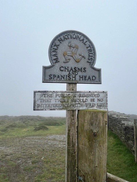
The Raad ny Foillan is 160km of coastal walking trail that circumnavigates the island and translates loosely as ‘The Way of the Gull”. Visitors and locals have been walking and talking about this trail for hundreds of years, so it makes sense for yours truly to investigate.
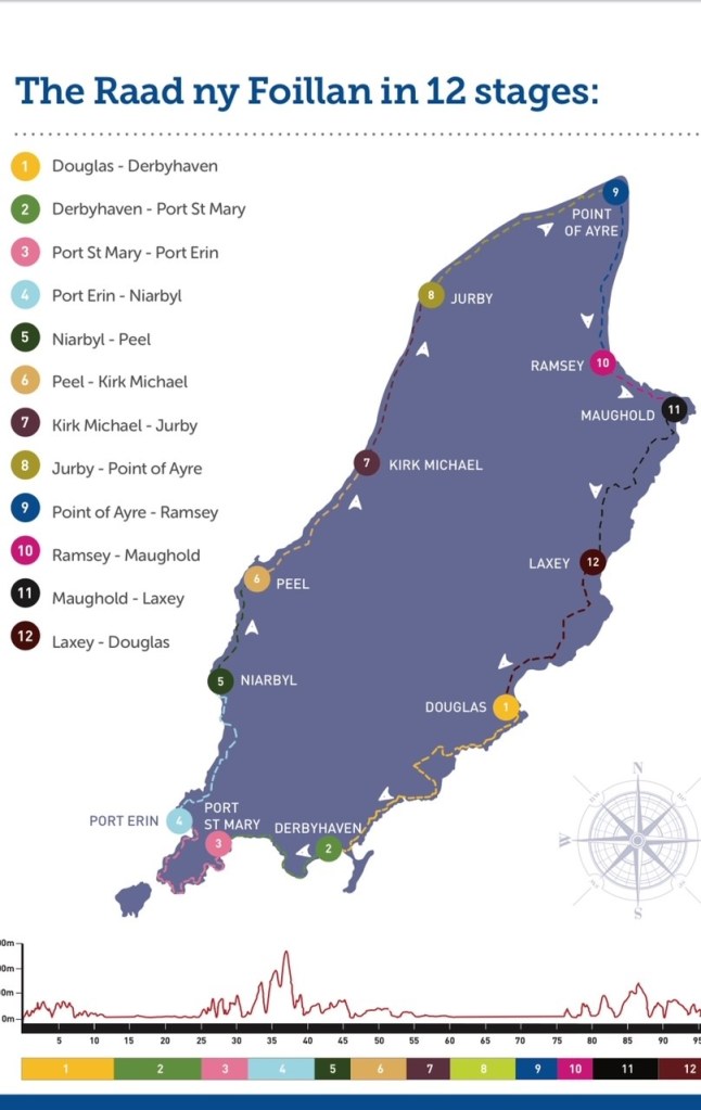
Our cruise excursion team arranged for us to walk a section of the Raad ny Foillan, taking in the clifftops of Port St Mary, cross the peninsula to Cregneash, and then down to Port Erin, about 7-8km all up.
About 20 hardy souls signed up to walk the section, led by a local hiking guide, Chris Callow from Island Heritage Tours. If you’re planning a trip to the Isle of Man and want a great hiking experience, I can thoroughly recommend him. He also does ancestral research and trips for Antipodeans looking for family heritage on the Isle – if you think you have ancestors from this neck of the woods, Chris is your bloke.
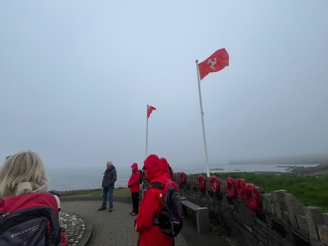
We started on the cliffs above Port St Mary beach. I was hoping for a clear day, but the sea mist was swirling, and although stunning, it meant that views might be out of the question. The beauty of a guide is that not only do you hike, but you also get a heaping of local stories and history – all very fascinating. Our first stop was a memorial for ships that took part in Operation Dynamo, the evacuation of Dunkirk in 1940. Three local ships assisting with evacuation were destroyed, with significant loss of life. It’s only fitting that the memorial sits on a clifftop overlooking the sea…
Handy hint – Manx is the word used to describe people or things that belong to the Isle of Man. Also, I believe, a cat without a tail which comes from the Isle. Go figure! We kept moving and wound our way towards the cliffs overlooking Perwick Bay facing due east, which I’m sure would show a spectacular sunrise – on a clear morning.


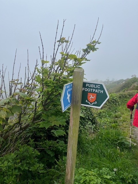
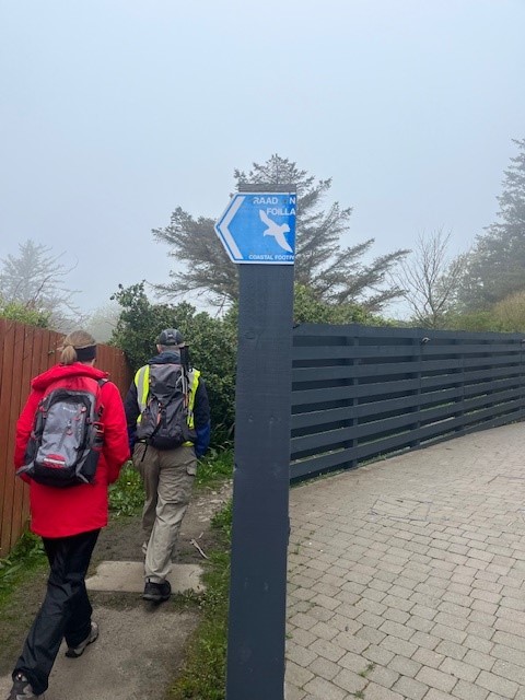
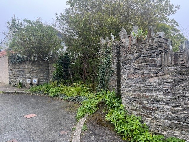
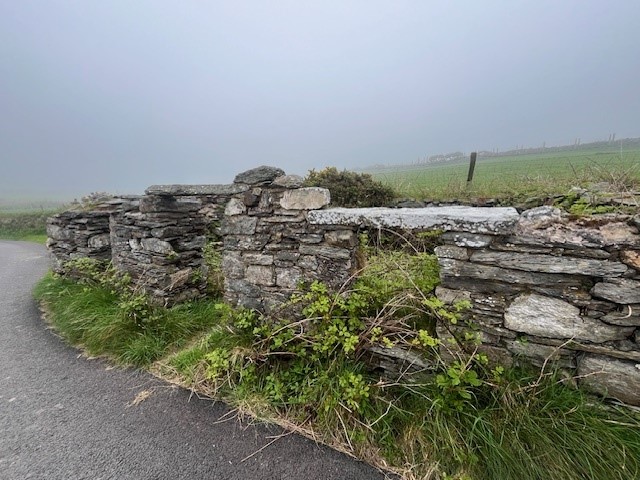
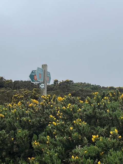
The trail is very well marked, and as I discovered in Kent, trails are supported and encouraged by the government, councils, and even private landowners. A hiker’s dream. The clifftop houses quickly made way for green open fields, dotted with woolly sheep and lambs. The stonework and foliage were just lovely, and kinda made up for the fact that the sea mist seemed to be getting heavier, not lighter!

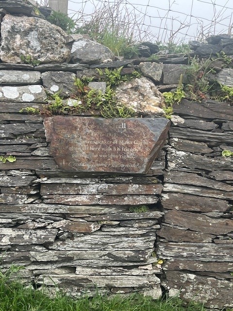
Our next fascinating fact was around the 2.4km mark where a sign and a simple wooden bench recognised Ned Maddrell, the last native Manx speaker on the island. Local schools are leading the charge to ensure that the next generation of Islanders retain this important cultural artifact, which is similar to Irish, Scottish, and Welsh Gaelic (all of which are waaaaay out of my remit). The locals are very proud of their language, culture, and independence, totally understandable.
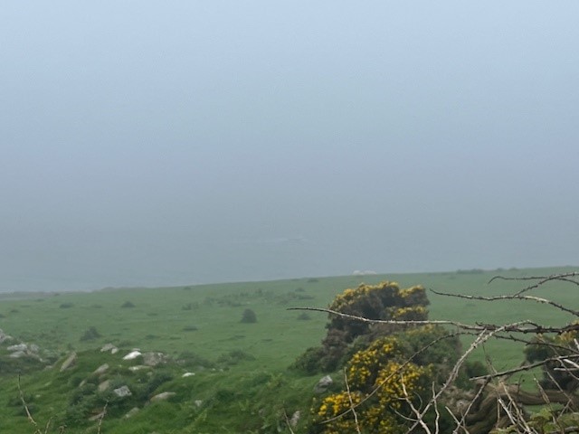

Not too far along the trail, we came to another reminder of the impact of war on the island. On a misty day probably very similar to this one, a US Flying Fortress crashed into the side of the hill, killing all on board. I wasn’t surprised, given the thickness of the mist we were hiking through. Still, a sobering reminder that the weather and the terrain will always remain dominant over us mere humans.


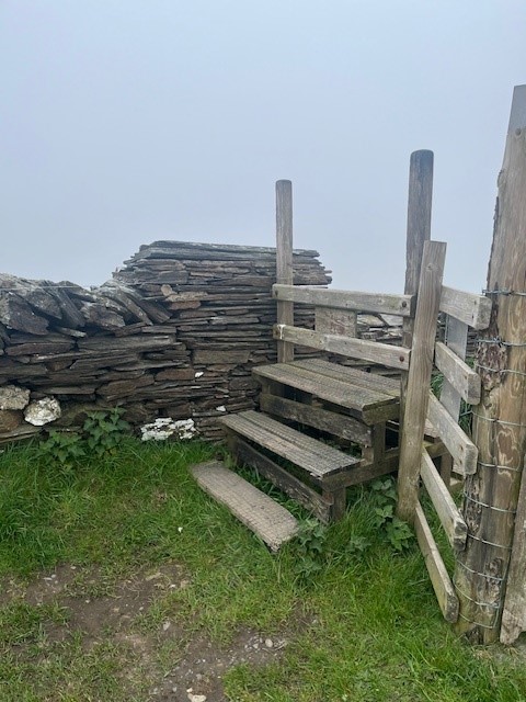
We kept climbing up and up and up. There were some quite steep sections, we traversed through fields, gorse patches, over stiles, and through gates. Most of the area looked like it was being actively farmed. so it was important we followed the hiker rule and leave gates as you find them.


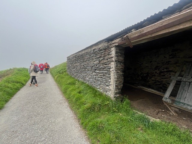
The highest point in the hike was about 4km in, a pretty amazing destination called Cregneash, a historical Manx village lovingly restored and running as an example of a 19th-century crofting community. Surprisingly, people still live here and little “private house” signs remind you not to barge on in. Good place for a quick coffee stop 🙂 Thankfully it was a short stop as the mist hadn’t cleared and it was quite chilly! Hiking meant moving and moving was warm.


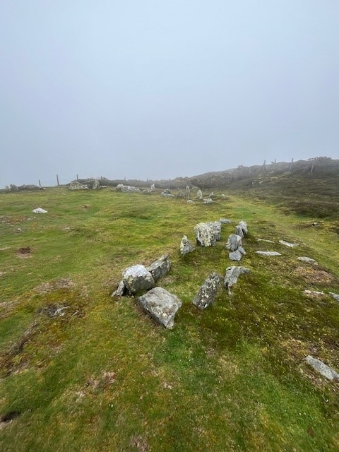
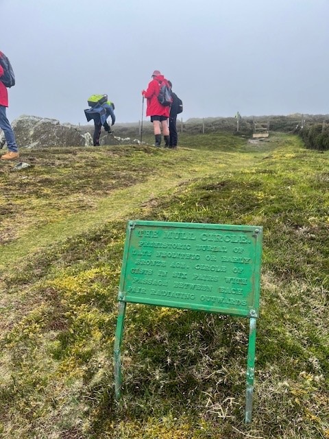
Our next waypoint was at 5.5km and on the crest of the peninsula. Meayll (Mull) Circle is a bronze age burial site that is evidence of island occupation from Neolithic to Medieval times. It’s a chambered cairn with 12 burial chambers in a 5.5m circle. It really was an honour and a privilege to hike through a countryside that has markers dating back thousands of years….and be able to walk the ground, touch the stones, and feel the history.


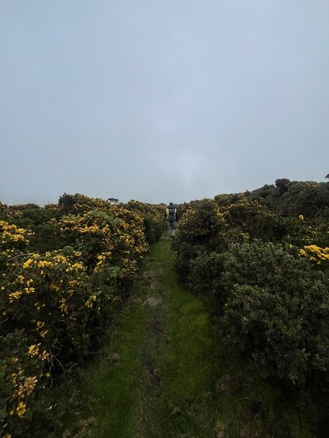
A lot of the landscape on the crest was gorse-laden, which was challenging to walk through. The tracks were wet and mucky underfoot, but thankfully I took my Merrell waterproof hiking shoes for just such an occasion. I had a decent backpack and took my wet weather gear. I still had to pick off quite a few gorse prickles at the end of the hike.
We were now heading downhill towards Port Erin. We traversed trails, a couple of country lanes and passed some fascinating stone buildings, one was going to be restored, and one that should probably be knocked down (yuk! no accounting for bad taste)


Thankfully on the leeward side of the island, the sea mist had lifted a bit, and we got a view down to the port and beyond. Heading down steep hills is usually a bit more challenging on the knees, but this trail was manageable and with the end in sight, the pace picked up.

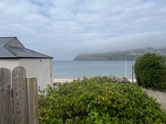
Our hike came to an end at the beach in Port Erin. We clocked about 7.5km – it was a fantastic hike. It had lots of uphill sections which I imagine on a clear day would give you the most incredible views. Despite limited views, we still had a great morning, and I managed to coax Mr PJ out for a hike – win! I haven’t converted him yet, but give me time… 😉

If the Isle of Man sounds like you, and you want to pack your hiking boots, then put Raad ny Foillan on your bucket list and get cracking!
See you out on the Scottish and Icelandic trails
PJ 🙂
