Trail Mix and Chill: Six Snack Ideas to Keep you Hiking and Happy

Hello fellow hikers/foodies! As Queensland is fully into summer (even though we are officially still in spring), my hiking plans are in hiatus for a couple of months due to my aversion to ticks, leeches and hiking in 32 degree heat. Never fear, we have lots to talk about, including the fuel that will get you from start to finish feeling great!

When you hike, what you take in your backpack is just as important as the trail itself. Every item serves a purpose, from water to a whistle, but few are as crucial as your food choices. The right snacks will fuel your body, keep you energised, and ensure you enjoy the adventure to its fullest. Whether you’re tackling a short day hike or a multi-day trek, here are my top six food items that I take along and why they are my ‘ride or die’ choices.

1. Nuts and Seeds: The Ultimate Energy Booster

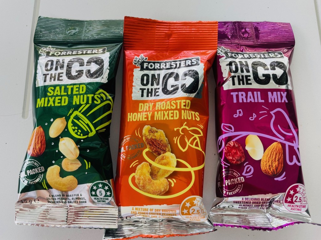
Nuts and seeds are powerhouses of nutrition, offering a perfect balance of healthy fats, protein, and carbohydrates. They’re lightweight, easy to pack, and don’t require refrigeration, making them an ideal hiking snack. A handful of almonds, walnuts, cashews, or mixed seeds can deliver a concentrated source of energy, which is essential for hikes when you need sustained fuel.
Why it’s essential:

Energy Dense – high in calories, perfect for refuelling on the go

Healthy Fats – keep you feeling full and satisfied

Protein Packed – supports muscle repair and recovery, especially during strenuous hikes

You can create your own trail mix (or scroggin, as Aussies and Kiwis call it) by combining nuts with dried fruits and chocolate for an extra energy kick. Opt for unsalted nuts to avoid excessive thirst, and try different combinations like pumpkin and sunflower seeds to keep things interesting.

2. Dried Fruits: Natural Sweetness for a Pick-me-Up

Dried fruits are nature’s lollies, providing a quick burst of sugar easily digested and converted into energy. They’re rich in vitamins, fibre, and natural sugar, making them a perfect companion to more protein-heavy snacks like nuts.

Some of the best dried fruits for hiking include raisins (small but packed with energy), apricots (high in potassium, important for electrolyte balance), dates (excellent for slow-burning energy and fibre) and banana chips (crunchy and sweet!).

Why it’s essential:

Fast Energy – replenishes sugar levels when energy dips

Lightweight – easy to pack and carry

Nutrient Dense– rich in vitamins and minerals

3. Jerky: Protein for Muscle Repair

Whether meat or plant-based, jerky is a high-protein snack perfect for the trail. Protein helps maintain muscle strength and aids in recovery, especially during longer or more challenging hikes.

A biltong style product available locally and delicious!

Since it’s dehydrated, jerky is lightweight and non-perishable, making it easy to carry for extended periods.

Why it’s essential:

Protein Rich – helps prevent muscle breakdown

Long Shelf Life – doesn’t require refrigeration and can last for weeks

Salty Goodness– contains sodium, replacing electrolytes lost through sweat

Choose a low-sodium jerky if you’re hiking in conditions where dehydration is a concern. Vegan and plant-based jerky options made from soy or vegetables are also available if you prefer a meat-free option.

4. Energy Bars: Compact and Convenient Fuel

Energy bars are designed specifically for active people, making them an ideal hiking food. They’re packed with essential nutrients like carbohydrates, fats and proteins in a small, easy-to-carry form.

Bars sitting in my pantry that come hiking with me (ignore expiry date on paleo bar!)

Whether you prefer muesli bars, protein bars, or whole food bars, these snacks are perfect for refuelling quickly and efficiently on the trail.

Why it’s essential:

Convenient – easy on the go, no preparation required

Nutrient Packed– offers a balance of carbs, protein and fats

Portion Controlled– helps manage your energy intake without over eating

Look for bars that are free from artificial additives and high in natural ingredients like oats, nuts and seeds. Avoid bars with too much sugar, as they can cause an energy crash later on.

5. Nut Butters: A Versatile Source of Energy

Nut butters are not only delicious but offer a great source of protein, fats, and carbs. When paired with celery or apples, they provide sustained energy, which is important for longer hikes.

Nut butters also come in single-serving packs, making them easy to carry and consume.

Why it’s essential:

Sustained Energy – combines fats and protein for long-lasting fuel

Versatile– eat it on fruit, veggies, bread or solo

Portable– single-serve packets are lightweight and easy to carry.

Prepare nut butter and apple/celery “sandwiches” ahead of time and pop them in a container for easy transportation and access.

6. Tuna Pots: High Protein with a Teeny Tiny Spoon!

Tuna pots or other pre-cooked options provide hikers a high-protein, filling option. They are convenient, lightweight and packed with omega-3 fatty acids, which help reduce inflammation and support heart health – essential for maintaining stamina during prolonged physical activity.


Why it’s essential:

Protein Rich – helps with muscle repair and keeps you feeling fuller longer

Omega-3s-supports overall health, especially heart health

Convenient– ready to eat and easy to pack, often available in flavours

Keep an eye out for packets that come with a spoon or easy-open designs for ultimate convenience, or you can make your own tuna, chicken or salami snacks to munch on.

Bonus Tips for Packing Hiking Snacks

When packing for a hike, it’s not just about the food you choose but also how you carry and consume it. Here are a few tips to help you make the most of your hiking snacks:

1. Portion Control

Pack enough to keep you energised, but avoid overpacking as extra weight can be a pain. Pre-portion snacks into small baggies or containers so you know how much you’re consuming.

2. Stay Hydrated

While food is essential, don’t forget about hydration. Many of the snacks I’ve mentioned are salty or dense, so fluid is key to staying in top form.

3. Mix and Match

Keep your taste buds tingling by catering to both sweet and savoury. Pair jerky with dried fruits or nut butter with celery. I sometimes take sushi or a salad wrap out on day hikes to keep snacks varied and something to look forward to at break time.

4. Leave Nothing but Footprints

Always make sure your wrappers and rubbish come back out with you. Our national forests are entrusted to us as hiking custodians – make sure you honour that trust.

5. Test New Snacks!

I can’t emphasise the importance of this tip. If you want to take a new snack, try it out ahead of time. This will avoid any nasty digestive surprises caused by food that might not suit you. Trust me; toilets out on the trails are few and far between…. 😮

So, whether you’re a seasoned hiker or just starting out, the right food can make all the difference in your hiking experience. From energy-boosting nuts to protein-packed tuna, these top six hiking snacks will keep you fuelled, energised and ready to tackle whatever trail you choose. So, next time you pack for an adventure, be sure to include these essential foods and enjoy your hike to the fullest!

See you out on the trails

PJ

PS – these suggestions are my opinion only. I am not a nutritionist and wouldn’t presume to give you dietary advice. Please speak to your doctor if you have specific dietary needs or health concerns.

Ships Ahoy and Ticks Galore!

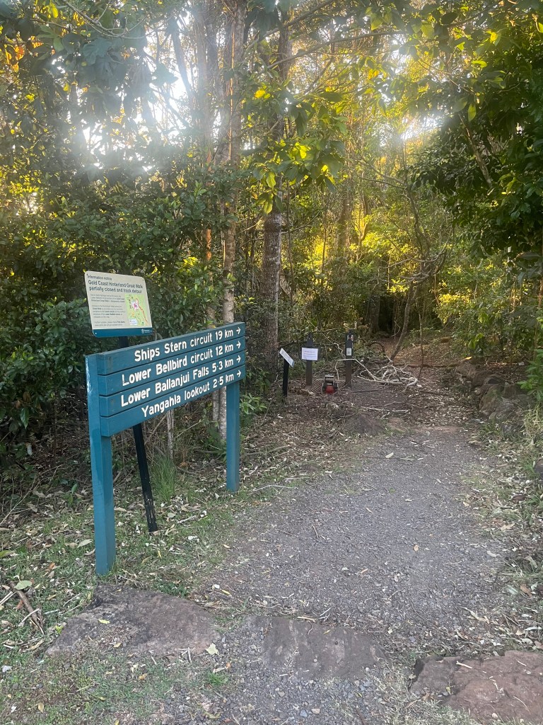
Tackling the Ships Stern Circuit in Lamington National Park

Ahoy fellow hikers! Welcome back to another grand adventure, this time exploring one of Queensland’s treasures – the 20km Ships Stern Circuit in Lamington National park. A mere 70 minute hop from the Gold Coast, this park is part of the majestic Gondwana Rainforest, covering over 366,500 hectares of pure hiking heaven.

I’ve dallied with parts of Ships Stern before but never braved the full 20km loop. Well, today was the day! What could possibly go wrong, right? Spoiler alert: I didn’t anticipate the unseasonable heat, or the final unwelcome hitchhiker.

First Stage: Downward Delight (And Spiderweb Swords)

Being the clever clogs that I am, I arrived before 5.30am and parked at the top of the park near the Binna Burra Cafe, giving me an easy downhill finish to the hike. Plus, with a forecast of over 33 degrees Celsius, I wanted to beat the midday heat.

The first part of the trail was a lovely, gentle descent, perfect for soaking up the early morning rays….and as it turns out, spiderwebs. Oh, the webs! I became an impromptu samurai, waving a stick to fend off what felt like an entire arachnid population weaving across the trail! Note to self -arriving early means you get the fresh webs, lucky me.

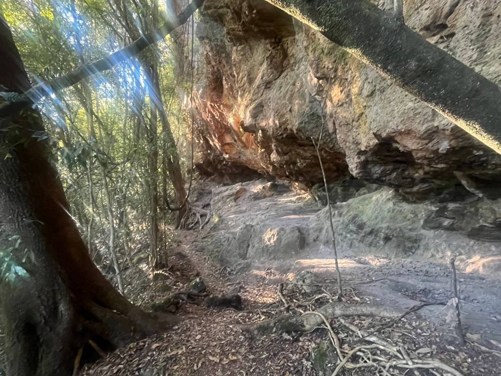
At about 1.5km in I hit my first dry creek crossing and took in the beautiful views from Koolanbilba Lookout. The trail became steeper as I continued, but I couldn’t help pausing at a natural cave around the 2.6km mark. Who else had sheltered her over the centuries? I felt like an explorer uncovering new lands and treasures – until I remembered I was actually just sweaty and armed with a samurai spider-stick.

Second Stage: Snakes, Sticks and Stunning Views

By the time I hit the 6.5km mark, I started the uphill slog. Let’s be real, I was a little nervous that the rest of the hike might be all uphill from here – but hey, what’s life without a a challenge?

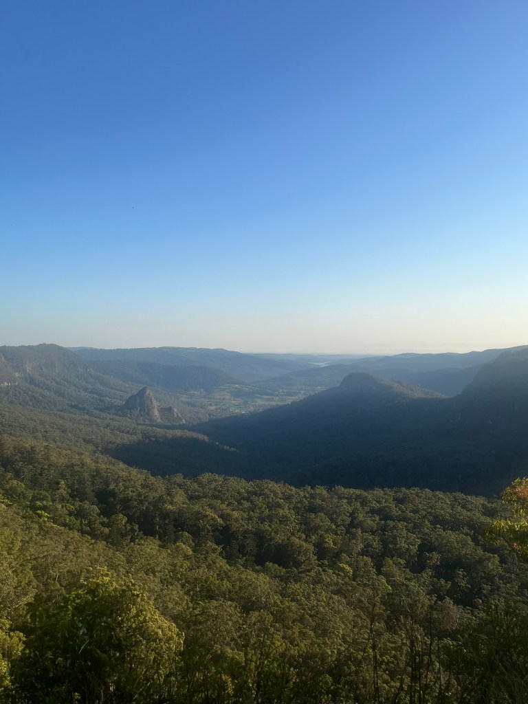
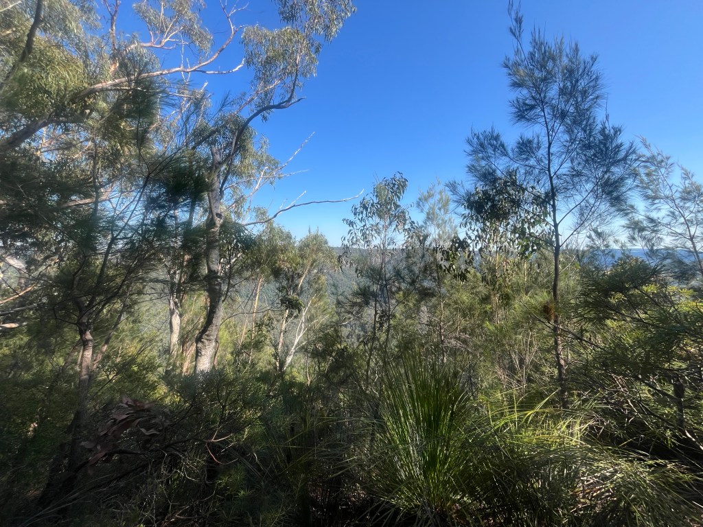
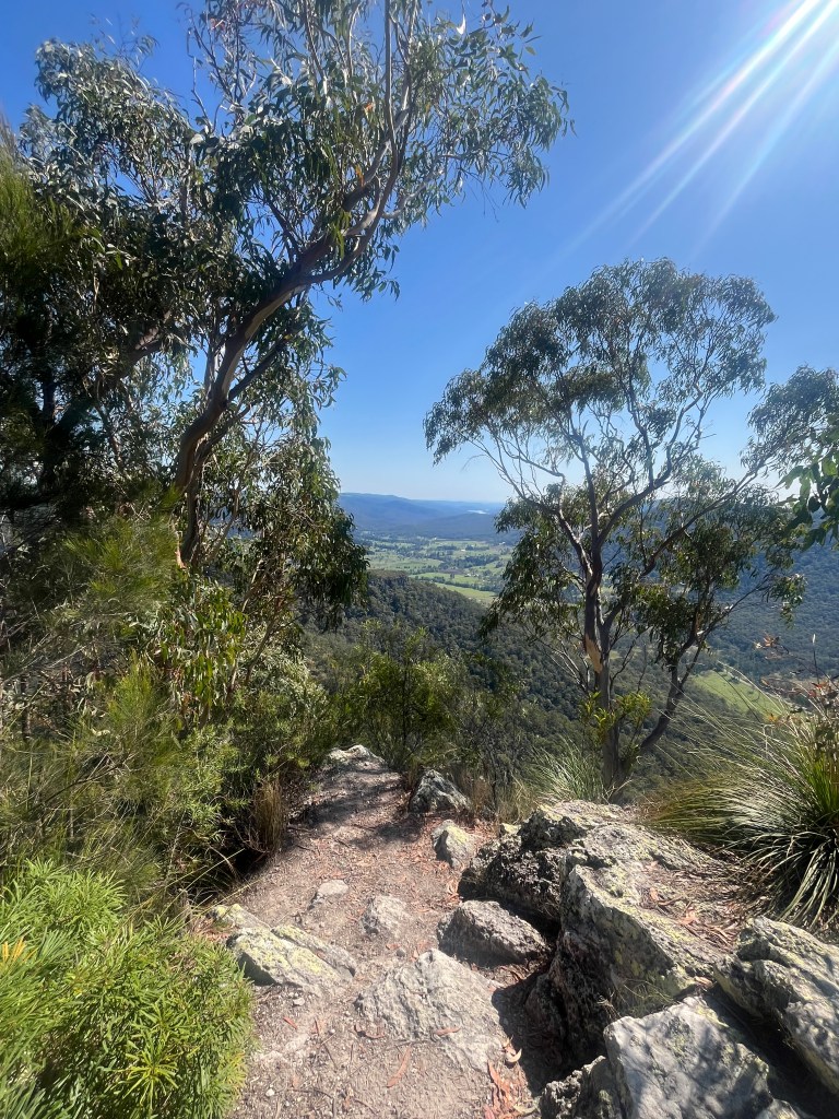
As I trudged upward, the trail opened up to spectacular valley views with grassy vistas, and I swapped my cobweb stick for a snake stick. in Queensland’s spring heat, snakes are out and about looking for love. Fortunately I only encountered one tine brown snake and it slithered away quicker than I could say, “NOPE!”

At 8.5km, I arrived at Charraboomba Rock, a stunning rocky outcrop with heart-stopping stairs that cling to the edge of the cliff. Heights aren’t my thing so I skipped this side adventure. Brave souls, you’re on your own for that one! I still had amazing views, so all was well.

Third Stage: Cliff Views and Cliffhangers

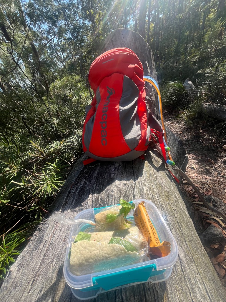
At 10km I found a perfect log for my snack break. Just me, my salad wrap, chocolate bar, and the valley stretching out below. I took the opportunity to spray myself liberally with insect repellent, than goodness for that decision as the next part of this tale will reveal!

Feeling refreshed, I set off again, only to find the second stunning lookout just 500m later. Could’ve had my breakfast with an even better view, but oh well! I had a sit and a look, and then continued along the trail, enjoying the breath-taking scenery and the stillness of the morning completely to myself. So far, I had not seen another soul on the trail – a very special experience.

By now I was halfway through the circuit and starting the long trek back. Around the 13km mark, I began the final ascent. I knew that the last 2km would be downhill, but getting there was a sweaty grind – happily the views made it worthwhile.

At 15km I took a breather at Nagarigoon Falls – the only ‘falling’ waterfall I found. Not a huge amount of water, but hey, it was still peaceful and pretty.

Fourth Stage: The Downhill Stretch (And… The Incident)

Finally, I reached the marker for the Border Track and the start of the downhill section, just 2.3km to my car, and more importantly, a flat white at the Binna Burra Café. With gravity on my side, I happily trotted along, oblivious to the horror that awaited me.

With around 1km to go, my backpack strap started to feel…odd. The right hand side was digging in, and no amount of adjusting seemed to help. But I pressed on, keen to finish. It wasn’t until I got back to the car that I discovered the truth.

Fifth Stage: THE TICK (Cue Dramatic Music)

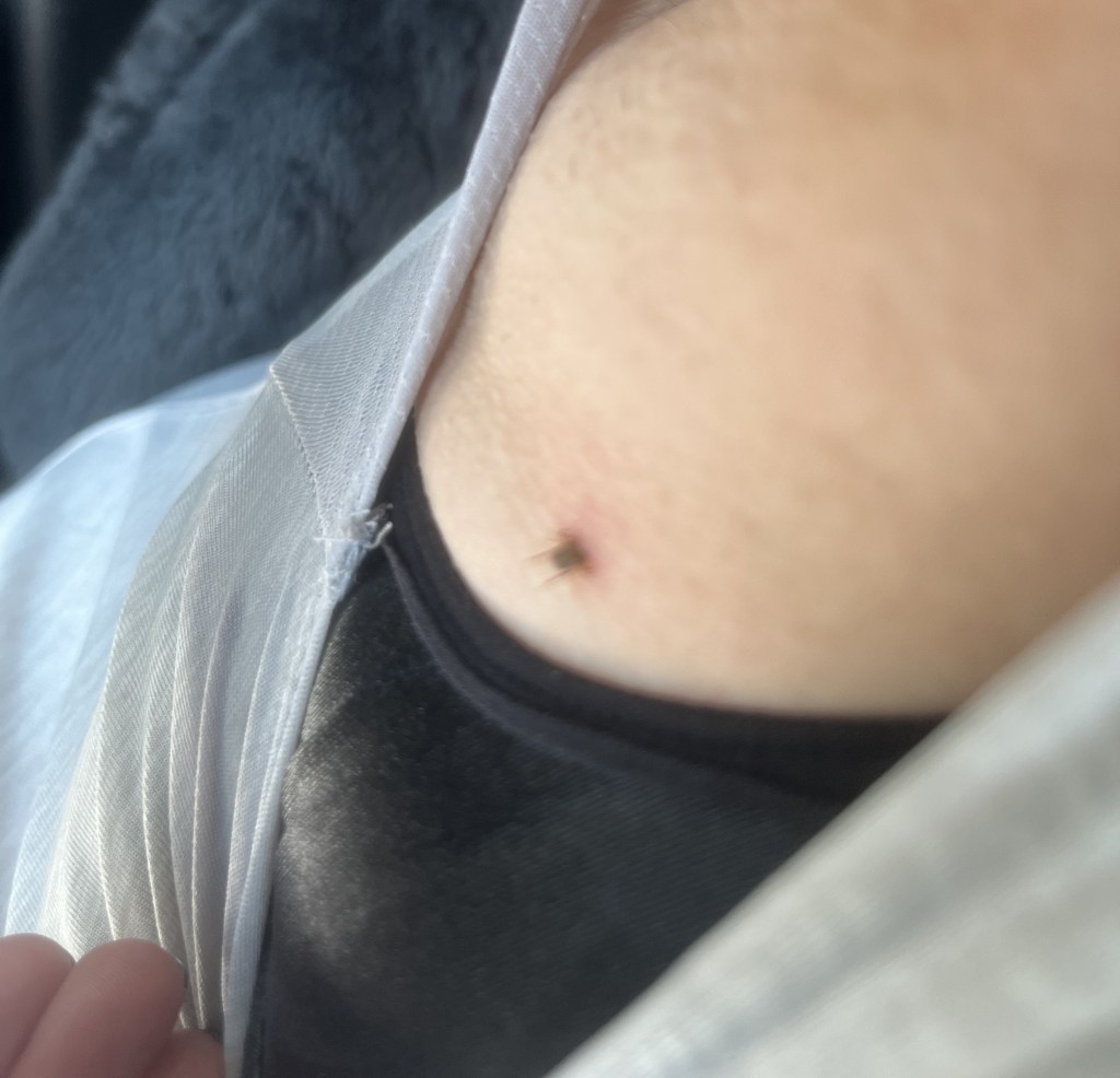
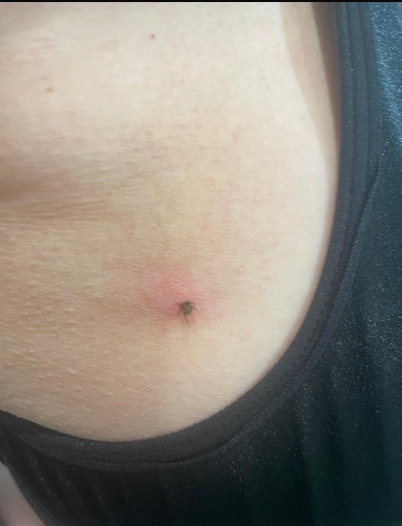
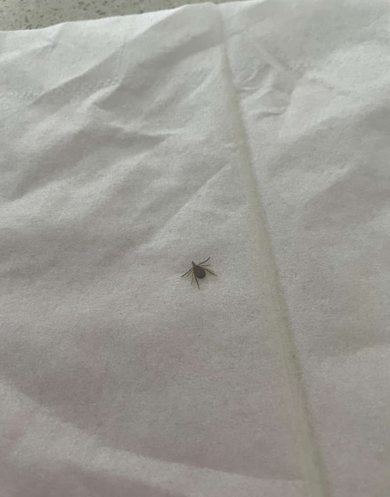
Back at the car, sipping my well earned coffee, the discomfort in the front of my right shoulder was getting worse. What was going on? I checked the area, and there it was. A massive black tick, wriggling happily away like it was at a buffet.

My photographic skills right handed without glasses!

I’ll spare you the gruesome details (yeah nah), but let’s just say that tick had dug in DEEP. With a 70 minute drive home, I had to resist the urge to yank it out, knowing full well you can’t just pull a tick out without risking leaving its head – and its toxins – behind. I emptied a half a can of insect spray on the little bugger and called my sister (a.k.a. tick removal expert). After a tense tweezer-tugging session at her place, the tick was out, intact, and my armpit was back to normal the next day. Crisis averted!

Final Thoughts

Tick drama aside, Ships Stern Circuit was another incredible experience. Stunning views, varied terrain and a good mix of challenge and fun.

Just remember – pack extra insect repellent, watch out for snakes and always, always check for ticks!!

See you out on the trails…

PJ

The One Where A Girl Went Up the Side of an Icelandic Volcano…!

Hello and welcome to my LIKETHEHIKE blog. I’m PJ and I write about the hikes I take, giving you insights, photos, commentary, tips, and tools so you can enjoy hiking and embrace the experience.

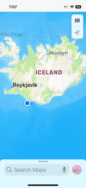
VELKOMINN TIL ISLANDS! We’re in Iceland! Land of fire and ice, home to huldufolk, Bjork, the cod wars, glaciers, puffins, $25 glasses of wine (!), and whales.

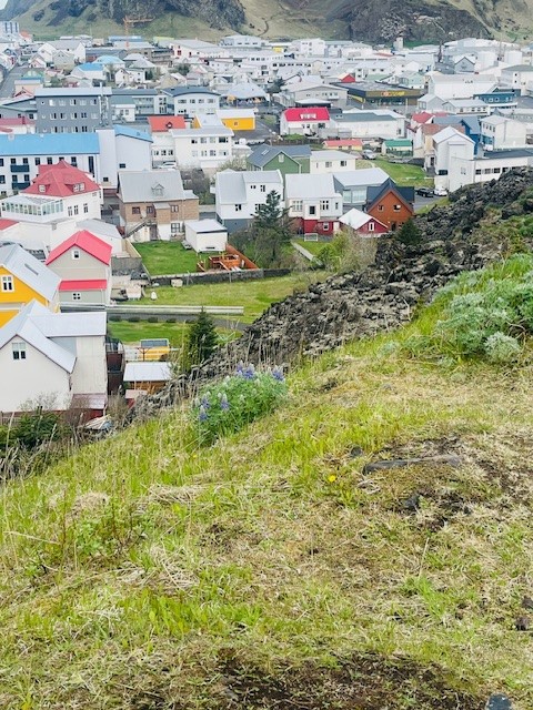
One of our destinations was the island town of Vestmannaeyjar. Located off the southern coast of Iceland, Vestmannaeyjar is a small fishing town on the island of Heimaey, and completely unremarkable except for an incident in 1973 that made global headlines and firmly planted this small island on the tourist map forever.

Before we get into the hike – and yes, I really did hike up and down a live volcano – a bit of context about Heimaey. It’s part of a group of 15 islands and has about 5,000 residents. Believe it or not, this makes Vestmannaeyjar the 12th most populous place in Iceland, given the total population is only 380,000, and 140,000 of those live in the capital Reykjavik.

Heimaey was settled sometime in the 9th century and has remained populated since then, despite losing large numbers of residents to a Turkish pirate raid in 1627 and then the inevitable disease and infant mortality in the 18th century.

Fast forward to January 1973.

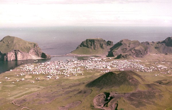
Without any warning, an eruption started in the early hours of 23 January and completely destroyed about 60% of the town. Half the houses disappeared under a lava flow, and almost all of the residents were evacuated to the nearby mainland. Bad weather the previous week meant the fishing fleet was in port, miraculous indeed as this enabled the residents to be moved to safety. Amazingly, only one resident died during the eruption. Our local guide advised that the person had broken into a local pharmacy during the eruption and died from noxious fumes after lingering too long…. eek!

The eruption was declared over by July 1973, when the massive cleanup operation commenced. 300 houses had gone under the lava field, and the rest of the town was covered in thick black ash.

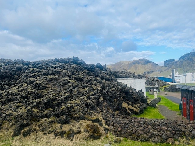
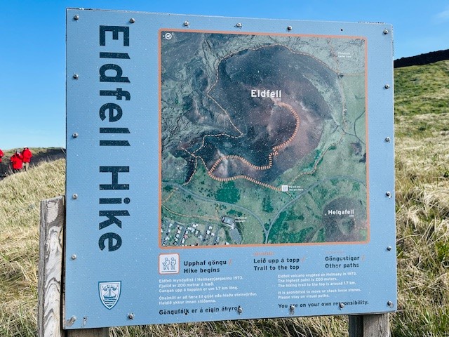
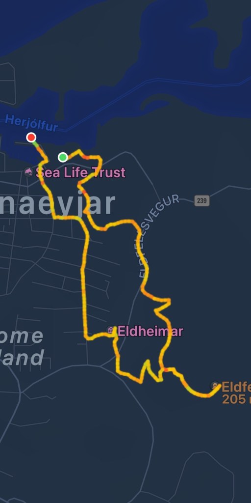
The result of the eruption was the creation of a brand new volcano called Eldfell (hill of fire). Eldfell recently turned 50 years old, so is younger than yours truly! The eruption and resulting lava flow increased the island size by about 20% and completely changed the coastline, pushing into the sea before finally cooling.

Eldfell was our hiking destination – I was going to climb an active volcano!!!

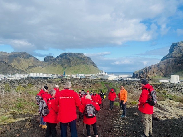
About 20 of us started but that number dropped quickly when the incline of the hike became apparent. We started at the port with our guide taking us past the edge of the lava field, pretty much where the residents were able to stop the lava flow by pumping sea water at it for over 4 months, via huge pumps provided by the US military.

The main export of Heimaey is fish, but not just for eating. The town manufactures fish oil, and also artificial skin for grafting – all from fish skin! Absolutely fascinating – if you can stand the smell of the factory 😦

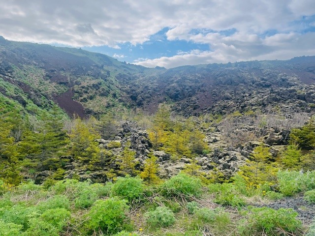
We started upward past what was once the town swimming pool and water supply, now under 10m of lava field. The eruption destroyed much of the island’s small forest, which has been replanted. However, due to such a short growing season, it’s taking a while to get reforested. There’s a saying in Iceland, if you get lost in the forest, just stand up 🙂

The day was cold but clear and the sun provided some relief from the biting wind. I was pleased the hike was heading uphill – it gave me a good chance to warm up.

I really struggled to wrap my head around the fact that before January 1973, the landscape we were hiking through didn’t exist. It’s not like the volcano was there before and erupted….nope. Before 1973 it was fields, a dairy farm, and houses. The volcano literally came up out of the earth and grew.

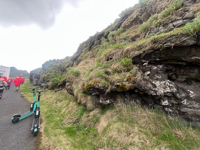
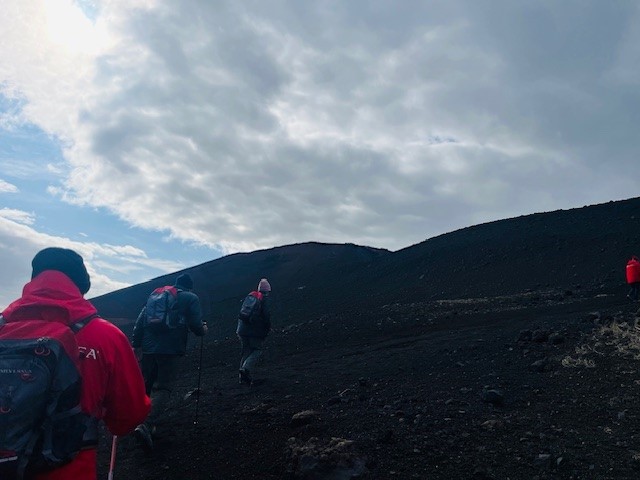
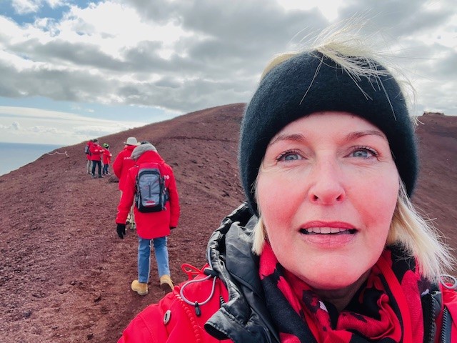
The hiking terrain quickly changed from grass and vegetation to red volcanic rubble. Every now and again little bits of vegetation were present, but it was pretty much barren. It really did feel like we were hiking on the moon. the trail switched back and forth up the side of the volcano and then trekked along the crests. Some parts were a little narrow, but I found that if I kept my head down and focussed on the path, the edges were less scary. Some readers may recall that I really don’t like hiking along cliff edges, it’s not the fear of heights, it’s the fear of falling… 🙂

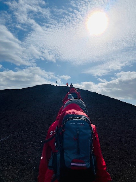
Two cairns marked the start of the final climb. I could see our destination across the valley and the silhouettes of a couple of hikers right up the top – eeek! It seemed like quite a long way and 200m doesn’t sound that bad until you have to hike it.

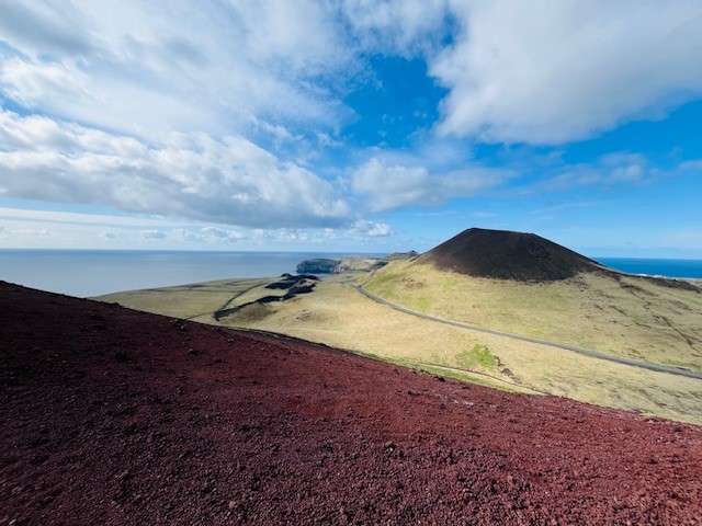
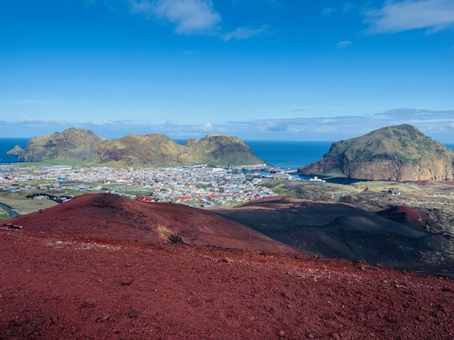
After a lot of huffing and puffing, we made it to the top – kinda. There was a stone marker and a bit of flat space to stand and look at the amazing views, and the original inactive Heimaey volcano called Helgafell.

What the photo on the right shows very clearly, is the original coastline to the right, and the new land on the left created by the lava flow….quite incredible.

We then walked along the final quite narrow crest to a section of the volcano where the ground remains warm – confirming we were on an active volcano! Our lovely guide told us that until recently, his party trick was to drop a piece of paper into one of the fissures at the top of the volcano and it would burst into flames. Imagine his disappointment when one day – no fire…! Eldfell is slowly cooling down, but we still felt the warmth in the ground. Thankfully the weather held and the views from the top were pretty amazing.

FUN FACT

The island to the right in the photo is called Ellioaey and is meme famous for being the loneliest place on earth. However – it’s not in the “middle of nowhere” and it’s not “Bjork’s old home” nor has it been “empty for 100 years” and definitely not “built by a billionaire to escape a zombie invasion”– it’s a lodge that can be booked for weekend getaways, and as you can see, it’s literally within spitting distance from Heimaey. Myth busted!

It was time to start the downward journey. Funnily enough, downhill is actually harder than uphill. We were hiking on volcanic scree (little stones) and it made the path quite slippery. More than one person took a backward tumble onto their butts!

I have mentioned this before, but there is a knack to hiking downhill, especially if you’re on loose gravel. If you tilt every so slightly forward from your waist, and just go a little bit faster than normal, your centre of gravity stays marginally in front, so rather than your feet slipping out from under you (and you ending up on your butt) you tend to stay upright. Trust me – it works!

We weren’t going down the trail we came up, We deviated to the southern side of the volcano as our destination was Eldheimar – a museum dedicated to the Eldfell eruption. At the museum, there were a couple of partially excavated homes, and our guide dropped a bombshell. One of the homes belonged to his foourafi (grandfather)!! Very personal.

Our hike then looped back into town and down to the port. We saw markers for lava flow, where the side of a street was destroyed, and the other side untouched. We covered about 7km and it was worth every chilly and windy step!

Some of the most interesting hikes emerge from the unlikeliest of places, and our hike up Eldfell was exactly that. If you choose to be a traveller, rather than a tourist, you will discover some amazing opportunities and experiences. Being open is the key.

As you saw above, Mr PJ was along for the hike and loved it. There was a bit of grumbling about the climb, but that quickly evaporated with the amazing views.

As Icelandic folk say to describe a really great experience…..rusinan I pylsuendanum….. have fun unpicking that one!

See you out on the trails

PJ 🙂

Two Scottish Isles, Two Hikes, Two Days – Can It Be Done??

Hello and welcome to my LIKETHEHIKE blog. I’m PJ and I write about the hikes I take, giving you insights, photos, commentary, tips, and tools so you can enjoy hiking and embrace the experience.

I’m a week into my holiday exploring the islands of England Scotland and Iceland. I have the opportunity to hike on not one BUT TWO SCOTTISH ISLES! I only have a short window to accomplish this and I’m pretty sure I can pull it off so let’s get into it.

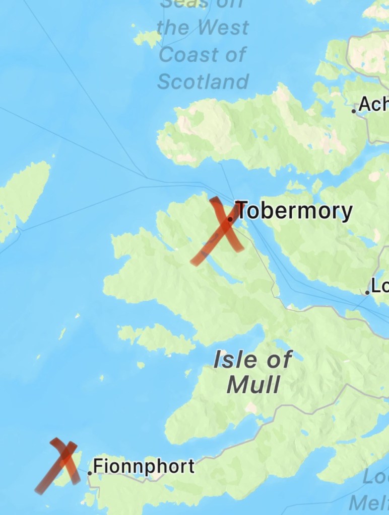
So, this is where I am. What I understand to be the Inner Hebrides, a cluster of islands off the west coast of Scotland. The two isles in question are Mull and Iona.

The Isle of Mull sits northwest of Glasgow and is well known for the capital fishing village of Tobermory (Wombles anyone… 😉 ) and a single malt whisky distillery conveniently located about 120m from the pier. It’s green, lush, inviting, home to 1,000 people, and gives off a cosy, welcoming vibe.

The Isle of Iona is completely different in every way. It sits about 125km southwest of Tobermory, right on the western tip of Mull. It’s a tiny isle, no more than 5km long and 1.5km wide. Home to less than 17o residents and the world-famous Iona Nunnery and Abbey, it’s stark, windswept, and hauntingly beautiful. Standoffish but when you get to know it – unforgettable.

DAY ONE MORNING – Hiking the Isle of Mull

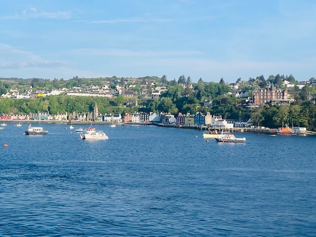
Welcome to Tobermory 🙂 We landed at the pier of this picture postcard village on the northeastern side of the Isle of Mull. It’s the capital of the island and is instantly recognisable for its brightly painted buildings that line the front of the fishing harbour. Tobermory comes from the Gaelic Tobar Mhoire or Mary’s Well, referring to a well nearby dedicated to the Virgin Mary.

We had a 6km hike that would take us out to the Aros waterfall and explore the harbour front. Rather than hike as part of a group, Mr PJ and I went rogue and decided to do our own thing. Now I wouldn’t usually recommend this, anyone on FB knows what happens to Australian tourists who abandon the cruise excursions and do their own thing…however, the hike was a ‘there and back’ and I was confident that we could manage this in the timeframe given to us.

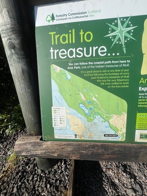
The trail started at the pier, with an easy set of signs and a map. After a short but sharp climb, we were at the first clifftop and so began a hike that offered view after view after view. We were walking away from the village so every vantage point gave us stunning views back to the village and our ship – Silversea Endeavour.

Tobermory has luscious trees and abundant vegetation with everything in spring bloom. The hike out to the waterfall was just gorgeous. It was mid-morning, the temperature was mild, and the clothing layers came off very quickly. After about 3km we arrived at the waterfall.

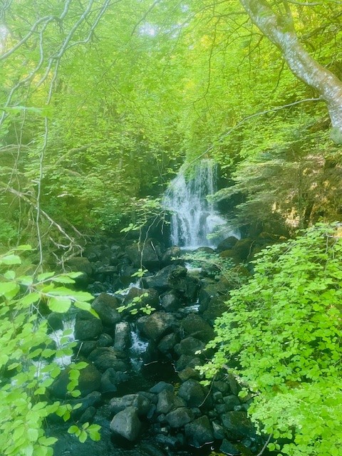
It was a series of short, sharp switches up, and then the same back down to the base of the waterfall. If you hike in Australia, you might be used to high, narrow waterfalls. The Aros was wider and less high, but still very lovely to spend a moment or three contemplating.

We went beyond the falls and explored the adjoining camping and facilities area, where I sadly discovered that the toilets were ‘closed until further notice’. This gave the local wildlife an interesting morning show, but when you gotta go, you gotta go! After my unplanned toilet stop, we decided to head back so we were within our deadline for transfer back to the ship.

Now, I’m not a petty person by nature, but….it gave me great pleasure to pass the ship hiking group as they huffed and puffed their way up the hill, walking poles flying in all directions and excursion staff urging them onwards and upwards. You take your joy where and when you find it 🙂

The return section was just as enjoyable as the outward section. We passed trail runners, hikers, walkers with dogs, and a heap of visitors just enjoying the Isle.

We did the hike in good time, but remember, it’s not about the time you take, but the time you spend. 🙂

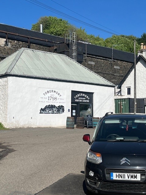
Tobermory, you turned it on weather wise, hike wise and whisky wise. Oh, we had to stop at the distillery at the end of the hike and sample the wares, it would have been rude not to!

DAY TWO AFTERNOON – Hiking the Isle of Iona

If Tobermory was a soft spring morning, Iona was a wild and exciting afternoon. I could not have picked two more different isles to hike on.

Iona is world famous for the Iona Nunnery and Abbey. It’s one of the oldest Christian centres in Western Europe, with first dated records from about 560AD. It’s home to clan Donald and Macdonald, neither of which are my ancestors. I hail from mainland Scotland, clan Leslie just outside of Aberdeen 🙂

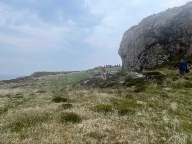
We had a fascinating walk around the Nunnery and the Abbey, then met for the hike traversing the Isle, Yep – traversing the isle! Not for the faint-hearted as we had limited time and a decent distance to travel, so only the fit and feisty were present. We started just outside the Abbey and made our way through the fields. The first thing that struck me as we walked along was the complete absence of any trees. Iona is at the western tip of a series of isles and is exposed to the forces of nature. Any trees on the island would be imported and protected as part of a house garden. There are no trees naturally on Iona, the winds destroy them long before they can take root.

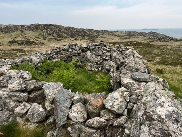
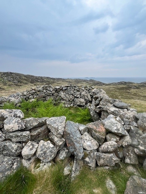
At around the 1.5km mark, the guide took us up a hill to a cluster of stones, originally a hermit cell. It’s an ancient ruin nestled into the side of the hill, built by a devout Christian hermit – or so the legend says. Whether it was built by a hermit or shepherds wanting shelter, the structure is centuries old and pretty special to visit.

The terrain was interesting to traverse. Much of the ground is either boggy or a mixture of reeds and sphagnum moss, which looks dry and stable but is actually full of spring water. So as soon as you step on it, down you go! It caught out a few people wearing sneakers. Not me though, thank you Gore-tex Merrells 😉

To be honest, I found the landscape a little unnerving. If you hike regularly in forests and bush trails, a space devoid of any vegetation higher than your knee is ‘interesting’. There were rocky outcrops covered in lichen and magnificent views down to a grey and menacing sea. The hike was very much about the environment and what we were walking through – very different and visually confronting.

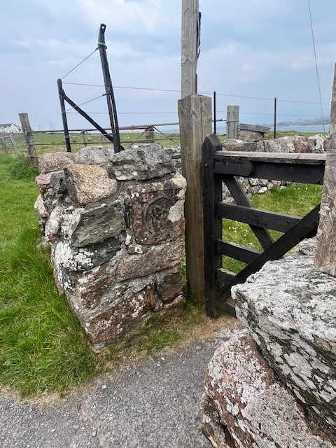
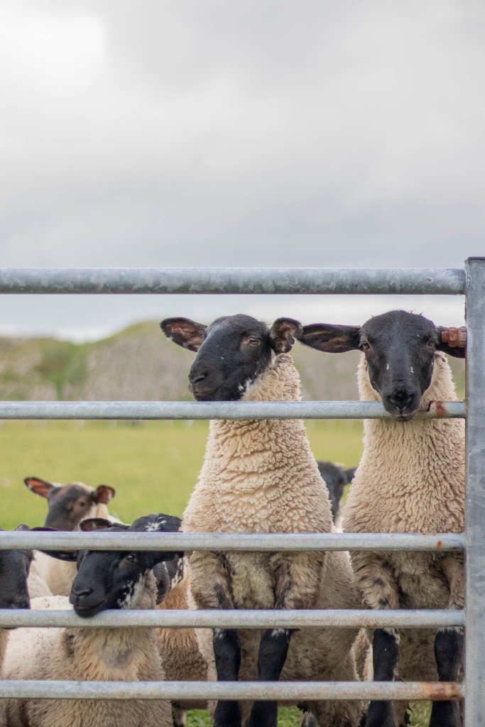
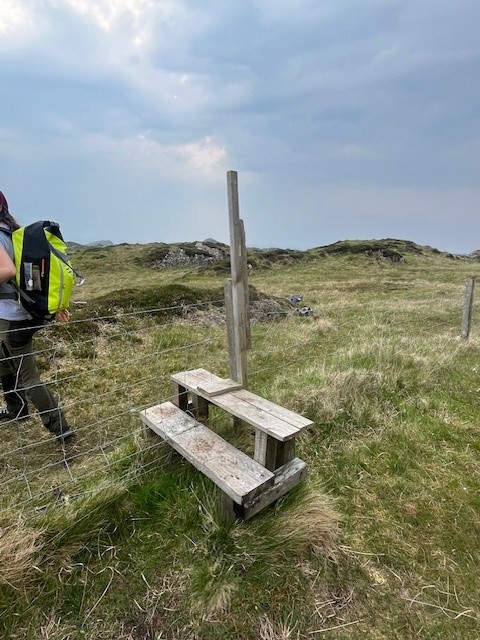
There were gates and stiles to navigate and at about 3km we went over a stile that marked the high point, we were officially in the middle of the island. Occasionally we passed flocks of sheep and their cute little black headed lambs.

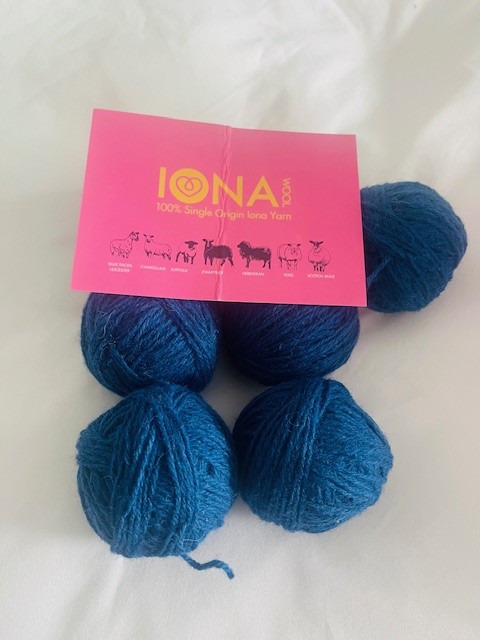
Side note – Iona is home to seven crofts (little rented farmlets), two larger farms and over 1,000 native sheep. The wee black headed ones are Suffolk or Scotch Mule breeds. I know this as I may have spent some time pre-hike at the Iona Wool Store in the village. No judgment please, I like to shop and knit. Two for one! It’s that kind of blog.

We made our way downward, and what did we stumble upon but the local golf course! Well, this is Scotland so I’m not surprised. From what I understand, Scotland is first in the world for the most golf courses per capita. The Iona Golf Course is mown by sheep and cattle, free to play on, and has a wicked 14th hole 😉

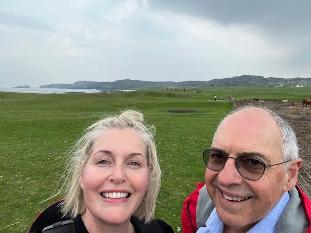
Downward we went, and soon we arrived at the ocean, wild, grey, and absolutely breathtaking. We had the beach to ourselves, and forget sand, it was pebbles, grass, and sheep poop. Our final 1.2km was a brisk walk down the main (only) road back toward the village and pier.

I was struck yet again by the stark and windswept nature of the isle, and what it might mean for residents. Looking at the houses, they are all built to capture sunlight when possible, everyone has skylights and glass to make the most of daylight. I saw woodpiles for home fires, which must come in via ferry as there are no forests or trees on the isle.

Such a beautiful and awe-inspiring land to walk across, such a pleasure, such a privilege.

Just a fraction under 6km to hike across an island – pretty cool! The village’s name is Baile Mor… which means big town. It’s not…

So I did it, two Scottish Isle hikes in two days. WOOOOOOOHOOOOO!

Not the longest of hikes if you read some of my previous blogs, but definitely up there in terms of uniqueness and enjoyment.

The Scottish Isles offer such a range of experiences and opportunities, for all budgets, all mobilities, and all persons. I can absolutely recommend them as a destination for anyone wanting to simultaneously lose and discover themselves hiking. Have a look at visitscotland.com for more info.
See you soon out on the Icelandic trails!

PJ 🙂

Come Hike Raad ny Foillan With Me! The Isle of Man awaits!

Hello and welcome to my LIKETHEHIKE blog. I’m PJ and I write about the hikes I take, giving you insights, photos, commentary, tips, and tools so you can enjoy hiking and embrace the experience.

Today I’m on the Isle of Man – woohoo!!!!! A self-governing Crown dependency smack in the middle of the Irish Sea between England and Ireland. Best known for the TT motorcycle race, the Isle of Man is home to 65,000 islanders descended from both Celtic and Viking invaders. The Isle of Man is part of our UK holiday – and I couldn’t wait to hike on it.
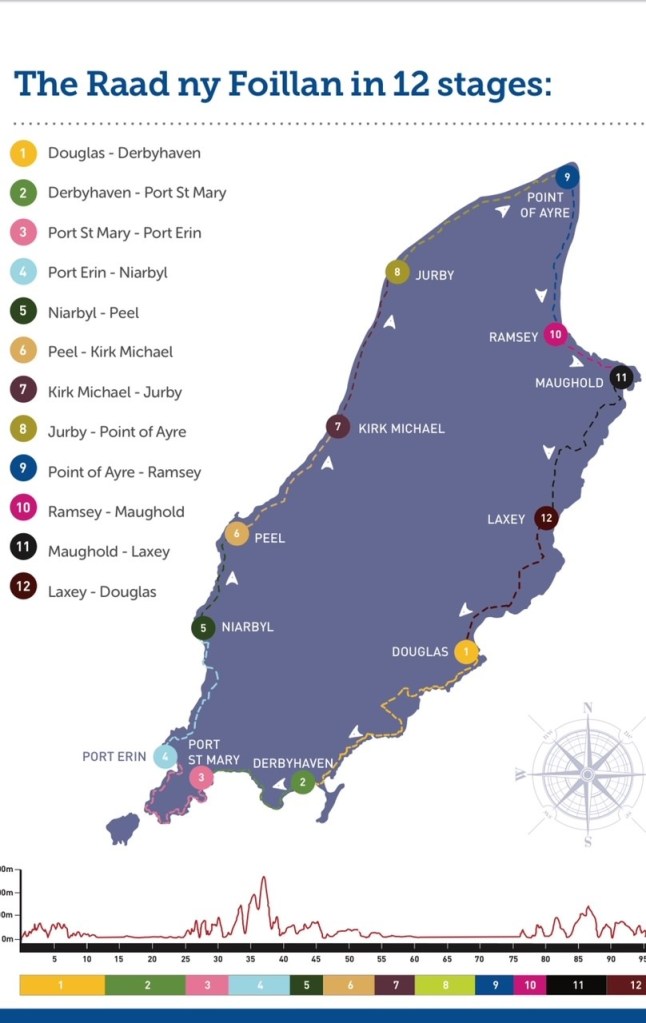
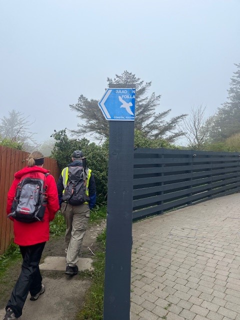
The Raad ny Foillan is 160km of coastal walking trail that circumnavigates the island and translates loosely as ‘The Way of the Gull”. Visitors and locals have been walking and talking about this trail for hundreds of years, so it makes sense for yours truly to investigate.

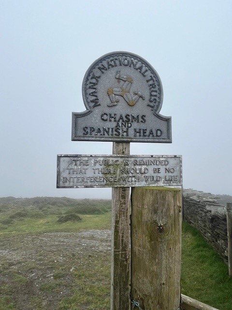
Our cruise excursion team arranged for us to walk a section of the Raad ny Foillan, taking in the clifftops of Port St Mary, cross the peninsula to Cregneash, and then down to Port Erin, about 7-8km all up.

About 20 hardy souls signed up to walk the section, led by a local hiking guide, Chris Callow from Island Heritage Tours. If you’re planning a trip to the Isle of Man and want a great hiking experience, I can thoroughly recommend him. He also does ancestral research and trips for Antipodeans looking for family heritage on the Isle – if you think you have ancestors from this neck of the woods, Chris is your bloke.

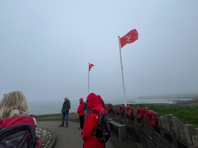
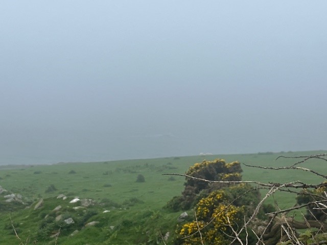
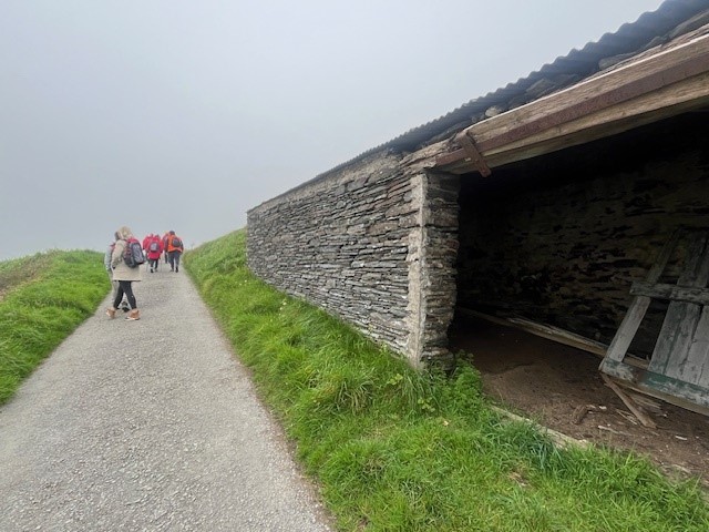
We started on the cliffs above Port St Mary beach. I was hoping for a clear day, but the sea mist was swirling, and although stunning, it meant that views might be out of the question. The beauty of a guide is that not only do you hike, but you also get a heaping of local stories and history – all very fascinating. Our first stop was a memorial for ships that took part in Operation Dynamo, the evacuation of Dunkirk in 1940. Three local ships assisting with evacuation were destroyed, with significant loss of life. It’s only fitting that the memorial sits on a clifftop overlooking the sea…

Handy hint – Manx is the word used to describe people or things that belong to the Isle of Man. Also, I believe, a cat without a tail which comes from the Isle. Go figure! We kept moving and wound our way towards the cliffs overlooking Perwick Bay facing due east, which I’m sure would show a spectacular sunrise – on a clear morning.

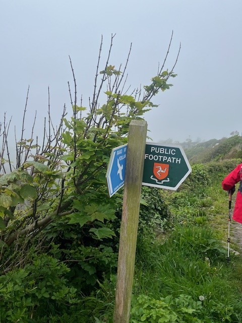
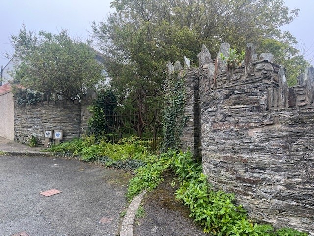
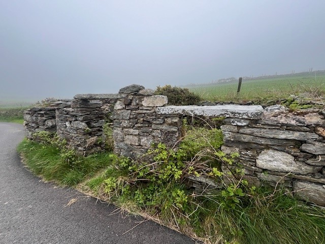
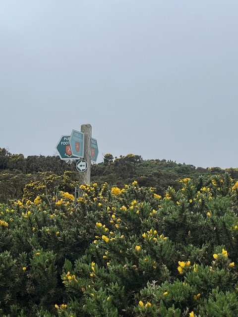
The trail is very well marked, and as I discovered in Kent, trails are supported and encouraged by the government, councils, and even private landowners. A hiker’s dream. The clifftop houses quickly made way for green open fields, dotted with woolly sheep and lambs. The stonework and foliage were just lovely, and kinda made up for the fact that the sea mist seemed to be getting heavier, not lighter!

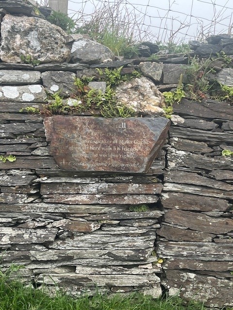
Our next fascinating fact was around the 2.4km mark where a sign and a simple wooden bench recognised Ned Maddrell, the last native Manx speaker on the island. Local schools are leading the charge to ensure that the next generation of Islanders retain this important cultural artifact, which is similar to Irish, Scottish, and Welsh Gaelic (all of which are waaaaay out of my remit). The locals are very proud of their language, culture, and independence, totally understandable.

Not too far along the trail, we came to another reminder of the impact of war on the island. On a misty day probably very similar to this one, a US Flying Fortress crashed into the side of the hill, killing all on board. I wasn’t surprised, given the thickness of the mist we were hiking through. Still, a sobering reminder that the weather and the terrain will always remain dominant over us mere humans.
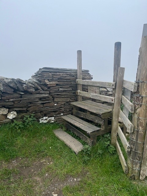
We kept climbing up and up and up. There were some quite steep sections, we traversed through fields, gorse patches, over stiles, and through gates. Most of the area looked like it was being actively farmed. so it was important we followed the hiker rule and leave gates as you find them.
The highest point in the hike was about 4km in, a pretty amazing destination called Cregneash, a historical Manx village lovingly restored and running as an example of a 19th-century crofting community. Surprisingly, people still live here and little “private house” signs remind you not to barge on in. Good place for a quick coffee stop 🙂 Thankfully it was a short stop as the mist hadn’t cleared and it was quite chilly! Hiking meant moving and moving was warm.

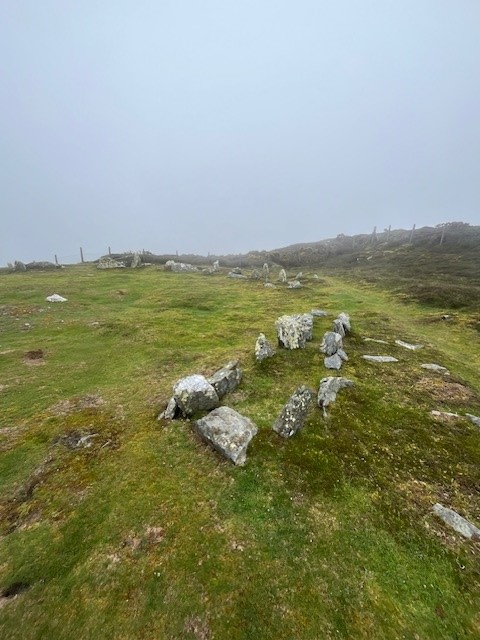
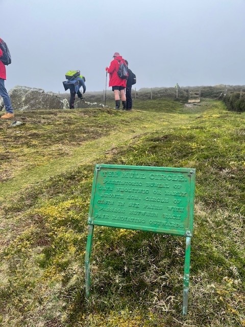
Our next waypoint was at 5.5km and on the crest of the peninsula. Meayll (Mull) Circle is a bronze age burial site that is evidence of island occupation from Neolithic to Medieval times. It’s a chambered cairn with 12 burial chambers in a 5.5m circle. It really was an honour and a privilege to hike through a countryside that has markers dating back thousands of years….and be able to walk the ground, touch the stones, and feel the history.

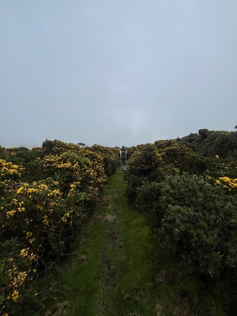
A lot of the landscape on the crest was gorse-laden, which was challenging to walk through. The tracks were wet and mucky underfoot, but thankfully I took my Merrell waterproof hiking shoes for just such an occasion. I had a decent backpack and took my wet weather gear. I still had to pick off quite a few gorse prickles at the end of the hike.

We were now heading downhill towards Port Erin. We traversed trails, a couple of country lanes and passed some fascinating stone buildings, one was going to be restored, and one that should probably be knocked down (yuk! no accounting for bad taste)

Thankfully on the leeward side of the island, the sea mist had lifted a bit, and we got a view down to the port and beyond. Heading down steep hills is usually a bit more challenging on the knees, but this trail was manageable and with the end in sight, the pace picked up.

Our hike came to an end at the beach in Port Erin. We clocked about 7.5km – it was a fantastic hike. It had lots of uphill sections which I imagine on a clear day would give you the most incredible views. Despite limited views, we still had a great morning, and I managed to coax Mr PJ out for a hike – win! I haven’t converted him yet, but give me time… 😉

If the Isle of Man sounds like you, and you want to pack your hiking boots, then put Raad ny Foillan on your bucket list and get cracking!

See you out on the Scottish and Icelandic trails

PJ 🙂

Hiking the Bridle Trails in Kent, England

Hello and welcome to my LIKETHEHIKE blog. I’m PJ and I write about the hikes I take, giving you insights, photos, commentary, tips and tools so you can enjoy hiking and embrace the experience.

HOW EXCITING!!! I’m coming to you from the green and lush countryside of Kent, in southern England. Him and me are on holiday for a month, so come with me on some hikes as we make our way through England, Scotland, Iceland, and beyond!

Today we are in Kent, staying in a lovely pub called The Three Chimneys for three nights. The best barman ever (Scott) gave me a local map that showed a range of footpaths and bridle trails which made planning my hike super easy. Three Chimneys has a 350-year history and an association with Sissinghurst Castle that is fascinating, but more on that later…

I thought it prudent to map a hike out the night before and identified Sissinghurst Castle as my preferred destination. To be fair, I did map it out at the same time I sampled the local pressed cider….so buckle in for a bit of an adventure… 🙂

Thursday morning, 6am. I rugged up and left the warmth of our room. The English countryside in spring means it’s light around 5.15am and dusk doesn’t hit until around 8.30pm, so I had the benefit of an early start. However, the air does have a bit of a nip in it, so remember to layer if needed. I also took my phone and checked I had 4G coverage. Safety first hikers!

I was determined to explore the bridle and footpath trails which crisscrossed the countryside. Bridle paths and footpaths are legally protected routes that the public can use on foot or on horseback. It’s even legislated under a national act, the Highways Act 1980! This includes farm fields with cattle, sheep, you name it.

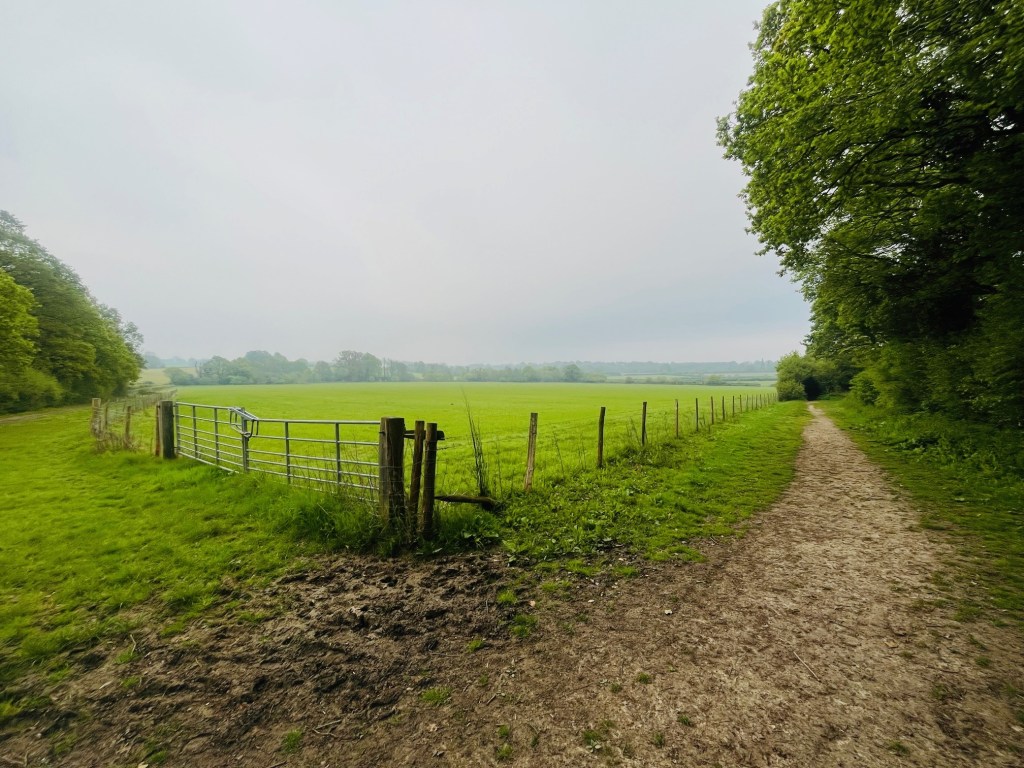
As you can see, my first departure down a footpath (which isn’t a footpath as you think, but merely a sign into a field) was a bit of a bust, it led back to the pub across the paddock. So nope! Back onto the road, and thankfully the next footpath sign was about 150m down and was the correct one. Off I went, the path was freshly mown, and I was on my way. I weaved behind a row of farmhouses feeling quite brave and breathing deeply, loving the fresh bracing air with my merino beanie firmly covering my ears, which don’t like the cold 🙂

I came upon my first stile – how exciting!! The stile opened into a large field with hedgerows on three sides, and two cows…..have a look in the distance and you will see them right down the end of the field. I had a fair idea of where I was aiming for, so off I went. Now, if you haven’t walked through a farming field before, they can be challenging. It’s not the same as walking in a park. Cattle are heavy, usually around 600kg. And in this field, there were two cows. Paying me attention. Which is fine, I grew up on a farm so cows I’m OK with. But this wasn’t my field, my farm, or my cows. Thankfully the inhabitants were two ladies, and guessing from their heavy udders, they may have just weaned some calves. So, starting my brisk walk across the field I had to traverse a terrain that was pockmarked with cattle hoof divots. Definitely not flat and definitely a potential menace to the ankles.

I wasn’t even 100m into the field and I had two escorts…..trotting up to say hello and find out all my business!

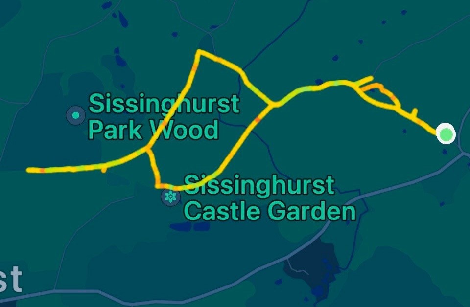
Even though I am used to farms and cattle, having two 600kg+ cows cantering up to you is a little intimidating! About now I realised I couldn’t see my exit point in the opposite hedgerow. Imagine this. I’m in a foreign field, with two huge cows tracking me like F18 Hornets, what’s my next move? I saw a gate. To the left. Which opened back onto the lane. Change of plan. Bessie and Biddy would have preferred I stay for a chat, but I had a hike to enjoy and it wasn’t going to end in a boggy field in Biddenden. Two minutes later I scaled a fence and was back out in the lane, a little sweaty and slightly defeated. You can see the loop at the start of my hike tracking pic. SIGH. I ventured down the adjacent lane to see if I could find the next stile, but no luck. Back to the original mission – my castle! The destination is important, but really, hiking is all about the journey.

I knew there was a castle in the vicinity and a range of ways to get there. It was now down to my google map reading skills (and the map Scott gave me) to get there.

You gotta love some of the Kentish road names. HarePlain Rd. Grandshore Lane. DigDog Lane. Lewd Lane. How did these names come about?? The mind boggles.

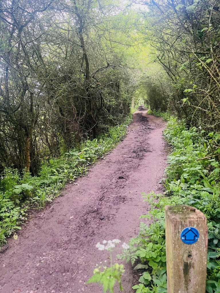
I loved walking down DigDog Lane to find my castle. I saw the bridle trail markers at about the 2.5km mark so it was time to leave the road and start into the trails proper, thankfully without my friends of the bovine persuasion. And wow, was I in for a fantastic few kms!!! I entered what can only be described as a leafy green otherworld tunnel heading up a gentle slope that seemed to run forever, and I had it all to myself.

This is what I craved, beautiful English countryside trails that ran through rolling fields with a smattering of happy woolly sheep. The trail was very well used, with an equal mix of horse and human prints. Oh. And doggos. I encountered a few during my hike who were having the best day ever! I even had an intimate experience with a very exuberant Dalmatian who left an indelible imprint on me….!

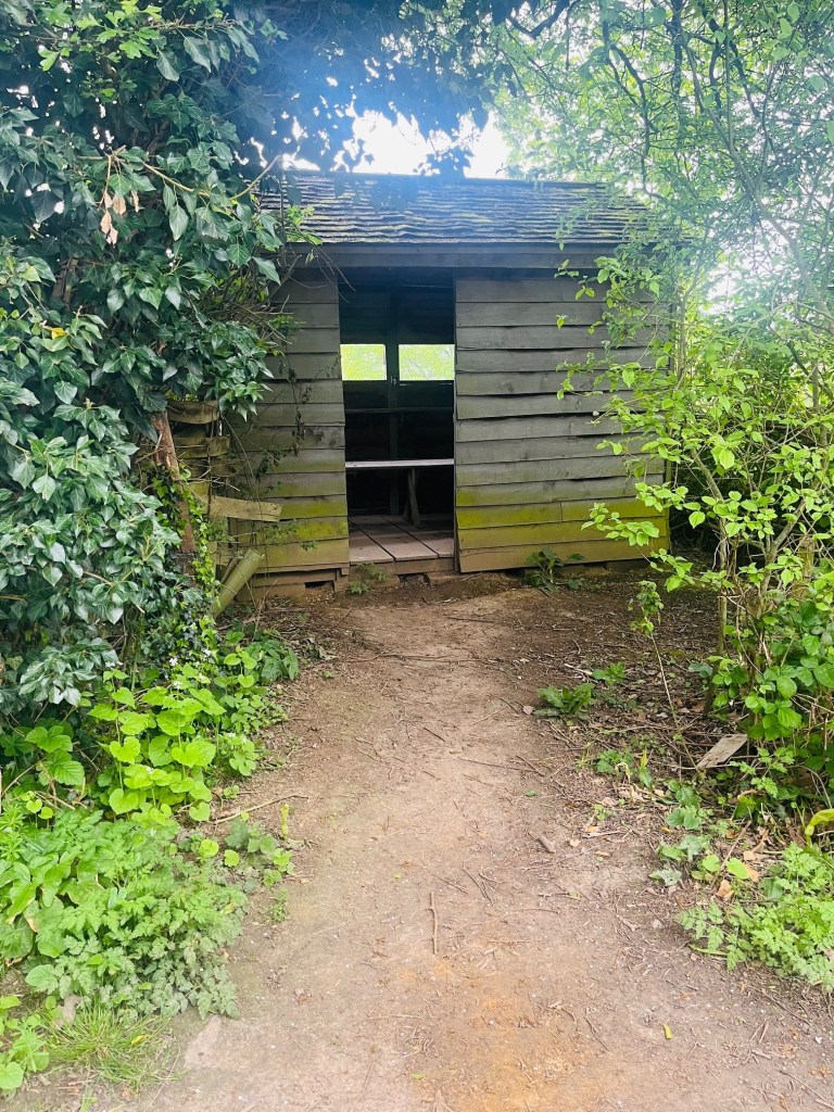
Around 2.8km I encountered what looked like a tiny wooden bus stop, but it was a hide. A hide is a wee structure that people use to observe wildlife, usually birds. Which makes sense as I could hear several very busy ducks in the nearby pond, and in the background, the haunting call of peacocks. Once you hear a peacock call, you’ll never forget it…. magical.

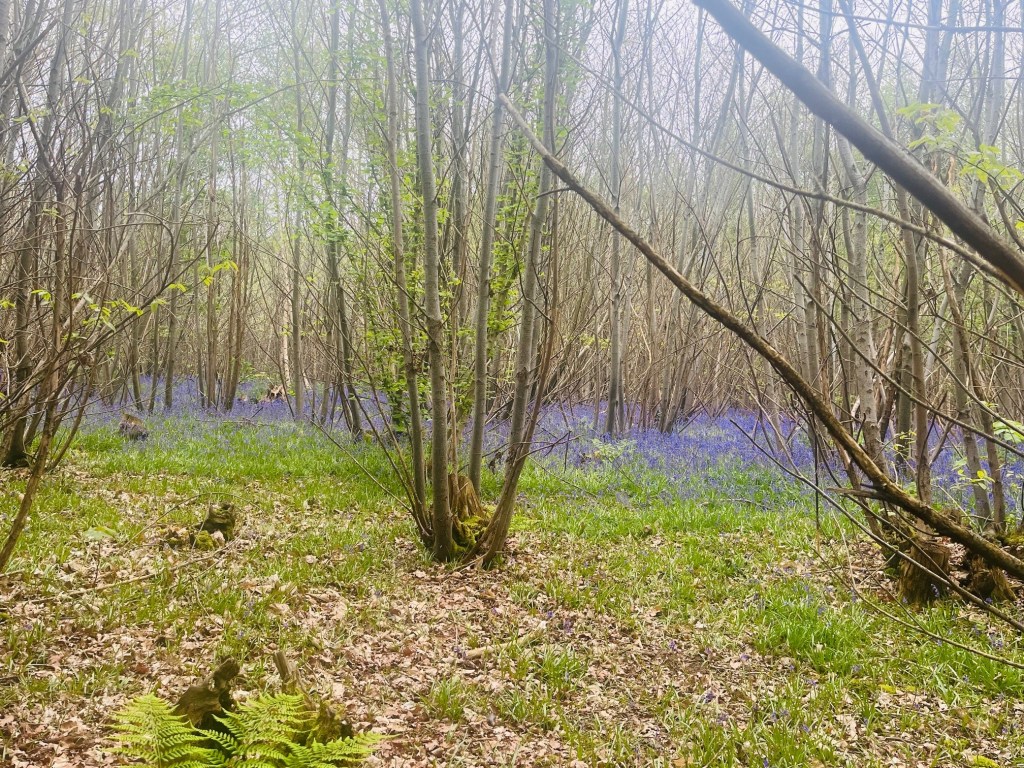
The temperature was cool, but not cold. I had on a long sleeved merino and a sleeveless puffer, and heading uphill I was starting to feel quite warm. Around the 3.5km mark I took a right hand turn and had an orchard on my left, and a bluebell forest on my right. Stunning.

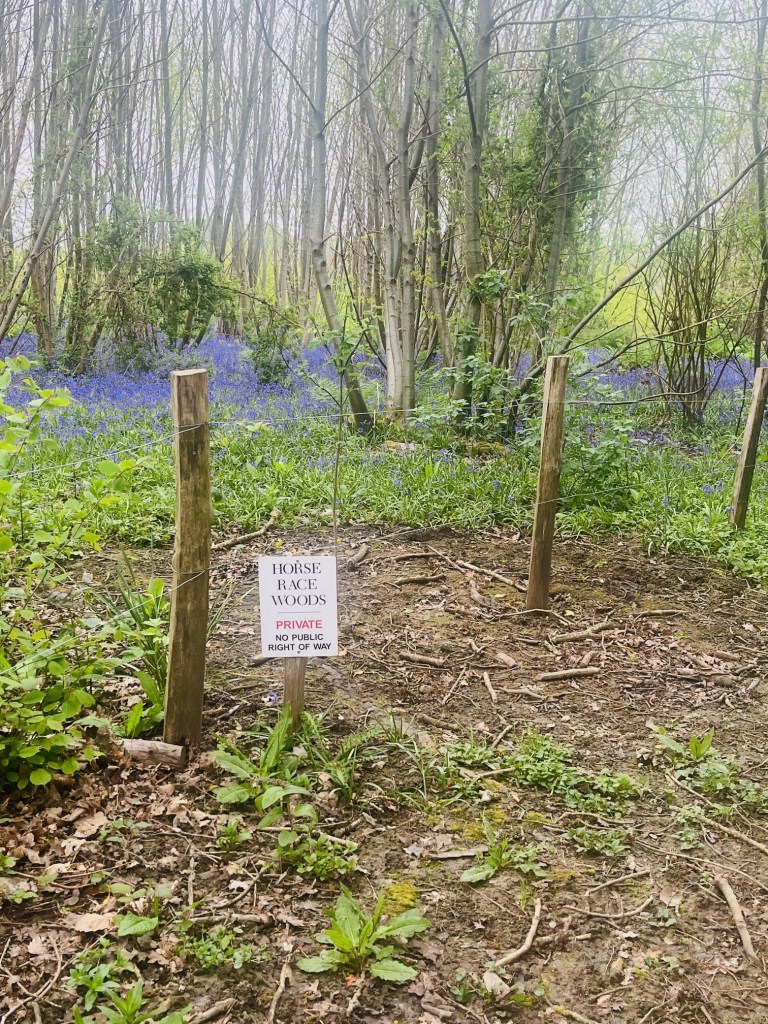
By the time I reached the 4km mark, I started to think I had overshot my castle. I was still on the bridle path, but had gone past a couple of farm houses, and seemed to be heading for another main road (not my fav place to hike). I had also passed a large estate called Horse Race House. Now, I’m about to say some not very nice things about the owners of Horse Race House. Skip on if you don’t want to read my savage interpretation of some Kent locals!

So, imagine buying a heritage house and woods adjacent to a national park and castle. You have land, I’m guessing a few acres, and you are next to a bridle path. The public uses the land all around you. So, what do you do? Go with the flow? Hell no. You put up as many unfriendly signs as possible which, TBH I didn’t see anywhere else in four days of wandering, and label yourself as a bit of a tosspot. All these signs were along a 300m section of the path. SIGH.

I did a u-turn just after Horse Race House (a great name!) and came back down the bridle path hill. I had gone through a couple of forks in the path on my way up, so one of those was going to be my next destination. What’s the saying? “when you come to a fork in the road, take it”. I knew one of the forks would take me to my castle.

YAYAYAYAYAYAYAYAY!!! I found my castle at 5.5km. I knew it was there, I just had to take the right bridle path.

My castle isn’t the biggest. It’s not the oldest or the most famous. But at about 7am I found it. And it was all mine to explore. I saw the castle vegetable garden that generates over 6 tonnes of produce a season for the local castle restaurant. I saw the perfectly preserved Oast hop kilns that dry hops to make beer. I saw the barn where French prisoners of war lived during the Seven Years’ War which kicked off in 1756. The POWs were allowed out on parole to venture as far as the Three Chimneys Pub, which they called Tres Chemins (three junctions)…which over the generations, morphed into Three Chimneys. I think there may be quite a few descendants in the area!!

I wandered around the moat and grounds which are expertly managed by the National Trust. I felt honoured to have this perfect castle all to myself on a still spring morning. As hikers would understand, the best hikes not only ground your day, but they fill your soul.

All good things must, however, come to an end. It was time to leave my castle. I had maybe 3-4km back to my digs and no firm plan on how to get there. I chose the bridle trail that made sense, in the general direction of my destination. I was sidetracked at the 6km mark with the Frogmead restoration project, but it’s important to appreciate the land you’re hiking through. And who doesn’t love a frog!

I found DigDog Lane, more by luck than design. The narrow hedgerow lanes are quiet and intimate. The barman at Three Chimneys said the drummer from Cold Play lives in DigDog Lane…I can’t confirm or deny, but I kept my eyes peeled for fancy cars and tinted windows!

If you want to experience a hike that you definitely WON’T forget, I can absolutely recommend Kent and Sissinghurst. I stayed at a 350 year old pub, ate some incredible food, met some warm and friendly locals, hiked in the English countryside and I found my very own castle.

How can you top that???!!! (stay tuned to find out), and see you out on the English, Scottish, and Icelandic trails.

PJ

The Blog about NOT HIKING…

Hello and welcome to my LIKETHEHIKE blog. I’m PJ and I write about the hikes I take, giving you insights, photos, commentary, tips and tools so you can enjoy hiking and embrace the experience.

Ahhhh, the enjoyment of a hike. Getting your pack ready, pouring over hiking maps, deciding on your snacks, your gear, the timing, then actually getting there and having a fantastic day.

EXCEPT.

When you don’t.

HIKING IN QUEENSLAND SUMMERS

I’m very lucky to live in a beautiful part of Australia. Queensland is an outdoor pursuits paradise and as they say, it’s beautiful one day and perfect the next. I can drive one hour south and been in the middle of the Gondwana Forest. An hour north puts me in a subtropical rainforest wonderland.

For nine months of the year, hiking in Queensland is a pure delight. For the other three months, it can be positively hazardous to your health.

Let me tell you why…..in escalating order of threat to safety and sanity….

#1 Hazard – Leeches

Or scientifically speaking, the Gnathobdellida (jawed leech). Leeches are closely related to earthworms, but act very differently especially when hikers are around!

Leeches are common on the ground or in foliage in rain forests. They are sanguivorous, blood sucking parasites that feed on preferred hosts like kangaroos, possums, padymelons, birds, frogs and HIKERS.

My first encounter with leeches was about 10 years ago when I did a short hike in Lamington National Park. The waterfalls were in full flow, the birds were singing, the sun was shining and it was a great day….until I got back to the car and took my boots off. There, tucked into the top of my socks and firmly attached to my legs were about eight leeches.

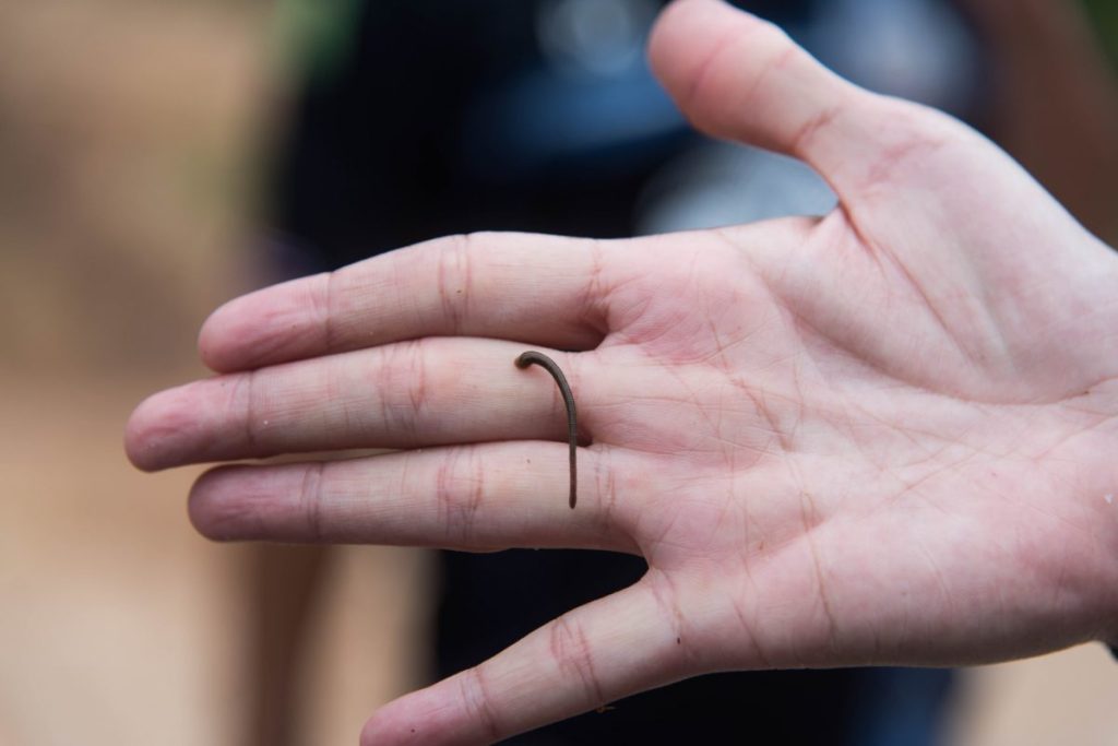
They ranged in size from a thin worm (like above) to fat black sausages the size of a thumb, all pulsing in sheer delight as they feasted. To say I panicked was an understatement. I didn’t know anything about leeches, how to remove them, what to do….so I ripped them all off as I hopped and cursed around the car. Not a pretty sight.

I now know that leeches are not painful, nor are they poisonous. In fact, you rarely know you have one on yo, so they are rather polite creatures. They inject an anticoagulant/anaesthetic as part of their feeding process so when they’re removed, you continue to bleed for quite some time. Leeches aren’t dangerous but they rate quite high in the YUK category so prevention is much better than cure.

TIP

Carry either bug repellent or a Ziploc of salt, either will easily remove a feasting leech. I liberally spray myself with bug repellent before I hike and this seems to keep most creepy crawlies at bay. Remember to spray BEFORE you put on socks, pants etc as they just love to burrow under clothing…

#2 Hazard – Ticks

So now we head into more dangerous territory. Ticks are parasites that feed on human and animal blood, They can vary in size from a pinhead to a fingernail, and they need blood to grow. Unlike leeches which drop off once finished, ticks stay attached to their hosts and feed for several days. Depending on the species of tick, this longevity can make the host quite sick.

Hikers are susceptible to ticks in summer. I went on a two day group hike last October, and ticks were literally dropping out of the trees onto us. Each rest break involved some serious tick inspections, with several of the group removing ticks from chests, groins and even ears!

Tick season runs from the end of winter, through spring and into summer, with ticks being most active during periods of high humidity, which in Queensland is summer.

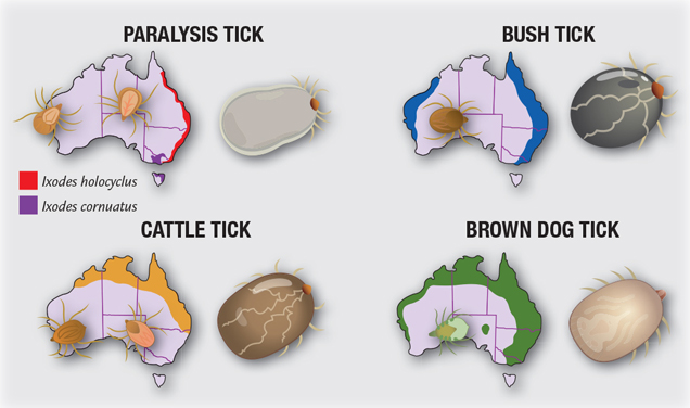
Just because it’s Australia, we have a tick called Ixodes holocyclus, or the Australian Paralysis Tick.

This nasty causes paralysis by injecting neurotoxins into its host. Tick paralysis is most often seen in animals but humans can also be affected.

Locating and removing ticks early is important as human reactions can range from itching, to full blown allergies, and respiratory distress. There is a saying in Australia, “freeze it, don’t squeeze it” which means, don’t try to pull the tick off as often its head remains embedded…along with the toxins. Instead use a pressurised cryoliquid product like Tick Off to kill the tick.

TIP

I carry Tick Off as part of my first aid kit when I hike. I haven’t needed to use it (but friends have) and it works by killing the tick, which then drops off. I do know some hikers who are confident to tweezer ticks out, and there’s a tale that you can remove them safely by twisting them out anticlockwise but I will stick with the spray thanks!

#3 Hazard – Snakes

The one thing that will strike fear in my heart is the thought of a snake bite when I’m hiking. But really, how prevalent are snakes when out hiking in summer?

In Queensland more that 800 people were bitten by snakes annually in 2020-2022. In January 2023, 97 people were bitten.

As snakes are cold blooded, these encounters happen during our summer months when the slithery critters are on the move for food or a mate. Interestingly, most snake bites occur when people are trying to interact with a snake, to move it or kill it. 90% of these bites happen in people’s homes or back yards and not all snakes are venomous.

So, statistically, my chance of being bitten by a venomous snake when out hiking is pretty low. Doesn’t change how I feel about it though!

I have only ever seen two snakes out hiking. One was a lovely emerald tree snake sunning itself on a trail and the other was a death adder, also snoozing on a trail. Both scarpered pretty quickly.

My philosophy is to treat all wildlife with healthy caution, especially snakes. Given they are much more active in summer, I’m very happy for them to have the bush for those months, and I’ll hike in the cooler months 🙂

TIP

Snakes aren’t aggressive unless they are threatened, so if you come across a snake, stand still and wait to see where it goes. Then you go the other way, letting it disappear. Whatever you do, don’t try to move it, touch it or scare it. They sense the vibrations in the ground as you approach and are usually long gone before you even see them.

#4 Hazard – Dehydration

I bet you were expecting me to name another dreaded Aussie insect or animal as my highest summer hiking hazard – but NO!

From my experience, the most hazardous aspect of hiking in a Queensland summer is dehydration. Temperatures can reach well over 35 degrees (95+f) by mid-morning and any strenuous prolonged exercise can trigger dangerous dehydration. And our 2023-2024 summer has been brutal with a number of heatwaves lasting days.

The worts part about dehydration is you may not even know its happening. Feeling thirsty means you’ve gone too long without fluids and a dry mouth and decreased energy could be mistaken for a response to summer heat. Another good trick to stay alert for dehydration is the “umbles”. Stumbling, mumbling, grumbling and fumbling are all signs that you need to stop and hydrate.

The added challenge for staying hydrated in summer is that water alone isn’t going to cut it. Your body needs electrolytes and minerals such as potassium, magnesium and zinc. When I hike in hotter months, I use a dual water bladder so I can carry plain water in one chamber and electrolytes in the second chamber. And when you think you’ve packed enough fluid, throw in another bottle because you just might need it! The general rule of thumb for hydration while hiking in heat is one litre per hour.

TIP

If you are hiking in summer, hydrate BEFORE you start, Chug down 500-750ml of fluid in the hour before you hit the trail. When you’re hiking, take small, frequent sips. My water bladder has a great mouth piece that I thread through my shoulder straps and it sits nicely near my neck, handy for sipping. Finally, continue to hydrate AFTER you’re done, using electrolytes or a sports supplement like DripDrop or Skratch in at least 1 litre of water.

In Summary…

So there we are. My top four reasons for not hiking in the height of summer in Queensland.

It’s a personal preference only, and of course, anyone can enjoy hiking in any season and not experience discomfort, but I really enjoy my hikes and I don’t want to be panicking about sucky, slithery, bitey creatures!!

The threat of leeches, ticks, snakes and heat keep me off the trails for just a few months, but trust me, the rest of the year I’m out there having a ball!

See you out on the trails (very soon)

PJ

Backpack Hacks: What You Really Need for a No-Regret Day Hike

Ahhh, the day hike. Nature’s cure for office chair back pain, screen-induced headaches and that nagging feeling that you’ve forgotten how the sun feels on your face. But there’s one tiny hurdle between you and hiking bliss: packing your backpack. Some might think, “its just a few hours, how hard can it be?” Well, let me tell you, it’s a lot harder than it seems if you’re the newbie who brought sunnies, a phone and no water.

Whether you’re a seasoned hiker or just fancy a stroll up and down a few hills, packing the right gear is key. So, let’s dive into the essential items every hiker should pack, and, equally important, the rookie mistakes you want to avoid.

1. Water: Your Best Friend

It sounds obvious, but you’d be surprised how many people underestimate their water needs. A good rule of thumb is to pack at least two litres for a moderate day hike. Add more if you’re hiking in summer, or on a challenging trail.

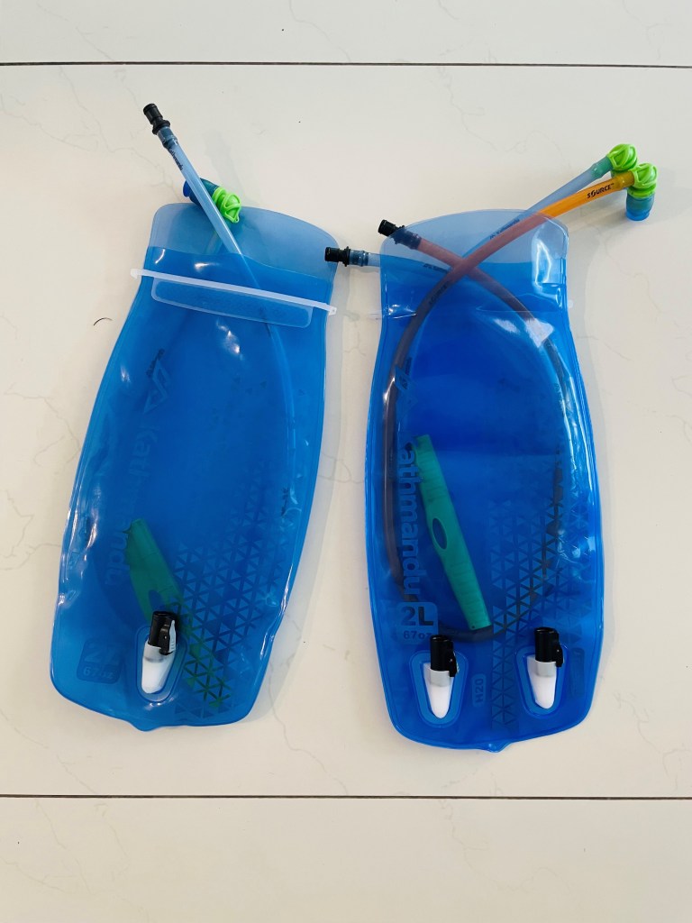
Hydration bladders are great because they fit snugly into your pack and you can sip as you hike without stopping. I have a 2L single, and a 2 x 1L double, both from Kathmandu. With the tubing conveniently on my backpack strap, I can rehydrate whenever I feel like it.

Rookie Mistake – Thinking a bottle of water is enough for an all day hike. It’s not. Unless you’re Bear Grylls and are prepared to drink from a dirty old stream, pack extra.

2. Snacks: Fuel for the Soul (and the legs)

Nothing says “I’m one with nature” like eating a protein snack bar halfway up a mountain. Seriously though, hiking burns calories and unless you enjoy that rumbling feeling on the way back to the car, pack plenty of snacks. Think nuts, fruit, highly dense protein and carb options that will keep you full. Even a good old sandwich does the trick.

snack time on the trail!

Rookie Mistake – forgetting snacks altogether, or worse, packing snacks that are highly fragile or perishable. I once packed sushi (which I thought was a great choice). Nope. It disintegrated during the hike because of the rough trail….! Stick to non-perishables that won’t turn into a science experiment by midday.

3. First Aid Kit: For when Nature Fights Back

You might think,” it’s only a day hike, I won’t need a first aid kit.” And that’s exactly when you’ll get a blister the size of a $1 coin, get poked in the head by a nasty branch, or discover the joys of a tick bite. A basic kit should include bandaids, wipes, painkillers or anti-imflammatories. Trust me, the one time you don’t pack it will be the time you trip over that rock and wish you had.

Rookie Mistake – Thinking a first aid kit is for “serious” hikes only. Even a short trail can deliver some nasty surprises (hello trips, falls and ticks)

4. Navigation Tools: GPS and Maps

You may be thinking, “I have my phone, why would I need a map?” Well, my friend, phone batteries die, GPS signals drop, and then there you are, lost in the wilderness, trying to find the Wi-Fi password of the nearest tree. Maps are lightweight and definitely don’t need charging.

Rookie Mistake – relying solely on your phone for navigation. Fun fact, phones don’t always work in the middle of nowhere and no, your phone flashlight doesn’t count as a backup plan.

5. Clothing: Playing the Weather Guessing Game

Here’s a fun game nature likes to spring on hikers. It’s called “Guess What the Weather Will Do Next!” You’ll be sweating one moment and freezing the next, so layers are your best friend. Pack a lightweight waterproof jacket and bring an extra layer for warmth. Even on warm days, the temperature can drop, especially at higher elevations. I’ve been hiking along a ridge in Binna Burra and gone from a t-shirt to a jumper, beanie, gloves and jacket within 2km and 20 minutes.

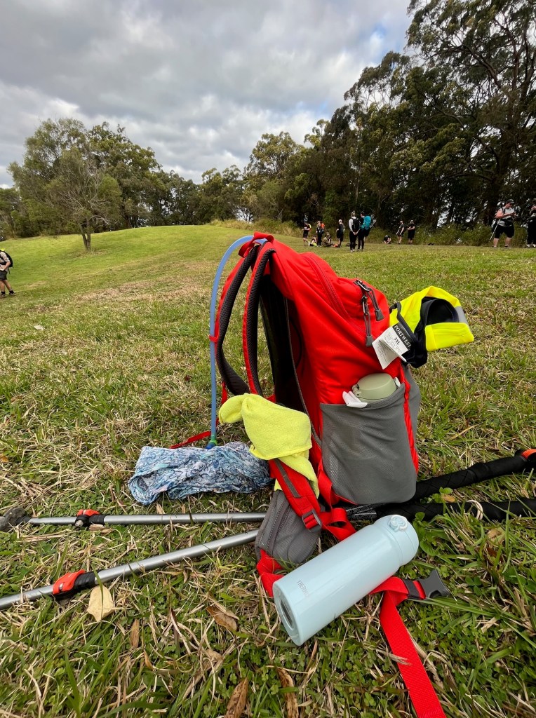
Contents of my backpack for a 40km hiking challenge in winter in Queensland. The mint green mound is my rolled up jacket!

Rookie Mistake – dressing for how it feels when you walk out the door. It might be sunny and warm now, but trust me, by the time you reach the summit, that singlet and shorts combo will be a regret you feel deep in your soul.

6. Sun Protection: Slip, Slop, Slap !

Down here in Australia, sun protection is a big deal. We are taught to slip on a shirt, slop on sunscreen and slap on a hat from before we can walk! Trust me, nothing ruins a good hike like turning into a human tomato. Sunscreen is a must, even if it’s overcast because UV rays don’t care about pesky things like clouds. I always have a hiking hat with me, I’m sure you’ve seen it in my photos! Added bonus, hats protect you from ticks that love to drop from the tree canopies…

Rookie Mistake – “It’s cloudy, I don’t need a hat or sunscreen.” If I had a dollar for every sunburnt hiker, I could afford to install shade sails across every trail in Queensland.

7. Hikers Wool: The Best Thing You Never Knew You Needed

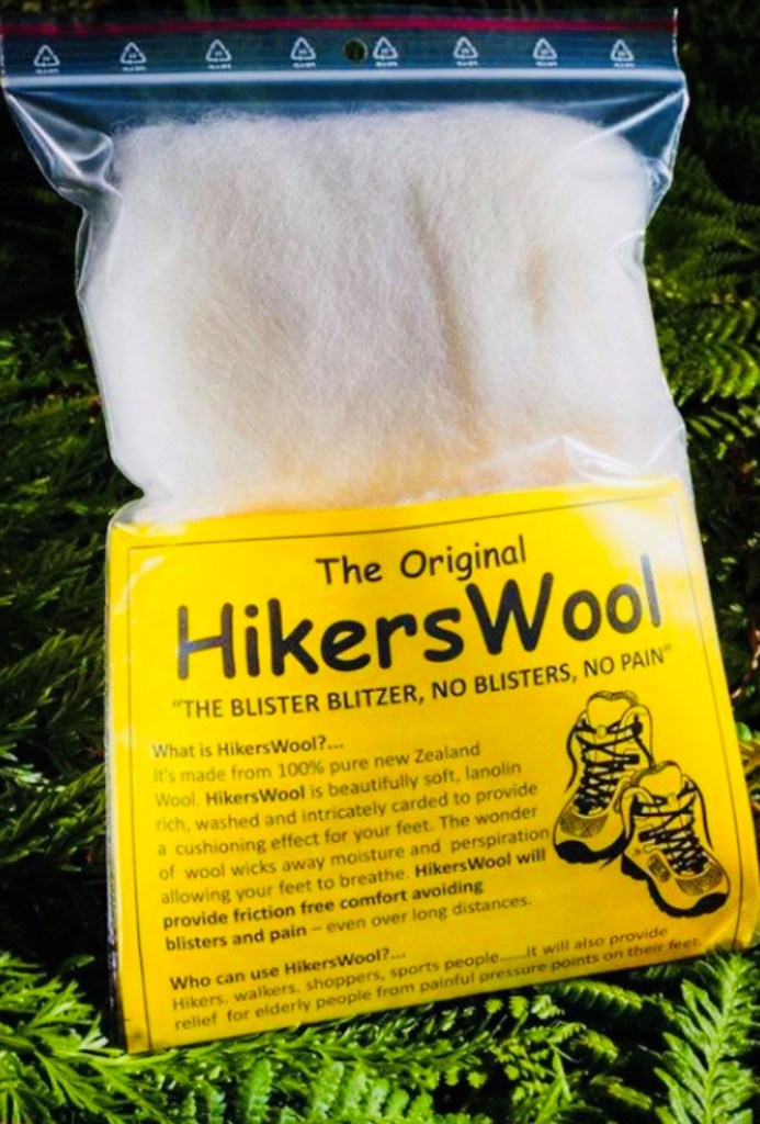
I’ve waxed poetic in previous blogs about the undiscovered hero of hiking, Hikers Wool. It’s a kiwi product, and is a godsend for sore feet and toes on hikes. Use it to relieve pressure spots or in between your toes for support. It is a permanent fixture in my backpack.

Rookie Mistake – not taking some form of product to manage blisters. Your feet are the one tool you can’t replace on a hike, and even experienced hikers can suffer from blisters. Throw in some bandaids and some wool, all sorted!

8. Emergency Shelter: Because Sometimes Sh*# Happens

Even if you’re just out for the day, pack something for emergency shelter, something as simple as a space blanket. Hopefully you’ll never need it, but it’s a game changer if something does go wrong and you’re stuck on the trail longer than you planned. I have a couple of ‘crunchie wrappers’ in the bottom of my pack (crunchie because its gold on one side, silver on the other!) They take up very little room but I know I’ve got them if sh*# happens.

Rookie Mistake – Thinking a day hike means no emergency gear. Day hikes can turn into night hikes if you get lost, injured, or take a detour that your mate swore by!

9. Headlamp: When Flashlight-in-Teeth Isn’t a Good Look

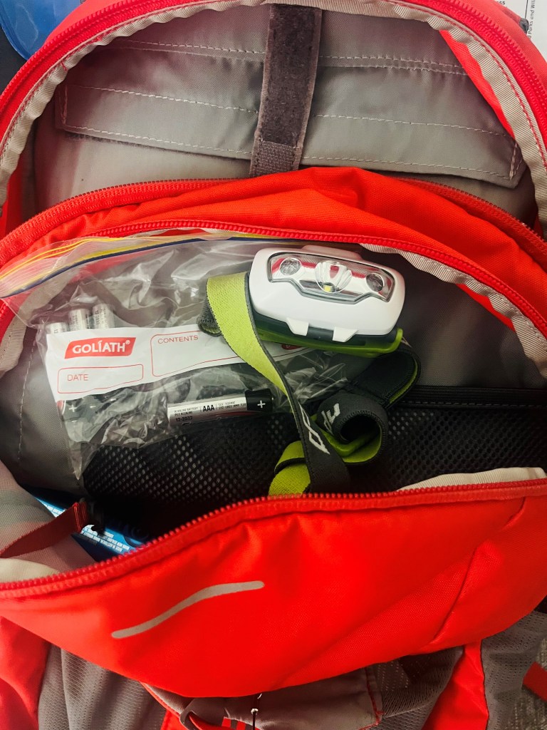
Scrambling down the side of a mountain trail in the dark with your phone clamped in your teeth? Not ideal. Avoid the dental drama and pack a lightweight headlamp instead. Did you know that dusk in the bush comes 60-90 minutes before everywhere else?? A lamp is perfect for those “oops, I guess we’re hiking after dusk” moments.

Rookie Mistake – Assuming you’ll always beat the sunset. One day on Kumano Kodo, the trail was harder and longer than we planned, and the last hour we were barrelling down the mountain, wanting to be clear before we lost light! Nature’s got no respect for your itinerary…

Conclusion: Hike Smart, Not Hard

So, there you have it. Pack the essentials, avoid rookie mistakes, and you’ll be on your way to a glorious day on the trails. Or at least, you’ll be prepared when your mate shows up with nothing but flip-flops and a can of fizzy drink, saying “I thought we were just going for a stroll?!

See you out on the trails

PJ 😉

Toolona Creek Circuit – your beautiful hike awaits!

Hello and welcome to my LIKETHEHIKE blog. I’m PJ and I write about the hikes I take, giving you insights, photos, commentary, tips and tools so you can enjoy hiking and embrace the experience.

It’s Been A While

Looking at my blog, it’s been a while since I’ve shared. That’s not to say I haven’t been hiking, but I’ve also been working and travelling, which unfortunately has cut into my blogging time.

However – I’m back and ready to share some of the great hikes I’ve done in the last couple of months.

Toolona Creek Circuit

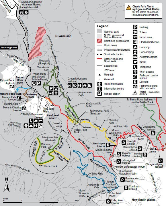
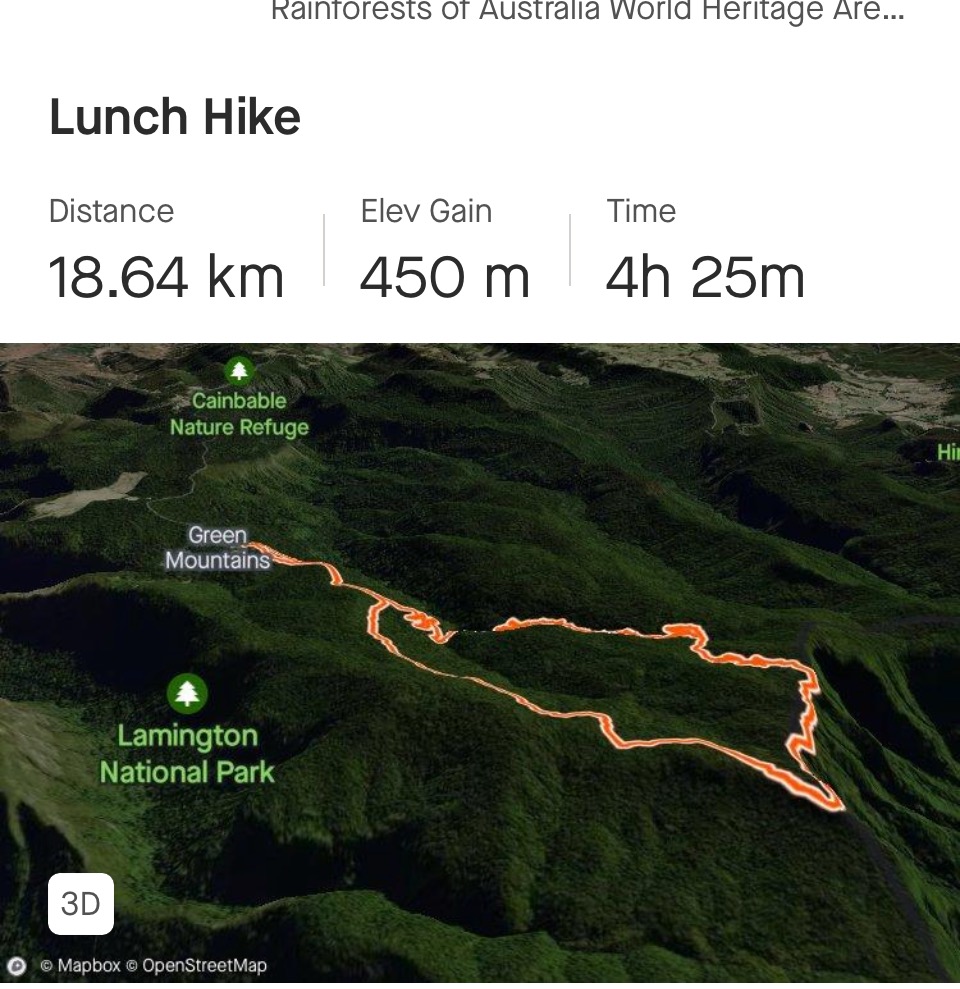
What a stunning hike – and it’s all yours to explore. Hidden away in the Green Mountains section of Lamington National Park, Toolona is a half day circuit, starting and finishing at O’Reillys Rainforest Retreat. Strava advises that I hiked 18.6km that day and Fitness says 18.3km so safe to say, 18.5km is the distance.

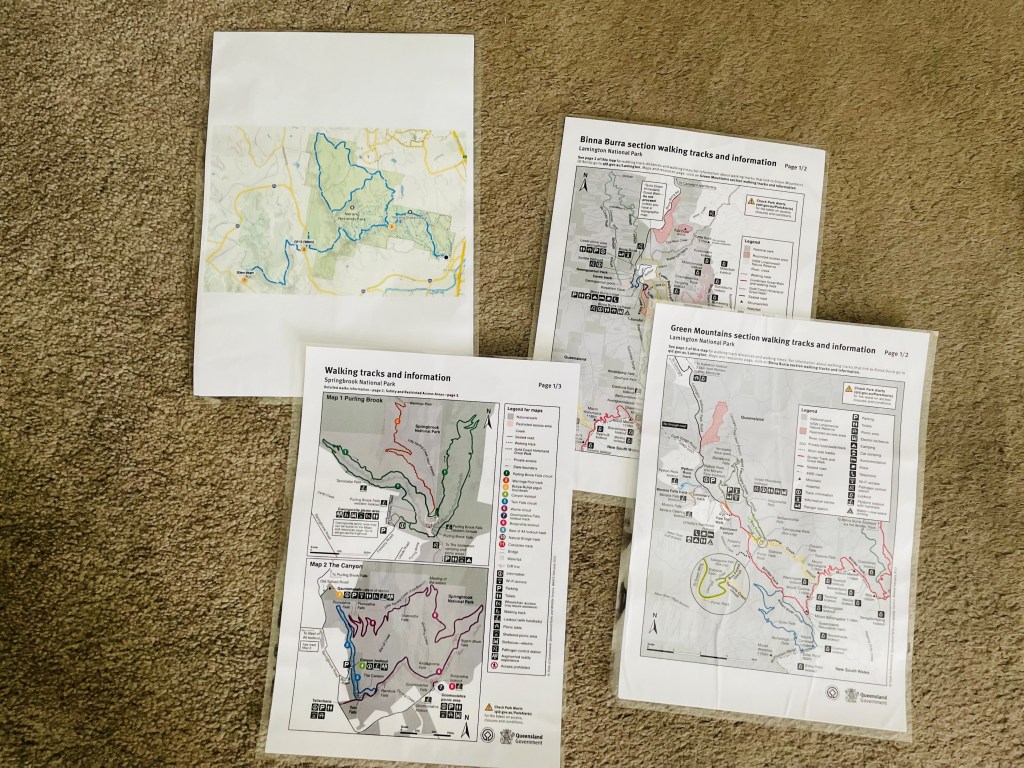
Maps make life easy

The Toolona Circuit provides a shady and protected experience for hikers and is a true rainforest paradise sitting around 1,000m above sea level, complete with a plethora of waterfalls and creek crossings to keep you entertained. Along with the rainforest encounter comes the risk of creepy crawlies, but more on that later…

I departed obscenely early to get up to O’Reillys by 6 a.m. I realised that I was hiking on a weekend during the school holidays , so if I wanted a quiet experience on the trail, an early start was essential. It was a lot cooler up in the Green Mountains, I had packed my raincoat and a lightweight merino jumper, but left my gloves and headwrap at home – rookie mistake!

The track early in the morning was made cooler with a light drizzle. Happily, the mist dampened down the dusty track, and as I ploughed through cobwebs, I realised I was the first hiker on the track 🙂

The Department of Environment recommends Toolona to be walked clockwise, although now that I’ve hiked it, it can be walked either way. As with any circuit involving creeks and waterfalls, you will have a hike down, and then the corresponding hike back up. I started off on the Main Border Track and at 1.7km, took the signposted left hand turn to start Toolona proper. Once on the trail, it starts gently descending down through the forest.

Switchbacks start around 2.4km and the gradient got steeper. At 3km another junction appeared, and I had the choice of going to Box Forest Circuit or Toolona, so just follow the directions which are very clear and well posted. I started to encounter creek crossings and little secret waterfalls…it was just lovely. It was very obvious that the whole area is quite low on rainfall so far this season. Some crossings were completely dry and I didn’t get wet feet at all during the day.

Picnic Rock – and the Creepy Crawlies!

About 3.5km down the circuit I arrived at Picnic Rock. As the name suggests, this is one of the lower points of the hike and is a small enclave nestled against the hillside, with a picturesque waterfall and smooth rocks to perch on while you have morning tea and admire the surroundings.

I stopped here for coffee and a snack, and about 23 seconds after I finished this wee video, I found a leech who was attached to my sleeve and determined to find some skins to make his snack!!!!

CAUTION – Creepy Crawlies

Leeches, ticks and other fauna are a fact of life when hiking. The time of year does make a difference in Australia – ticks seem to come out during spring and summer, and leeches just love the wet, however both can be present any time of the year. Right now, both are present in South East Queensland. It’s important to be aware of the risks they pose – and prepare accordingly.

So there I was, flailing around Picnic Rock trying to dislodge the leech. First he suckered from my arm to my finger, and then as I flicked him, he suckered onto my other hand. It was all a bit frantic! I found my bug repellent and emptied most of the can onto my hand, and then sprayed a fog over every body surface. Backpack was hurriedly packed up and I made haste up the hill away from the leech infested Picnic Rock….

I really did think they were chasing me up the hill….I did the first 2km up in record time…..I really don’t like leeches :O

TIP – FIRST AID FOR CREEPY CRAWLIES

There are two main perpetrators when hiking in Queensland (apart from snakes and just steer clear of those). Leeches are the lesser ones and can be dislodged with either bug repellent or salt. They inject an anticoagulant and an anaesthetic so you won’t feel them but after a while you can certainly see them 🙂 Ticks are more treacherous and left in situ can cause problems. I haven’t been ‘ticked’ but people say it’s like a small bee sting. You will know when you have one. There are products which direct a jet of liquid nitrogen at them, they freeze and you wait for them to fall out, OR you can remove them, keeping the body and head intact. I’m told that you twist them out counter clockwise as they burrow in clockwise. If you can’t remove the whole tick, it’s off to the doctor to have it extracted. Preventative wise, I’ve found that a very thorough bug repellent spray before and after getting dressed works….

Moving Onward and Upward

After my leech encounter, I passed a lovely swimming hole which I imagine is very popular in summer. The track was becoming narrower and rougher as I wound my way up the other side of the gorge. As I crisscrossed the creek, the waterfalls, although gentle, were quite beautiful. For those of you who enjoy forest bathing, it was an absolute delight.

The misty rain had certainly come down the side of the mountain, and at the 10km mark I re-joined the Main Border Track. Up on the ridge it was windy and raining, my coat was on and I was moving to stay warm! There was time for a couple of lookouts, but I was keen to clear the ridge and the wind.

I made it off the eastern ridge after the turnoff to Bithongabel Lookout and once I headed west at 12km, the wind and rain stopped, and I was back in the calm forest oasis that is the beauty of the Gondwana Rainforest. Estimated to be over 100 million years in the making, this area of Queensland is a superb example of the forest mosaic that makes Gondwana a world heritage listed site.

No more wind, no more rain, just me and a glorious forest. Walking through the dappled sunlight with the delicious earthy loamy smell of the leaves underfoot is such a happy thing to experience.

Before I knew it, the O’Reillys paved path was in front of me, which means the end of my hike was near.

I completed Toolona in just under five hours. I hiked around 18.5km, climbed around 470m and my average heart rate was 137 (we aren’t counting the spike when I ran away from the marauding leech).

The fun bit about finishing at O’Reillys is they have a great café where I got hot chips for my drive home. I may have also picked up some O’Reillys wine, which is *chefs kiss*.

In Summary

Toolona is a half day trail, family friendly and a good beginner hike that can easily be achieved by all levels of fitness. I absolutely recommend this as a way to immerse yourself in a stunningly beautiful part of Queensland and hey – who doesn’t like hot chips as a reward for escaping the marauding leeches??!

See you out on the trails 😉

PJ

THE HIKE THAT WENT WRONG….!

Hello and welcome to my LIKETHEHIKE blog.

I’m PJ and I write about the hikes I take, giving you insights, photos, commentary, tips and tools so you can enjoy hiking and embrace the experience.

Ahhh – Kokoda Gold Coast 2023. My friend Fran and I decided that we would register for the new 30km Kokoda Challenge.

And then it went wrong! OUCH 😮

The Kokoda Challenge

The Kokoda Challenge is Australia’s toughest team endurance event that raises funds for programs run by the Kokoda Youth Foundation. Events are held mainly in Queensland (Brisbane, Sunshine Coast and Gold Coast) and in New South Wales (Lake Macquarie).

For those of you not from the Antipodes, Kokoda is referring to the 1942 Kokoda Campaign in Papua New Guinea, where Australian troops and local infantry battled the advancing Japanese army to protect access to the local airfield. The challenge distances ( 96km and under ) represent the real Kokoda Track distance of 96km and the history of Kokoda is recognised and honoured by many Australians, with many families having generational ties to the campaign.

Kokoda on the Gold Coast

I’ve hiked Kokoda 48km twice before. The first time was in 2016 as part of a work team and then again in 2021 with my sister TB and her two daughters. Our team was aptly named “SistasnBlistas” 🙂

I’ve not tried the 96km, not sure if I have the intestinal fortitude to tackle it but… never say never.

The 30km was a new addition to Kokoda Gold Coast in 2023 and meant that we could sign up with a short training lead time. I regularly hike 20+ so 30km was very achievable.

Hikers – Start Your Engines!

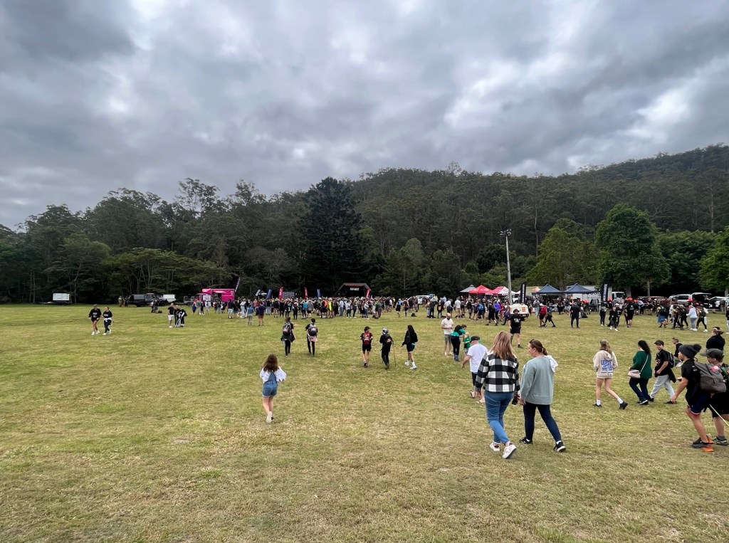
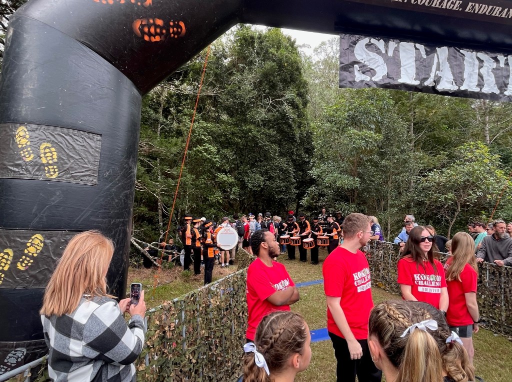
My Kokoda buddy Fran is a hiker from way back. She used to volunteer with NSW Rural Fire Service and spent many days hiking in the Blue Mountains so she was keen to flex a bit of hiking muscle for Kokoda. Our hike started at 2pm at Little Clagiraba Reserve. We kicked off along with what felt like 3,000 school teams – but was probably only about 300 kids. There was a little bit of a kerfuffle delay with the start shute as it led straight into a narrow creek crossing and a single file track, but once we hit the start line we were off! Thankfully it was a mild, cloudy Queensland winter day so perfect conditions for hiking.

Section 1 – Up a Hill and Down Again

So the start of the 30km is actually the support crew location for the 48 and 96km. Once you go through the start shute, its 2.6km straight up.

In 2016 and 2021, you could sit at your support crew camp, have a bit to eat and a rest while you watch the headlamps twinkle as teams wound their way up the side of the mountain. A bit different for the 30km as it’s the first thing you do – slog up a huge hill!

We climbed 250m as we hiked 2.6km pretty much straight upward. Underfoot was shale and rock, and boy was it dusty. Lots of feet kicking up dust as everyone climbed. It was slow, and still quite warm. Took about an hour to make it up to the top with little stops to catch our breath.

We crested the top of the hill and came into a lovely grassy meadow, the perfect place to stop and take a short break. It also allowed some of the larger school teams to move off and we could then hike with a little more peace and quiet 😉

What’s in the Backpack?

Pleased you asked.

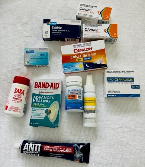
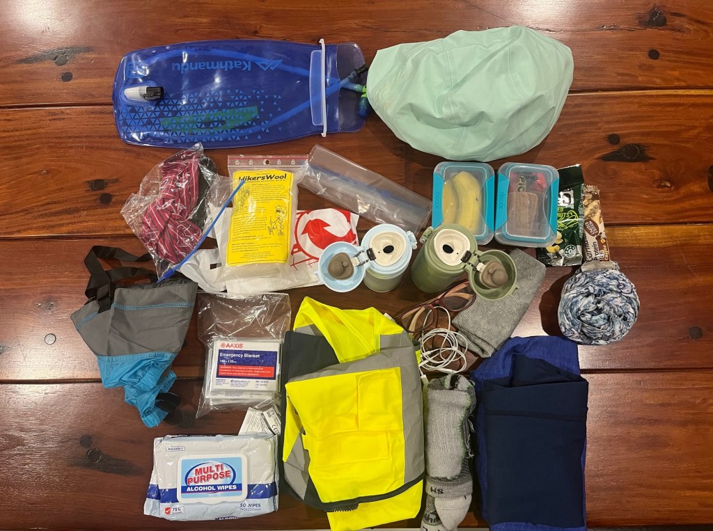
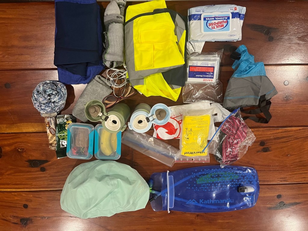
Packing for a 30km hike is a bit of a hybrid. It’s 10 hours and crosses from day into night. We had planned to complete the 30km before midnight, so averaging 3km an hour. Food and water was a must. The Kokoda organisers also require to you have a high vis vest as we cross a couple of large roads, a whistle, a first aid kit and we needed to download an emergency finder app. I included a couple of layers – merino wool, as well as a beanie, gloves and my trusty raincoat. Then I had assorted items – headphones, headlamp and batteries, two mobiles, drugs, antiseptic wipes, hikers wool and…here is what I packed…

Clockwise from 6pm we have raincoat, food, coffee, scarf, tops, extra socks, glasses, earbuds, high vis vest, space blankets, wipes, gloves and hat, gaiters, bags, hikers will and water bladder. Fran carried the first aid kit and whistle 🙂

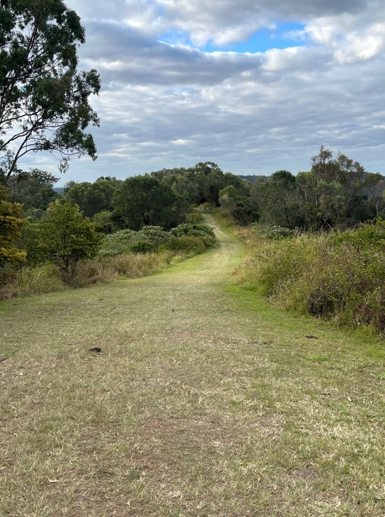
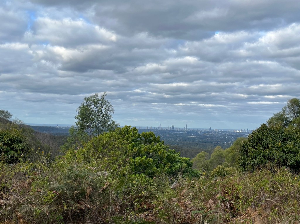
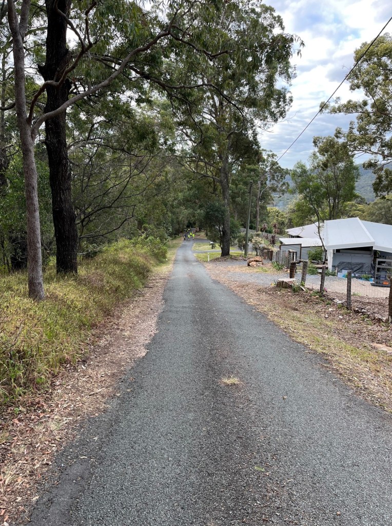
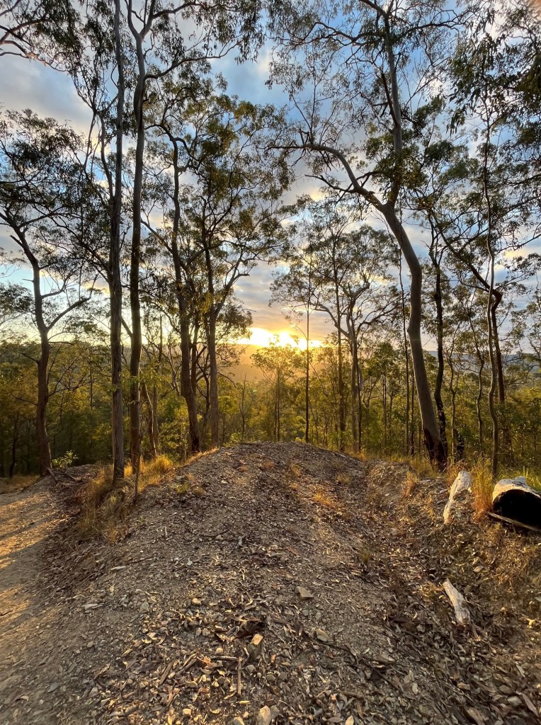
After our little rest at the top of the hill we then walked along the ridge, with stunning views down to the Gold Coast glitter strip. The weather turned on some lovely mild temperatures and the cloud cover was just perfect. After walking for 3km on shale and rocks, the grassy paths were very welcome. It was then time to start walking downhill to Nathan Valley where the first checkpoint was located – which transitioned us onto a local road.

Of course hikers know what goes down, must go up…..!

Section 2 – Into the Forest and Disaster!

Committing to the Kokoda Challenge means you need to travel through the requisite checkpoints and pass over the electronic pads to record your progress. Importantly, teams need to pass through the checkpoints together – for safety as well as reflecting Kokoda mateship. Nobody gets left behind.

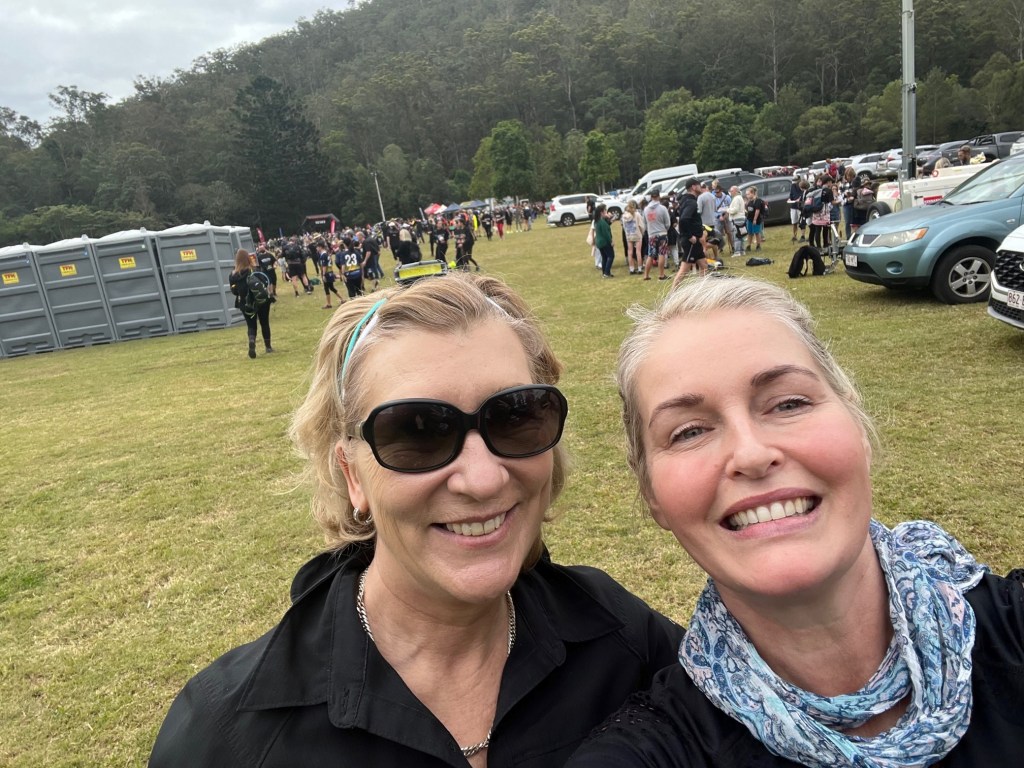
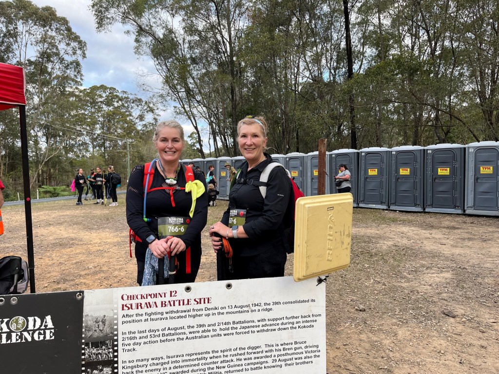
Fran and I arrived at the first checkpoint in good shape and really enjoying the hike so far. We had come about 6km, and it was late afternoon. Time for another photo, and toilet break and steeling ourselves for the next big mountain climb.

We crossed over Maudsland Rd, tracked alongside it for a bit and entered into Nerang National Park proper. We had another big hill to hike up, around 200m and 2km. Again, we were back on the shale and rock hiking underfoot, which can be quite punishing on the soles of your feet.

Around 5pm we were almost at the top – and disaster struck!

Fran injured herself…!

Not badly, but enough for us to stop and have a bit of a think about what the rest of the hike was going to look like. She was already hiking with a knee brace so this wasn’t a good thing.

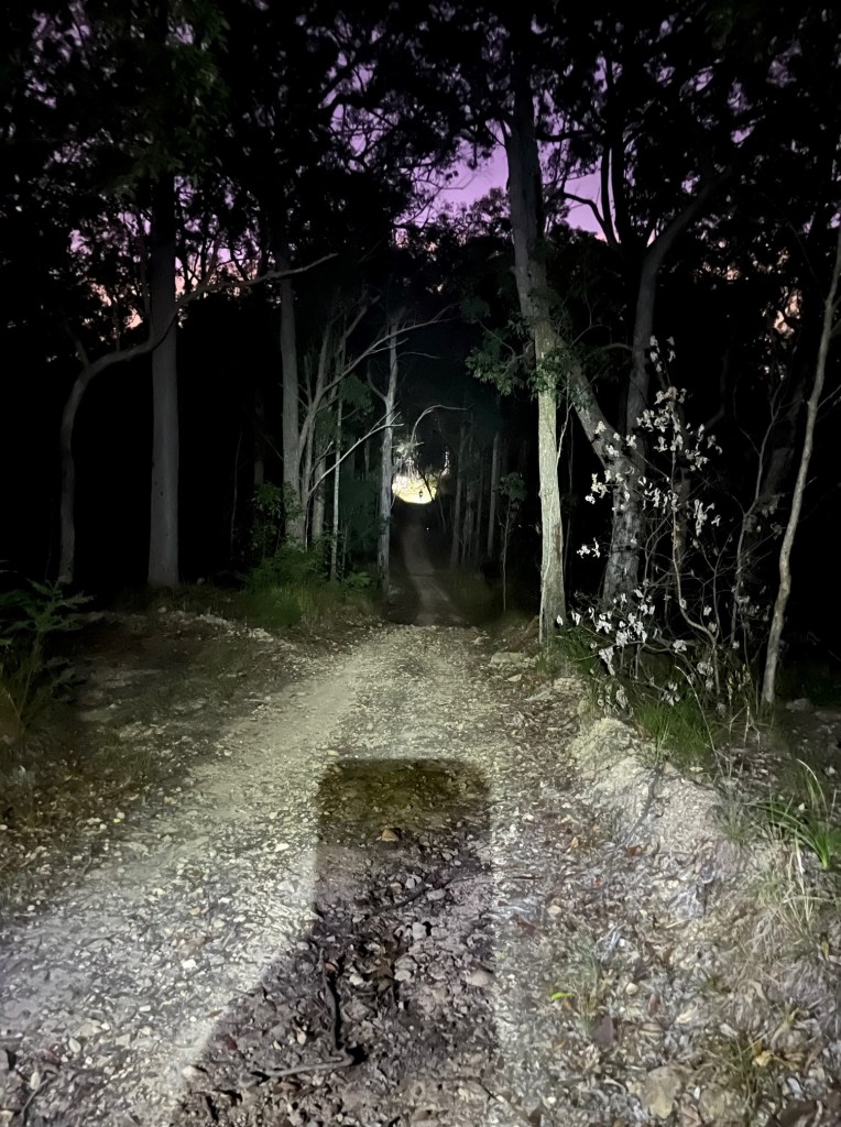
It was heading into dusk – so it was headlamps on and darkness was upon us.

You can see a team ahead of us on the track 🙂

A decision needed to be made. Could Fran keep going and finish the 30km or did we need to cut our hike short and live to fight another day?

I’m very pragmatic about my hiking, and given that I’m over the half century mark, keeping my body intact is important. A quinquagenarian doesn’t bounce back injury wise as quickly as a quadranscentennial – sad but true.

Decisions decisions…

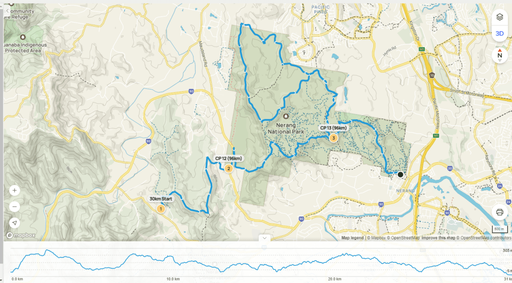
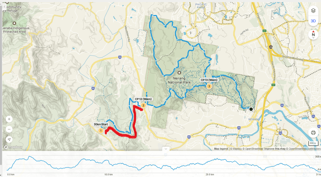
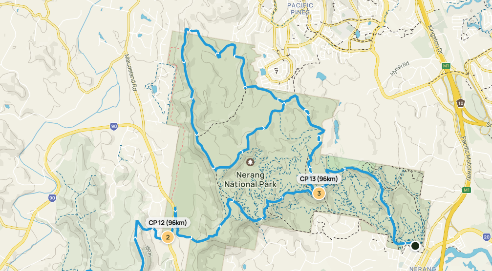
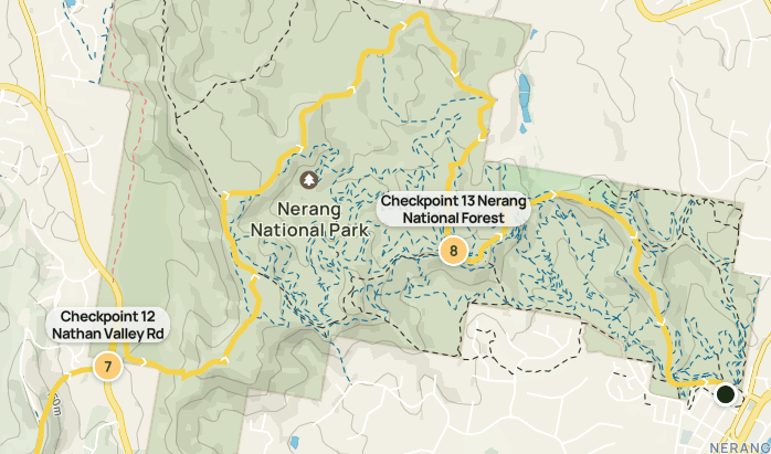
As you can see below, the 30km map involved a loop in the forest, and the 48km map was a shorter distance back to the finish. Unfortunately I didn’t have the two maps to look at when we were deciding what to do, but instead referenced the challenge signage on the track, so we made the call to hike the remainder of the 48km challenge route, estimating it would take us to the finish in 10km, rather than 20km…

What I should have done is taken the short route to Checkpoint 13 and then dropped down to the finish. Lesson learned.

Our pace slowed a bit, which was OK as we knew we only had about 10km to cover. We still had some hills and valleys, but they were a lot smaller. I reckon there were about 500 hikers looping around following the blue route, and the fast 48km hikers were also coming through, so it was a busy couple of hours. Lots of dust being kicked up…!

Checkpoint 13 is about 4km from the finish. We stopped there for a break so Fran could rest up and make sure she could walk out. There were a few younger hikers parked up there waiting for first aid and 4×4 pickups, but Fran was emphatic she wanted to walk to the end and finish – even if it was a shorter distance.

So, the earbuds went in and the podcasts went on – and we walked.

The finish line is down the bottom of a gentle hill, and you can see the lights and hear the loudspeakers so it’s a fantastic atmosphere. Fran was in a fair bit of pain by now so it was a very welcome sight.

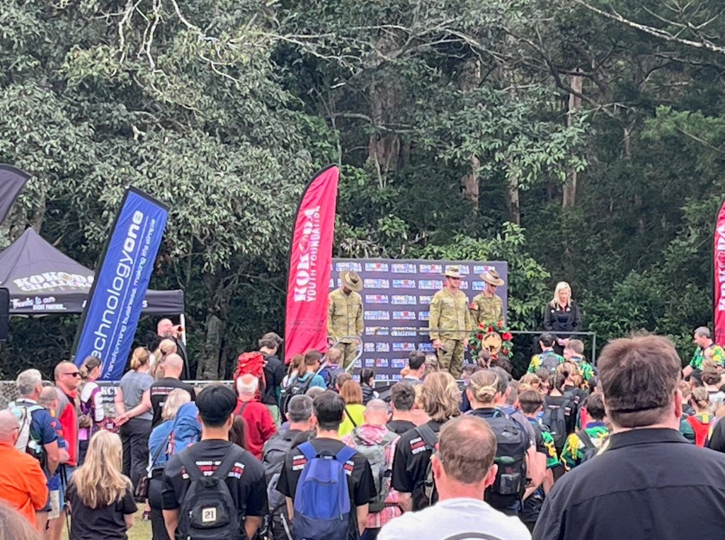
We crossed around 9pm, having just clocked over 20km. Unfortunately you can only walk through the fancy finish line and they read your names out AND your time AND there are a million enthusiastic supporters clapping etc…. 😮 . It was lovely but we hadn’t done 30km and Fran just really wanted to get off her feet.

DONE.DOT.COM

I emailed the organisers the next day, explained the situation and asked them to take us off the finish board, and put us on the ‘incomplete’…..we didn’t want credit for something we didn’t actually do.

In Summary…

The Kokoda Challenge is a terrific event and one really worth doing.

30km vs 48km – lots to say 🙂

It was the first time the 30km distance was offered and it was chaotic at the start. It was full of school teams, including primary schools kids so if you are a regular hiker, I’d avoid the 30km. I found it too visually and audibly frantic. The route quickly became littered with the emotional wailings of young people realising that a challenge is exactly that….We passed one young person halfway up a hill who was refusing to take another step and was throwing the hugest hissy fit. I felt very sorry for the exasperated, yet very patient teacher.

The other thing about the 30km is most of it is walking around the Nerang National Forest. You loop back and forth for 20km on a kind of circuit. Kokoda training hikes are often done in Nerang due to the fact that you finish there, so for me it was hours hiking on ground that I’ve already spent quite a bit of time on….meh.

Consider training for and entering the 48km. I’ve done it twice and it’s such a great event, you get to walk on private land, army land – places that you would not be able to access. And importantly, it’s a track that goes in one direction, from start to finish, and because of the distance, teams are more prepared and committed.

It’s important to remember- any hike is a great experience. You will be out in nature, having a wonderful time and along with any challenge comes the huge sense of achievement when you finish. Injured or not!

See you out on the trails 😉

PJ